27 Beaumont Road, Manchester, M21 8BG
About 27 Beaumont Road
27 Beaumont Road is a four-bedroom semi-detached house in Manchester (M21 8BG). It has a recorded floor area of 167 m² (around 1798 sq ft), construction records dating it to 1930-1949 and council tax band C. The latest certificate (March 2025) shows a D (score 68), on the cusp of jumping into the C band. Earlier certificates rated it C (May 2014); the latest reading is one band lower. Between certificates, roof efficiency went from Very Poor to Good and lighting went from Average to Very Good. The recommended improvements would push it to C (score 78). Other recorded features include a basement. Period features are noted in the property record.
At 167 m² the property is well over the postcode median (87 m² across 11 EPCs), placing it in the larger end of the local stock. Across 1997–2014, sale prices on this property compounded at 12.5% per year. Today's modelled estimate of £776,000 sits 63.4% above the 2014 sale of £475,000. 5 planning records sit against the property, 5 approved, 0 refused. Past consents include an extension and a conservatory, meaningful when judging how the property has evolved. Last sold in August 2014, so it's been off the market for around 12 years.
Know exactly what you're buying at 27 Beaumont Road
Before you offer, see what the listing won't tell you, the true value, the red flags and the full history.
Already flagged here
Valuation
against the asking price
Risks
planning & flood
Sold prices
similar homes nearby
Trends
the local market
What this property has
Inside
- Bedrooms4
- Bathrooms3
- Open-plan layoutYes
- Dining roomYes
- Utility roomYes
- CloakroomYes
- EnsuiteYes
- StudyYes
- BasementYes
Outside
- DrivewayYes
Building
- Period featuresYes
Energy performance
EPC Rating
Property Improvements
Changes detected from historical EPC data
Heating controls upgraded for better temperature management
Loft insulation installed or upgraded to 250mm+
More low energy lighting installed
Planning history
27 Beaumont Road has been extended on multiple sides of the property across separate planning applications.
- Jun 2021ExtensionFullIn report
Extension: Single storey · Side and rear of property
Erection of a single storey rear and side extension to form additional living accommodation
- Agent
- lh
- Documents
- 10 docs on file
- Reference
- 129981/FH/2021
- Apr 2020ExtensionFullIn report
Extension: Single storey · Side of property
Erection of a single storey side extension to form additional living accommodation
- Documents
- 9 docs on file
- Reference
- 126086/FH/2020
We flagged 1 thing worth checking at 27 Beaumont Road
Independent checks surfaced things a buyer would want to understand before offering. The report explains each one in full, with the underlying data and what to ask.
- Larger development activity nearby
30-day money-back guarantee
Sales history & valuation
27 Beaumont Road has more than quadrupled in price since its earliest registered sale in 1997.
£776,000
Modelled from EPC, postcode comparables and a sale-price growth of 12.5% per year over 18 years.
£475,000
Growth on file: 12.5% per year over 18 years.
Sales timeline
20 August 2014Most recent
£475,000
+126.2%over 9 years30 May 2005
£210,000
+250.3%over 8 years24 January 1997
£59,950
Median price across the last 5 sales in M21 8BG: £505,000 (2025–2019).
Nearby sales in M21 8BG
Everything we know about 27 Beaumont Road, in one report
What it's really worth, what could be wrong, and the planning, sales and area data in full.
What we flagged
- Larger development activity nearby

Versus other Beaumont Road homes
On floor area, 27 Beaumont Road stands well clear of the street.
Price per m²
£2,844
Street avg £4,438
Floor Area
167 m²
Street avg 92 m²
Habitable Rooms
7 rooms
Street avg 5 rooms
CO₂ Emissions
4.9 t/year
Street avg 4.1 t/year
Similar properties nearby
1 Clifton Road
M21 8UX
1 Dawlish Road
M21 8XR
1 Ansdell Avenue
M21 8TP
1 Clovelly Road
M21 8XU
1 Claude Road
M21 8BZ
1 Hartington Road
M21 8UZ
1 Cleveleys Avenue
M21 8TS
1 Limley Grove
M21 8UB
The neighbourhood at a glance
Rail-style transport is unusually close for this postcode.
Nearest stop
0.2 km
Chorlton Bus Station — bus station.
Closest school
0.4 km
Brookburn Community School. 42 schools nearby.
Go deeper on the local area
The full report breaks down crime, transport links, schools and air quality in depth.
Road noise across the postcode
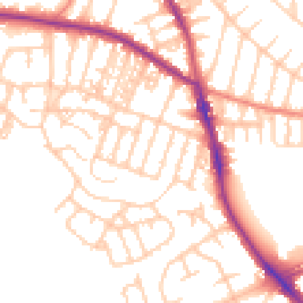
Daytime· 07:00 – 23:00
53.5dB

Night-time· 23:00 – 07:00
43.8dB