3 Bideford Avenue, Leeds, LS8 2AE
About 3 Bideford Avenue
3 Bideford Avenue is a three-bedroom semi-detached house in Leeds (LS8 2AE). It has a recorded floor area of 154 m² (around 1658 sq ft), construction records dating it to 1930-1949 and council tax band E. The latest certificate (October 2021) shows a D (score 66), on the cusp of jumping into the C band. The recommended improvements would push it to C (score 74). Records show the property has been extended at some point in its history.
Held since February 2005 — that's 21 years off the open market, well above the local norm. Today's modelled estimate of £592,000 sits 122.6% above the 2005 sale of £266,000. At 154 m² it's 28.9% larger than the typical home in the postcode (120 m² median across 18 EPCs).
What this property has
Inside
- Bedrooms3
- Bathrooms1
- StudyYes
Outside
- Private gardenWest-facing
- ParkingOff street
Building
- Previously extendedYes
Everything you need to know about 3 Bideford Avenue
The true value, the hidden risks and the full sale history, in one report.
Pick your report · from £14.99
One time fee only - money back guarantee

The data behind every report







Energy performance
3 Bideford Avenue's carbon output runs well above what efficient homes in the postcode produce.
EPC Rating
Certificate validity
Valid until 12 October 2031

Get a survey for this property
Level 3 Building Survey
Because the property has been extended more than once, we believe a Level 3 building survey should be considered.
From £1,085 · Includes VAT
Planning history
3 Bideford Avenue has no planning applications on record.
But the area is active
3 notable applications nearby — larger schemes and conversions that could reshape the street. The report maps them all.
Sales history & valuation
3 Bideford Avenue valuation sits well clear of the typical sold price in this postcode.
£592,000
Modelled from EPC, postcode comparables.
£266,000
Recorded with HM Land Registry.
Sales timeline
17 February 2005Most recent
£266,000
Median price across the last 5 sales in LS8 2AE: £646,000 (2026–2022).
Nearby sales in LS8 2AE
Versus other Bideford Avenue homes
On price per m², 3 Bideford Avenue runs well behind the street norm.
Price per m²
£1,727
Street avg £3,195
Floor Area
154 m²
Street avg 136 m²
Habitable Rooms
7 rooms
Street avg 6 rooms
CO₂ Emissions
6.5 t/year
Street avg 6.5 t/year
Everything you need to know about 3 Bideford Avenue
The true value, the hidden risks and the full sale history, in one report.
Pick your report · from £14.99
One time fee only - money back guarantee
The data behind every report
Similar properties nearby
The neighbourhood at a glance
Crime
488/mo
Falling year-on-year across the wider district.
Nearest stop
0.2 km
Talbot Road — bus stop.
Closest school
0.4 km
Talbot Primary School. 27 schools nearby.
Go deeper on the local area
A Local Area report breaks down crime, transport links, schools and air quality in depth.
Road noise across the postcode
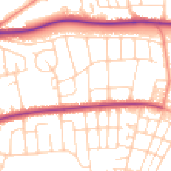
Daytime· 07:00 – 23:00
52.4dB

Night-time· 23:00 – 07:00
42.4dB