17 Denewood, Forest Hall, Newcastle Upon Tyne, NE12 7FA
About 17 Denewood
17 Denewood is a detached house in Forest Hall, Newcastle Upon Tyne, Newcastle Upon Tyne (NE12 7FA). It has a recorded floor area of 163 m² (around 1755 sq ft), construction records dating it to 1983-1990 and council tax band F. The latest certificate (May 2025) returns a B (score 84), comfortably above the UK average.
On energy efficiency it sits in the top 10% of properties in this postcode. Most recent transfer was October 2025 at £566,000 — fresh data. 4 planning records sit against the property, 2 approved, 0 refused. Past consents include tree works, meaningful when judging how the property has evolved. On a £-per-square-foot basis, the last sale (£323/sq ft) was about 61.3% above the typical sold price in the postcode.
Everything you need to know about 17 Denewood
The true value, the hidden risks and the full sale history, in one report.
Pick your report · from £14.99
One time fee only - money back guarantee

The data behind every report







Energy performance
17 Denewood ranks among the most efficient homes in the postcode for energy use.
EPC Rating
Certificate validity
Valid until 26 May 2035

Get a survey for this property
Level 2 HomeBuyer Report
We've checked 10 risk factors against the available data for this property and believe a Level 2 HomeBuyer Report could be a suitable option for you.
From £795 · Includes VAT
Planning history
Planning history at 17 Denewood is exclusively tree-management applications — typical for a property with mature trees on or near the plot.
4 applications on record at 17 Denewood, Forest Hall, Newcastle Upon Tyne, NE12 7FA
- Oct 2010Tree WorksTreesOutcome in report
T6 Lime - Thin crown 15-20%, lift crown up to 4m. T10 Hornbeam - Lift crown up to 4m. T11 Lime - Thin crown 15-20%, lift crown up to 4m. T12 Horse Chestnut - Thin crown 15-20%, lift crown up to 4m, 1m clearance to structure of neighbours garage. T13 Beech - Thin crown 15-20%, lift crown up to 4m. Would also like permission to prune back any branches of any tree hanging below 6 feet on an ongoing basis. Denewood, Killingworth TPO 2001
- Documents
- 5 docs on file
- Reference
- 10/02263/TPO
- More recent applications — locked
- Tree WorksJun 2025Decision
- Tree WorksSept 2024Decision
+ 1 more application in the report
Unlock 17 Denewood, Forest Hall, Newcastle Upon Tyne, NE12 7FA's full planning history
You're seeing the shape of it. The report has the substance.
- Every decision — granted, refused or withdrawn (4 on record)
- All 4 applications on this property in full, plus 2 notable nearby
- The 20 documents, officer reports & conditions
- What the pattern means for extending or converting here
One time fee only - money back guarantee
Sales history & valuation
Latest sale on 17 Denewood was the highest on Land Registry record across the postcode.
£582,000
Modelled from EPC, postcode comparables.
£566,000
Recorded with HM Land Registry.
Sales timeline
1 October 2025Most recent
£566,000
Median price across the last 5 sales in NE12 7FA: £481,000 (2023–2019).
Nearby sales in NE12 7FA
12 Denewood, Forest Hall, Newcastle Upon Tyne, NE12 7FA
Sold Nov 2023
£513,00011 Denewood, Forest Hall, Newcastle Upon Tyne, NE12 7FA
Sold Jul 2023
£535,00021 Denewood, Forest Hall, Newcastle Upon Tyne, NE12 7FA
Sold Sept 2020
£481,00023 Denewood, Forest Hall, Newcastle Upon Tyne, NE12 7FA
Sold Feb 2020
£430,00043 Denewood, Forest Hall, Newcastle Upon Tyne, NE12 7FA
Sold Jan 2019
£525,000
Versus other Denewood homes
On years held, 17 Denewood runs well behind the street norm.
Price per m²
£3,472
Street avg £2,621
Floor Area
163 m²
Street avg 163 m²
Habitable Rooms
8 rooms
Street avg 8 rooms
CO₂ Emissions
3.6 t/year
Street avg 6.0 t/year
Everything you need to know about 17 Denewood
The true value, the hidden risks and the full sale history, in one report.
Pick your report · from £14.99
One time fee only - money back guarantee
The data behind every report
Similar properties nearby
1 Barn Close, Killingworth
NE12 7EA
1 Denewood, Forest Hall
NE12 7FA
1 Elm Grove, Forest Hall
NE12 7AN
1 Acres Court, Killingworth
NE12 7BT
1 Barley Way, Killingworth
NE12 7BN
1 Allandale Avenue
NE12 7JD
1 Cotswold Avenue
NE12 7NT
1 Chiltern Drive
NE12 7NU
The neighbourhood at a glance
Crime
170/mo
Falling year-on-year across the wider district.
Nearest stop
0.3 km
Clousden Hill — bus stop.
Closest school
0.3 km
St Marys Catholic Primary School, Forest Hall. 20 schools nearby.
Go deeper on the local area
A Local Area report breaks down crime, transport links, schools and air quality in depth.
Road noise across the postcode
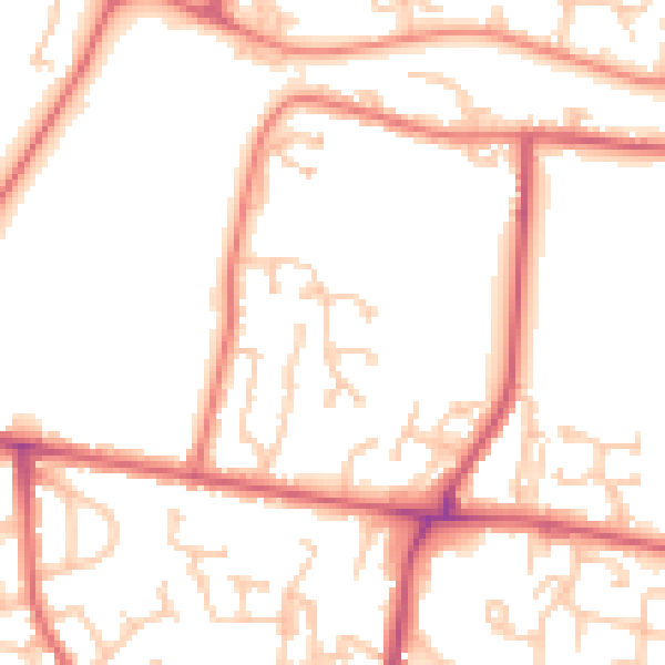
Daytime· 07:00 – 23:00
51.8dB
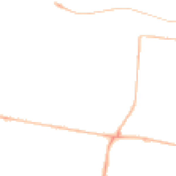
Night-time· 23:00 – 07:00
41.4dB