3 Cranbrook Drive, Prestwich, Manchester, M25 0JZ
About 3 Cranbrook Drive
3 Cranbrook Drive is a detached house in Prestwich, Manchester, Manchester (M25 0JZ). It has a recorded floor area of 142 m² (around 1528 sq ft), construction records dating it to 1900-1929 and council tax band E. The latest certificate (June 2016) shows a D (score 56), a step below the typical UK home. When first surveyed in May 2012 the rating was E, the property has climbed 1 band since. Between certificates, roof efficiency went from Very Poor to Good; while lighting dropped from Good to Very Poor. The recommended improvements would push it to C (score 78). The latest certificate is from June 2016, so improvements made since then won't be reflected.
Today's modelled estimate of £525,000 sits 69.1% above the 2014 sale of £310,500. On a £-per-square-foot basis, the last sale (£203/sq ft) was about 61.1% above the typical sold price in the postcode. Last changed hands 12 years ago, in October 2014. 3 planning records sit against the property, 0 approved, 2 refused.
Everything you need to know about 3 Cranbrook Drive
The true value, the hidden risks and the full sale history, in one report.
Pick your report · every report is £14.99
One time fee only - money back guarantee

The data behind every report


Energy performance
3 Cranbrook Drive's carbon output runs well above what efficient homes in the postcode produce.
EPC Expired
This certificate is over 10 years old and is no longer valid.Expired 03 Jun 2026
EPC Rating
Property Improvements
Changes detected from historical EPC data
Loft insulation installed or upgraded to 250mm+
Low energy lighting percentage decreased
Get a survey for this property
Level 3 Building Survey
Because the property was built before 1919, we believe a Level 3 building survey should be considered.
From £1,085 · Includes VAT
Planning history
3 applications on record at 3 Cranbrook Drive, Prestwich, Manchester, M25 0JZ
- Dec 2015Loft ConversionOutlineOutcome in report
Lawful development certificate for proposed construction of a flat roofed dormer to the sides and rear of the existing hipped roof - thereby enabling habitable accommodation to be formed at the new second floor level
- Documents
- 13 docs on file
- Reference
- 59529
- More recent applications — locked
- ExtensionMar 2016Decision
- ExtensionJan 2016Decision
Unlock 3 Cranbrook Drive, Prestwich, Manchester, M25 0JZ's full planning history
You're seeing the shape of it. The report has the substance.
- Every decision — granted, refused or withdrawn (3 on record)
- All 3 applications on this property in full
- The 33 documents, officer reports & conditions
- What the pattern means for extending or converting here
One time fee only - money back guarantee
Sales history & valuation
3 Cranbrook Drive valuation sits well clear of the typical sold price in this postcode.
£525,000
Modelled from EPC, postcode comparables and a sale-price growth of -0.2% per year over 8 years.
£310,500
Growth on file: -0.2% per year over 8 years.
Sales timeline
30 October 2014Most recent
£310,500
-1.4%over 8 years30 October 2006
£315,000
Median price across the last 5 sales in M25 0JZ: £310,000 (2022–2017).
Nearby sales in M25 0JZ
12 Cranbrook Drive, Prestwich, Manchester, M25 0JZ
Sold Nov 2022
£450,0001 Cranbrook Drive, Prestwich, Manchester, M25 0JZ
Sold Oct 2019
£307,5002 Cranbrook Drive, Prestwich, Manchester, M25 0JZ
Sold Jun 2018
£180,9687 Cranbrook Drive, Prestwich, Manchester, M25 0JZ
Sold Oct 2017
£390,0008 Cranbrook Drive, Prestwich, Manchester, M25 0JZ
Sold Oct 2017
£310,000
Versus other Cranbrook Drive homes
Price per m²
£2,187
Street avg £2,036
Floor Area
142 m²
Street avg 153 m²
Habitable Rooms
7 rooms
Street avg 7 rooms
CO₂ Emissions
7.3 t/year
Street avg 7.5 t/year
Everything you need to know about 3 Cranbrook Drive
The true value, the hidden risks and the full sale history, in one report.
Pick your report · every report is £14.99
One time fee only - money back guarantee
The data behind every report
Similar properties nearby
1 Craigwell Road, Prestwich
M25 0EF
1 Canterbury Drive, Prestwich
M25 0HY
1 Hereford Drive, Prestwich
M25 0JY
1 Cranbrook Drive, Prestwich
M25 0JZ
1 Hartley Avenue, Prestwich
M25 0AT
1 Carlton Avenue, Prestwich
M25 0EB
1 Breeze Mount, Prestwich
M25 0AH
1 Fort Road, Prestwich
M25 0HA
The neighbourhood at a glance
Rail-style transport is unusually close for this postcode.
Nearest stop
0.3 km
Crescent Avenue — bus stop.
Closest school
0.3 km
Sedgley Park Community Primary School. 39 schools nearby.
Go deeper on the local area
A Local Area report breaks down crime, transport links, schools and air quality in depth.
Road noise across the postcode
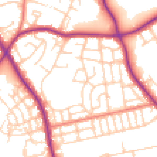
Daytime· 07:00 – 23:00
53.8dB

Night-time· 23:00 – 07:00
44.0dB