Church House, School Road, Risby, Bury St Edmunds, IP28 6RQ
About Church House
Church House is a semi-detached house in Risby, Bury St. Edmunds, Bury St Edmunds (IP28 6RQ). It has a recorded floor area of 210 m² (around 2260 sq ft) and construction records dating it to before 1900. The latest certificate (September 2013) shows an E (score 41), well below the UK norm with real room to improve. The rating has held steady at E across 3 certificates since September 2013. The recommended improvements would push it to D (score 63). Main heating runs on oil. The latest certificate is from September 2013, so improvements made since then won't be reflected.
3 planning records sit against the property, 2 approved, 0 refused. Past consents include an extension, a porch and partial demolition, meaningful when judging how the property has evolved. The record references conservation-area consent, which constrain future alterations. It lags the bulk of the postcode on energy efficiency (less efficient than 70% of similar EPCs). On a £-per-square-foot basis, the last sale (£288/sq ft) was about 52.4% above the typical sold price in the postcode. Last sale on file: £650,000 in December 2020.
Everything you need to know about Church House
The true value, the hidden risks and the full sale history, in one report.
Pick your report · from £14.99
One time fee only - money back guarantee

The data behind every report


Energy performance
Church House's carbon output runs well above what efficient homes in the postcode produce.
EPC Expired
This certificate is over 10 years old and is no longer valid.Expired 25 Sept 2023
EPC Rating
Certificate validity
Expired on 25 September 2023

Get a survey for this property
Level 3 Building Survey
Because the property was built before 1919, has been extended more than once, and has no mains gas supply, we believe a Level 3 building survey should be considered.
From £1,220 · Includes VAT
Planning history
Planning history includes recorded demolition works, indicating a major rebuild phase at this address.
3 applications on record at Church House, School Road, Risby, Bury St Edmunds, IP28 6RQ
- Jun 2010PorchFullOutcome in report
Extension: Single storey · Side of property
Planning Application - (i) Erection of single storey side porch extension (following demolition of existing porch) (ii) alterations to existing path to form ramp access
Extension- Documents
- 9 docs on file
- Reference
- SE/10/0629
- More recent applications — locked
- Tree WorksSept 2024Decision
- PorchJun 2010Decision
Unlock Church House, School Road, Risby, Bury St Edmunds, IP28 6RQ's full planning history
You're seeing the shape of it. The report has the substance.
- Every decision — granted, refused or withdrawn (3 on record)
- All 3 applications on this property in full, plus 2 notable nearby
- The 24 documents, officer reports & conditions
- What the pattern means for extending or converting here
One time fee only - money back guarantee
Sales history & valuation
The latest sale landed in the post-pandemic price surge — useful context when reading the figure.
£712,000
Modelled from EPC, postcode comparables.
£650,000
Recorded with HM Land Registry.
Sales timeline
23 December 2020Most recent
£650,000
Median price across the last 5 sales in IP28 6RQ: £725,000 (2025–2019).
Nearby sales in IP28 6RQ
West Glebe, School Road, Risby, Bury St Edmunds, IP28 6RQ
Sold Feb 2025
£325,000Gate House Cottage, School Road, Risby, Bury St Edmunds, IP28 6RQ
Sold Oct 2022
£200,000Melrose, School Road, Risby, Bury St Edmunds, IP28 6RQ
Sold Sept 2022
£846,000New Leaf Wood, School Road, Risby, Bury St Edmunds, IP28 6RQ
Sold Jan 2021
£725,000The Gate House, School Road, Risby, Bury St Edmunds, IP28 6RQ
Sold Sept 2019
£900,000
Versus other School Road homes
Church House is notably below the street on epc rating.
Price per m²
£3,095
Street avg £2,192
Floor Area
210 m²
Street avg 298 m²
Habitable Rooms
8 rooms
Street avg 8 rooms
CO₂ Emissions
14.0 t/year
Street avg 16.6 t/year
Everything you need to know about Church House
The true value, the hidden risks and the full sale history, in one report.
Pick your report · from £14.99
One time fee only - money back guarantee
The data behind every report
Similar properties nearby
1 Church Lane, Barton Mills
IP28 6AU
1 Chapel Lane, Tuddenham
IP28 6SP
1 Birkdale Court, Fornham St Martin
IP28 6XF
1 Abrey Close, Risby
IP28 6RY
1 Cornwallis Close, West Stow
IP28 6EU
1 Chestnut Close, Barton Mills
IP28 6AF
1 Chimney Mills, West Stow
IP28 6ES
1 Bakers Way, High Street, Tuddenham
IP28 6SL
The neighbourhood at a glance
Daytime road noise here sits well below conversation level — a quiet pocket of the postcode.
Crime
122/mo
Falling year-on-year across the wider district.
Nearest stop
0.1 km
Church — bus stop.
Closest school
0.4 km
Risby Church of England Voluntary Controlled Primary School. 1 school nearby.
Go deeper on the local area
A Local Area report breaks down crime, transport links, schools and air quality in depth.
Road noise across the postcode
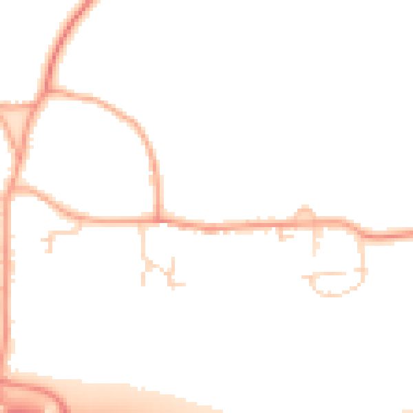
Daytime· 07:00 – 23:00
48.2dB

Night-time· 23:00 – 07:00
40.8dB