13 Spareleaze Hill, Loughton, IG10 1BS
About 13 Spareleaze Hill
13 Spareleaze Hill is a two-bedroom detached house in Loughton (IG10 1BS). It has a recorded floor area of 155 m² (around 1668 sq ft), construction records dating it to 1950-1966 and council tax band G. The latest certificate (October 2016) shows an F (score 35), near the bottom of the EPC scale. The recommended improvements would lift it to D (score 66), a 2-band jump. Other recorded features include attached land beyond the plot. Our model identifies extension potential, subject to local planning policy.
At 155 m² it sits well below the postcode median (296 m² across 20 EPCs), making it one of the more compact homes locally. On energy efficiency it sits in the bottom 10% of properties in this postcode — significant headroom for improvement. 3 planning records sit against the property, 2 approved, 1 refused. Past consents include an extension, meaningful when judging how the property has evolved. Across 1996–2017, sale prices on this property compounded at 7.5% per year. Today's modelled estimate of £1,344,000 is 22.2% above the 2017 sale price. On a £-per-square-foot basis, the last sale (£659/sq ft) was about 79.9% above the typical sold price in the postcode. 9 years since the last transfer (August 2017).
What this property has
Inside
- Bedrooms2
- Bathrooms1
- Dining roomYes
- EnsuiteYes
- StudyYes
Outside
- Private gardenYes
- LandYes
Building
- Heating systemElectric
- Extension potentialPossible
Everything you need to know about 13 Spareleaze Hill
The true value, the hidden risks and the full sale history, in one report.
Pick your report · from £14.99
One time fee only - money back guarantee

The data behind every report







Energy performance
13 Spareleaze Hill sits at the bottom of the postcode for energy efficiency — meaningful headroom to improve.
EPC Rating
Certificate validity
Valid until 6 October 2026

Get a survey for this property
Level 3 Building Survey
Because the property has been extended more than once, we believe a Level 3 building survey should be considered.
From £1,645 · Includes VAT
Planning history
3 applications on record at 13 Spareleaze Hill, Loughton, IG10 1BS
- May 2020ExtensionFullOutcome in report
Demolition of existing dwelling. Proposed 3 storey replacement dwelling with crown roof over, insert garage to front and rear flat roof dormer.
- Documents
- 32 docs on file
- Reference
- EPF/0411/20
- More recent applications — locked
- New BuildAug 2021Decision
- ExtensionFeb 2021Decision
Unlock 13 Spareleaze Hill, Loughton, IG10 1BS's full planning history
You're seeing the shape of it. The report has the substance.
- Every decision — granted, refused or withdrawn (3 on record)
- All 3 applications on this property in full
- The 70 documents, officer reports & conditions
- What the pattern means for extending or converting here
One time fee only - money back guarantee
Sales history & valuation
Price for 13 Spareleaze Hill has grown more than fourfold since the 1996 starting point.
£1,344,000
Modelled from EPC, postcode comparables and a sale-price growth of 7.5% per year over 21 years.
£1,100,000
Growth on file: 7.5% per year over 21 years.
Sales timeline
17 August 2017Most recent
£1,100,000
+360.3%over 20 years21 August 1996
£239,000
Median price across the last 5 sales in IG10 1BS: £1,930,000 (2024–2021).
Nearby sales in IG10 1BS
15 Spareleaze Hill, Loughton, IG10 1BS
Sold Dec 2024
£2,350,00023 Spareleaze Hill, Loughton, IG10 1BS
Sold Aug 2021
£2,153,00053 Spareleaze Hill, Loughton, IG10 1BS
Sold Mar 2021
£1,930,00041 Spareleaze Hill, Loughton, IG10 1BS
Sold Feb 2021
£1,650,00055 Spareleaze Hill, Loughton, IG10 1BS
Sold Jan 2021
£1,700,000
Versus other Spareleaze Hill homes
Floor Area for 13 Spareleaze Hill lags the street by a wide margin.
Price per m²
£7,097
Street avg £4,683
Floor Area
155 m²
Street avg 311 m²
Habitable Rooms
5 rooms
Street avg 9 rooms
CO₂ Emissions
11.0 t/year
Street avg 10.5 t/year
Everything you need to know about 13 Spareleaze Hill
The true value, the hidden risks and the full sale history, in one report.
Pick your report · from £14.99
One time fee only - money back guarantee
The data behind every report
Similar properties nearby
1 Ashley Grove, Staples Road
IG10 1HS
1 Brook Road
IG10 1BW
1 Durnell Way
IG10 1TG
1 Lanterns, Whitakers Way
IG10 1SQ
1 Kings Green
IG10 1RJ
1 Church Lane
IG10 1PD
1 Grasmere Close
IG10 1SL
1 Elmores
IG10 1NS
The neighbourhood at a glance
Rail-style transport is unusually close for this postcode.
Crime
222/mo
Falling year-on-year across the wider district.
Nearest stop
0.2 km
Alderton Hall Lane — bus stop.
Closest school
0.5 km
The Alderton Infant School and Nursery. 13 schools nearby.
Go deeper on the local area
A Local Area report breaks down crime, transport links, schools and air quality in depth.
Road noise across the postcode
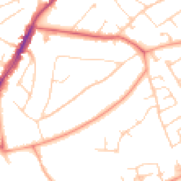
Daytime· 07:00 – 23:00
48.8dB

Night-time· 23:00 – 07:00
39.4dB