12 Hemming Way, Watford, WD25 0BX
About 12 Hemming Way
12 Hemming Way is a three-bedroom mid-terrace house in Watford (WD25 0BX). It has a recorded floor area of 90 m² (around 969 sq ft), construction records dating it to 1930-1949 and council tax band C. The latest certificate (December 2022) shows a D (score 65), on the cusp of jumping into the C band. The recommended improvements would push it to C (score 80).
A recent sale: £390,000 in April 2025. At 90 m² it's 25% larger than the typical home in the postcode (72 m² median across 55 EPCs). It lags the bulk of the postcode on energy efficiency (less efficient than 87% of similar EPCs). Across 1997–2025, sale prices on this property compounded at 6.3% per year. Today's modelled estimate of £441,000 is 13.1% above the 2025 sale price. On a £-per-square-foot basis, the last sale (£403/sq ft) was about 87.8% above the typical sold price in the postcode.
What this property has
Inside
- Bedrooms3
- Bathrooms2
- EnsuiteYes
Outside
- Private gardenRear
Everything you need to know about 12 Hemming Way
The true value, the hidden risks and the full sale history, in one report.
30-day money-back guarantee

The data behind every report


Energy performance
EPC Rating
Planning history
12 Hemming Way has no planning applications on record.
Notable planning nearby
2applications of note in the surrounding area
Sales history & valuation
Price for 12 Hemming Way has grown more than fourfold since the 1997 starting point.
£441,000
Modelled from EPC, postcode comparables and a sale-price growth of 6.3% per year over 28 years.
£390,000
Growth on file: 6.3% per year over 28 years.
Sales timeline
1 April 2025Most recent
£390,000
+25.4%over 9 years15 January 2016
£311,000
+74.2%over 7 years31 July 2008
£178,500
-3.0%28 March 2008
£184,100
+158.6%over 10 years29 May 1997
£71,200
Median price across the last 5 sales in WD25 0BX: £432,500 (2024–2014).
Versus other Hemming Way homes
Years Held for 12 Hemming Way lags the street by a wide margin.
Price per m²
£4,333
Street avg £5,031
Floor Area
90 m²
Street avg 70 m²
Habitable Rooms
4 rooms
Street avg 4 rooms
CO₂ Emissions
3.9 t/year
Street avg 2.6 t/year
Everything you need to know about 12 Hemming Way
The true value, the hidden risks and the full sale history, in one report.
30-day money-back guarantee
The data behind every report
Similar properties nearby
1 Derwent Close
WD25 0NQ
1 Austin Villas, Woodside Road
WD25 0GD
1 Bramble Close
WD25 0HF
1 All Saints Crescent
WD25 0LU
1 Cedar Wood Drive
WD25 0RR
1 Alder Walk
WD25 0RT
1 Aspen Park Drive
WD25 0RS
1 Coopers Mews
WD25 0JD
The neighbourhood at a glance
Crime
4/mo
Steady year-on-year across the wider district.
Nearest stop
0.2 km
Rushton Avenue — bus stop.
Closest school
0.3 km
Kingsway Junior School. 28 schools nearby.
Go deeper on the local area
The full report breaks down crime, transport links, schools and air quality in depth.
Road noise across the postcode
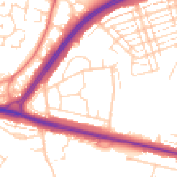
Daytime· 07:00 – 23:00
53.2dB

Night-time· 23:00 – 07:00
44.2dB