9 Rushton Avenue, Watford, WD25 0AP
About 9 Rushton Avenue
9 Rushton Avenue is a three-bedroom end-of-terrace house in Watford (WD25 0AP). It has a recorded floor area of 68 m² (around 732 sq ft), construction records dating it to 1930-1949 and council tax band C. The latest certificate (July 2019) shows a C (score 72). The recommended improvements would push it to B (score 87).
It hasn't traded since October 1996, a hold of 30 years that's notably long for the area. Only one transfer is on record with HM Land Registry, suggesting it has stayed in the same hands for a long time. Today's modelled estimate of £403,000 sits 907.5% above the 1996 sale of £40,000. On a £-per-square-foot basis, the last sale (£55/sq ft) was about 76.2% below the postcode norm.
What this property has
Inside
- Bedrooms3
- Bathrooms1
- Dining roomYes
- CloakroomYes
Outside
- Private gardenRear
Building
- Heating systemGas
Everything you need to know about 9 Rushton Avenue
The true value, the hidden risks and the full sale history, in one report.
30-day money-back guarantee

The data behind every report


Energy performance
EPC Rating
Planning history
9 Rushton Avenue has no planning applications on record.
Notable planning nearby
2applications of note in the surrounding area
Sales history & valuation
Latest sale on 9 Rushton Avenue was the lowest on Land Registry record across the postcode.
£403,000
Modelled from EPC, postcode comparables.
£40,000
Recorded with HM Land Registry.
Sales timeline
3 October 1996Most recent
£40,000
Median price across the last 5 sales in WD25 0AP: £370,000 (2021–2020).
Nearby sales in WD25 0AP
Versus other Rushton Avenue homes
Price per m² for 9 Rushton Avenue lags the street by a wide margin.
Price per m²
£588
Street avg £4,269
Floor Area
68 m²
Street avg 68 m²
Habitable Rooms
4 rooms
Street avg 4 rooms
CO₂ Emissions
2.2 t/year
Street avg 2.7 t/year
Everything you need to know about 9 Rushton Avenue
The true value, the hidden risks and the full sale history, in one report.
30-day money-back guarantee
The data behind every report
Similar properties nearby
1 Derwent Close
WD25 0NQ
1 Austin Villas, Woodside Road
WD25 0GD
1 Bramble Close
WD25 0HF
1 All Saints Crescent
WD25 0LU
1 Cedar Wood Drive
WD25 0RR
1 Alder Walk
WD25 0RT
1 Ennerdale Drive
WD25 0NG
1 Coopers Mews
WD25 0JD
The neighbourhood at a glance
Crime
4/mo
Steady year-on-year across the wider district.
Nearest stop
0.1 km
Rushton Avenue — bus stop.
Closest school
0.4 km
Kingsway Junior School. 28 schools nearby.
Go deeper on the local area
The full report breaks down crime, transport links, schools and air quality in depth.
Road noise across the postcode
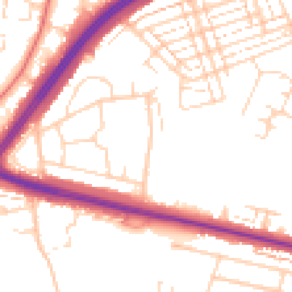
Daytime· 07:00 – 23:00
52.3dB

Night-time· 23:00 – 07:00
43.3dB