27 Rushton Avenue, Watford, WD25 0AP
About 27 Rushton Avenue
27 Rushton Avenue is a two-bedroom mid-terrace house in Watford (WD25 0AP). It has a recorded floor area of 69 m² (around 743 sq ft), construction records dating it to 1930-1949 and council tax band C. The latest certificate (March 2020) shows a C (score 70). The recommended improvements would push it to B (score 89).
Last sale on file: £370,000 in December 2020. Across the public record there are 4 sales, relatively high churn for a single property. One planning record on file: an extension approved in 2010. Past consents include an extension, meaningful when judging how the property has evolved. Across 2009–2020, sale prices on this property compounded at 7.2% per year. Today's modelled estimate of £417,000 is 12.7% above the 2020 sale price. On a £-per-square-foot basis, the last sale (£498/sq ft) was about 139.3% above the typical sold price in the postcode.
What this property has
Inside
- Bedrooms2
- Bathrooms1
Everything you need to know about 27 Rushton Avenue
The true value, the hidden risks and the full sale history, in one report.
30-day money-back guarantee

The data behind every report


Energy performance
EPC Rating
Planning history
27 Rushton Avenue has an approved single-storey rear extension on the planning record.
- May 2010ExtensionAmendmentIn report
Extension: Single storey · Rear of property
Single storey rear extension.
- Agent
- Prestige Projects Management Ltd
- Documents
- 25 docs on file
- Reference
- 10/00266/LDC
What's in 27 Rushton Avenue, Watford, WD25 0AP's planning history?
Refusals, disputes and full decisions on this property and nearby, in the report.
Sales history & valuation
Sale price has at least doubled since 2009.
£417,000
Modelled from EPC, postcode comparables and a sale-price growth of 7.2% per year over 11 years.
£370,000
Growth on file: 7.2% per year over 11 years.
Sales timeline
9 December 2020Most recent
£370,000
6 August 2020
£370,000
+48.0%over 5 years27 August 2014
£250,000
+46.2%over 4 years12 November 2009
£171,000
Median price across the last 5 sales in WD25 0AP: £350,000 (2021–2018).
Nearby sales in WD25 0AP
Versus other Rushton Avenue homes
27 Rushton Avenue is notably below the street on years held.
Price per m²
£5,362
Street avg £3,902
Floor Area
69 m²
Street avg 68 m²
Habitable Rooms
4 rooms
Street avg 4 rooms
CO₂ Emissions
2.5 t/year
Street avg 2.7 t/year
Everything you need to know about 27 Rushton Avenue
The true value, the hidden risks and the full sale history, in one report.
30-day money-back guarantee
The data behind every report
Similar properties nearby
1 Cedar Wood Drive
WD25 0RR
1 Alder Walk
WD25 0RT
1 Aspen Park Drive
WD25 0RS
1 Avon Close
WD25 0DN
1 Derwent Close
WD25 0NQ
1 Austin Villas, Woodside Road
WD25 0GD
1 Bramble Close
WD25 0HF
1 All Saints Crescent
WD25 0LU
The neighbourhood at a glance
Crime
4/mo
Steady year-on-year across the wider district.
Nearest stop
0.1 km
Rushton Avenue — bus stop.
Closest school
0.4 km
Kingsway Junior School. 28 schools nearby.
Go deeper on the local area
The full report breaks down crime, transport links, schools and air quality in depth.
Road noise across the postcode
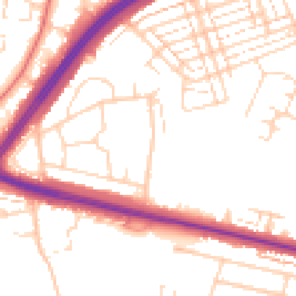
Daytime· 07:00 – 23:00
52.3dB

Night-time· 23:00 – 07:00
43.3dB