54b, Berry Avenue, Watford, WD24 6RY
About 54b
54b is a one-bedroom semi-detached house in Watford (WD24 6RY). It has a recorded floor area of 46 m² (around 495 sq ft), construction records dating it to 1930-1949 and council tax band B. At 46 m² this is the 5th smallest of 37 units on EPC record in the building, where floor areas span 31–122 m². The building's EPC ratings span F to C, with this unit at the top. The latest certificate (October 2023) shows a C (score 69), just inside the C band.
Untraded for 26 years, with the last transfer in March 2000. Only one transfer is on record with HM Land Registry, suggesting it has stayed in the same hands for a long time. Today's modelled estimate of £245,000 sits 265.9% above the 2000 sale of £66,950. On a £-per-square-foot basis, the last sale (£135/sq ft) was about 49.1% below the postcode norm. At 46 m² it sits well below the postcode median (73 m² across 36 EPCs), making it one of the more compact homes locally. Its energy rating outperforms most of the postcode (better than 81% of similar EPCs). 1 bedrooms is on the smaller side for this postcode, where 3 is the typical count.
What this property has
Inside
- Bedrooms1
- Bathrooms1
Everything you need to know about 54b
The true value, the hidden risks and the full sale history, in one report.
30-day money-back guarantee

The data behind every report


Energy performance
EPC Rating
Planning history
54b has no planning applications on record.
Notable planning nearby
4applications of note in the surrounding area
We flagged 1 thing worth checking at 54b
Independent checks surfaced things a buyer would want to understand before offering. The report explains each one in full, with the underlying data and what to ask.
- Signs of HMO activity in the area
30-day money-back guarantee
Sales history & valuation
54b's estimated value is more than triple its earliest registered sale price (2000).
£245,000
Modelled from EPC, postcode comparables.
£66,950
Recorded with HM Land Registry.
Sales timeline
30 March 2000Most recent
£66,950
Median price across the last 5 sales in WD24 6RY: £472,000 (2024–2022).
Versus other Berry Avenue homes
54b is notably below the street on price per m².
Price per m²
£1,455
Street avg £3,941
Floor Area
46 m²
Street avg 45 m²
Habitable Rooms
2 rooms
Street avg 2 rooms
CO₂ Emissions
2.0 t/year
Street avg 2.2 t/year
Everything you need to know about 54b
The true value, the hidden risks and the full sale history, in one report.
30-day money-back guarantee
The data behind every report
Similar properties nearby
The neighbourhood at a glance
Rail-style transport is unusually close for this postcode.
Crime
4/mo
Rising year-on-year across the wider district.
Nearest stop
0.3 km
Library — bus stop.
Closest school
0.3 km
Cherry Tree Primary School. 29 schools nearby.
Go deeper on the local area
The full report breaks down crime, transport links, schools and air quality in depth.
Road noise across the postcode
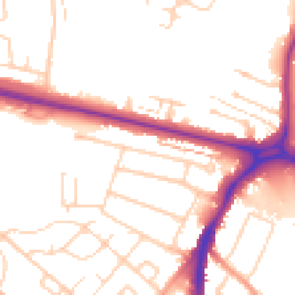
Daytime· 07:00 – 23:00
51.9dB

Night-time· 23:00 – 07:00
42.9dB