Skip to content

4 Broom Grove, Watford, WD17 4RY

1 planning record
Property type
Detached
Bedrooms
4
Bathrooms
2
Floor area
121 m²
1302 sq ft
Energy rating
E
Score 52
Council tax
Band G
Tenure
Owner Occupied
Overview

About 4 Broom Grove

A plain-English summary derived from public records, EPC certificates, sold prices and local data.

4 Broom Grove is a four-bedroom detached house in Watford (WD17 4RY). It has a recorded floor area of 121 m² (around 1302 sq ft), construction records dating it to 1967-1975 and council tax band G. The latest certificate (September 2019) shows an E (score 52), well below the UK norm with real room to improve. The recommended improvements would lift it to C (score 80), a 2-band jump.

Today's modelled estimate of £984,000 is 20.7% above the 2020 sale price. On a £-per-square-foot basis, the last sale (£626/sq ft) was about 86.8% above the typical sold price in the postcode. Most recent transfer: June 2020 at £815,000. One historical planning record sits against the property in 2021.

Specifications

What this property has

Pulled from EPC certificates, claim submissions and our property model. Empty categories are hidden — we only show what's known.

Inside

  • Bedrooms4
  • Bathrooms2
  • EnsuiteYes
Before you decide

Everything you need to know about 4 Broom Grove

The true value, the hidden risks and the full sale history, in one report.

£14.99one-off

30-day money-back guarantee

Preview of the full property report

The data behind every report

  • HM Land Registry, source of sold price history
  • Department for Education, source of schools data
  • Police.uk, source of crime statistics
  • Department for Transport, source of stations and transport links
  • Environment Agency, source of flood risk data
  • Department for Environment, Food & Rural Affairs, source of road noise data
  • PlanIt, source of planning application records
  • Beautiful Places, source of nearby scenic places
Energy

Energy performance

Every EPC certificate filed against this property — current rating, recorded improvements, and where there's headroom to reach a higher band.

4 Broom Grove's carbon output runs well above what efficient homes in the postcode produce.

EPC Rating

A
B
C
D
E
E52
F
G
Main Heating
Gas
Main Fuel
Gas
Hot Water
Good
Windows
Average
CO2 Emissions
7.1 t/year
Occupancy
Owner Occupied
Planning

Planning history

Applications and permits filed against 4 Broom Grove, Watford, WD17 4RY, sourced from the PlanIt planning register.
  1. Jun 2021
    ExtensionFull
    In report

    Extension: Single storey

    Erection of single storey rear extension, replacement roof to existing rear extension, replacement single storey side extension, single front extension, thermal and cladding upgrade to all dormers.

    Documents
    14 docs on file
    Reference
    21/00618/FULH
    View planning record

What's in 4 Broom Grove, Watford, WD17 4RY's planning history?

Refusals, disputes and full decisions on this property and nearby, in the report.

Price

Sales history & valuation

Recorded transactions, our model's current estimate, and a quick read on what neighbouring properties have sold for.

Latest sale on 4 Broom Grove was the highest on Land Registry record across the postcode.

Current estimate

£984,000

Modelled from EPC, postcode comparables.

See how we calculated this
Last sold (2020)

£815,000

Recorded with HM Land Registry.

Sales timeline

  1. 4 June 2020Most recent

    £815,000

Median price across the last 5 sales in WD17 4RY: £485,000 (2014–2005).

On the street

Versus other Broom Grove homes

Four headline reads against 4 similar houses on this street, drawn from the latest EPC and Land Registry data.

On years held, 4 Broom Grove runs well behind the street norm.

Price per m²

£6,736

Street avg £4,223

Above

Floor Area

121 m²

Street avg 132 m²

On par

Habitable Rooms

6 rooms

Street avg 6 rooms

Above

CO₂ Emissions

7.1 t/year

Street avg 7.6 t/year

On par
Before you decide

Everything you need to know about 4 Broom Grove

The true value, the hidden risks and the full sale history, in one report.

£14.99one-off

30-day money-back guarantee

Preview of the full property report

The data behind every report

  • HM Land Registry, source of sold price history
  • Department for Education, source of schools data
  • Police.uk, source of crime statistics
  • Department for Transport, source of stations and transport links
  • Environment Agency, source of flood risk data
  • Department for Environment, Food & Rural Affairs, source of road noise data
  • PlanIt, source of planning application records
  • Beautiful Places, source of nearby scenic places
Area

The neighbourhood at a glance

A condensed read of the local area. Each tile links through to the full breakdown on the Watford district page.

Daytime road noise here sits well below conversation level — a quiet pocket of the postcode.

Crime

10/mo

Steady year-on-year across the wider district.

Nearest stop

0.2 km

Bay Tree Walk — bus stop.

Closest school

0.2 km

Nascot Wood Infant and Nursery School. 34 schools nearby.

Go deeper on the local area

The full report breaks down crime, transport links, schools and air quality in depth.

Noise

Road noise across the postcode

Modelled day and night-time noise levels around WD17 4RY from Defra's strategic mapping. The pin marks this postcode's centroid.
Daytime road noise heatmap for WD17 4RY

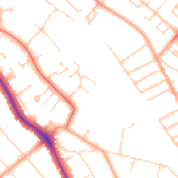
Daytime· 07:00 – 23:00

49.0dB

Low
Night-time road noise heatmap for WD17 4RY

Night-time· 23:00 – 07:00

39.5dB

Low
55 dB
60 dB
65 dB
70 dB
75 dB
80 dB
Defra Road Noise Strategic Mapping, Round 4
FAQ

Common questions

The questions buyers, sellers and homeowners most often ask about 4 Broom Grove, Watford, WD17 4RY. Each answer is also embedded as structured data for search engines.