19 The Plantation, Greenwich, London, SE3 0AB
About 19 The Plantation
19 The Plantation is a mid-terrace house in Greenwich, London, London (SE3 0AB). It has a recorded floor area of 85 m² (around 915 sq ft), construction records dating it to 1967-1975 and council tax band E. The latest certificate (April 2016) shows a D (score 63), on the cusp of jumping into the C band. The recommended improvements would lift it to B (score 87), a 2-band jump. The latest certificate is from April 2016, so improvements made since then won't be reflected.
Most recent transfer: November 2021 at £705,000. Across the public record there are 4 sales, relatively high churn for a single property. That sale was during the post-pandemic price surge, when transactions cleared materially above pre-2020 trend. One planning record on file: an extension approved in 2023. Past consents include an extension, meaningful when judging how the property has evolved. Across 2000–2021, sale prices on this property compounded at 5.3% per year. Today's modelled estimate of £786,000 is 11.5% above the 2021 sale price. On a £-per-square-foot basis, the last sale (£771/sq ft) was about 49.5% above the typical sold price in the postcode.
Know exactly what you're buying at 19 The Plantation
Before you offer, see what the listing won't tell you, the true value, the red flags and the full history.
Valuation
against the asking price
Risks
planning & flood
Sold prices
similar homes nearby
Trends
the local market
Energy performance
Recommended upgrades on file would lift this property by multiple EPC bands.
EPC Expired
This certificate is over 10 years old and is no longer valid.Expired 12 Apr 2026
EPC Rating
Planning history
19 The Plantation has an approved single-storey rear extension on the planning record.
- Sept 2023ExtensionFullIn report
Extension: Single storey · Rear of property
Construction of a single storey flat roof full-width rear extension, extending 1.9 meters in London stock brick to match existing and new outbuilding in rear garden in London stock brick.
- Agent
- Studio-ia Ltd
- Documents
- 12 docs on file
- Reference
- 23/1437/HD
What's in 19 The Plantation, Greenwich, London, SE3 0AB's planning history?
Refusals, disputes and full decisions on this property and nearby, in the report.
Sales history & valuation
Sale price has grown by over 3x since 2000.
£786,000
Modelled from EPC, postcode comparables and a sale-price growth of 5.3% per year over 22 years.
£705,000
Growth on file: 5.3% per year over 22 years.
Sales timeline
22 November 2021Most recent
£705,000
+4.4%over 2 years31 July 2019
£675,000
+110.9%over 15 years11 May 2004
£320,000
+39.1%over 4 years4 May 2000
£230,000
Median price across the last 5 sales in SE3 0AB: £750,000 (2025–2023).
Nearby sales in SE3 0AB
21 The Plantation, Greenwich, London, SE3 0AB
Sold Mar 2025
£720,00020 The Plantation, Greenwich, London, SE3 0AB
Sold Feb 2025
£710,00018 The Plantation, Greenwich, London, SE3 0AB
Sold Oct 2024
£765,00022 The Plantation, Greenwich, London, SE3 0AB
Sold Feb 2024
£750,0009 The Plantation, Greenwich, London, SE3 0AB
Sold Feb 2023
£760,000
Everything we know about 19 The Plantation, in one report
What it's really worth, what could be wrong, and the planning, sales and area data in full.
- Am I paying too much?
- Is something wrong with it?
- Is the agent's story true?
- Will it hold its value?

Versus other The Plantation homes
Price per m²
£8,294
Street avg £7,608
Floor Area
85 m²
Street avg 90 m²
Habitable Rooms
4 rooms
Street avg 4 rooms
CO₂ Emissions
3.6 t/year
Street avg 4.0 t/year
Similar properties nearby
1 Collins Square, Lewisham
SE3 0BT
1 Brigade Street, Lewisham
SE3 0TW
1 4, Hurren Close, Lewisham
SE3 0XA
1 Birchmere Row, Pond Road, Lewisham
SE3 0SS
1 4, Nesbitt Close, Lewisham
SE3 0XB
1 Eliot Vale, Lewisham
SE3 0UU
1 Holm Walk, Greenwich
SE3 0HD
1 Collins Street, Lewisham
SE3 0UG
The neighbourhood at a glance
Rail-style transport is unusually close for this postcode.
Crime
10/mo
Rising year-on-year across the wider district.
Nearest stop
0.4 km
Kidbrooke Park Close — bus stop.
Closest school
0.5 km
Brooklands Primary School. 54 schools nearby.
Go deeper on the local area
The full report breaks down crime, transport links, schools and air quality in depth.
Road noise across the postcode
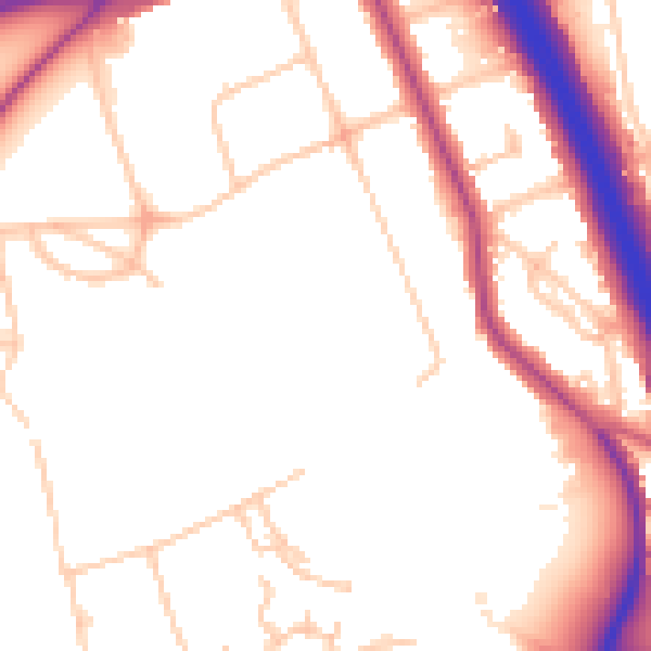
Daytime· 07:00 – 23:00
51.7dB

Night-time· 23:00 – 07:00
43.4dB