10 Francis Hill Court, Church Lane, Lincoln, LN2 1QJ
About 10 Francis Hill Court
10 Francis Hill Court is a two-bedroom detached house in Lincoln (LN2 1QJ). It has a recorded floor area of 72 m² (around 776 sq ft), construction records dating it to 1976-1982 and council tax band B. At 72 m² this is the 4th smallest of 10 units on EPC record in the building, where floor areas span 56–116 m². The building's EPC ratings span E to C across 10 units on file. Other recorded features include a balcony and notable views. The latest certificate (February 2011) shows a D (score 63), on the cusp of jumping into the C band. The recommended improvements would push it to C (score 78). The latest certificate is from February 2011, so improvements made since then won't be reflected.
4 planning records sit against the property, 1 approved, 0 refused, 1 pending. Past consents include tree works, meaningful when judging how the property has evolved. An active application for tree works is awaiting a decision. Most recent transfer: March 2019 at £168,000. Across the public record there are 5 sales, relatively high churn for a single property. Across 2001–2019, sale prices on this property compounded at 5.4% per year. On a £-per-square-foot basis, the last sale (£216/sq ft) was about 30.5% above the typical sold price in the postcode. At 72 m² it's 25.7% smaller than the typical home in the postcode (97 m² median across 15 EPCs).
What this property has
Inside
- Bedrooms2
- Bathrooms1
- Dining roomYes
- EnsuiteYes
Outside
- Communal gardenYes
- ParkingOff street
- BalconyYes
- Notable viewsYes
Building
- Central heatingYes
- RefurbishedYes
Everything you need to know about 10 Francis Hill Court
The true value, the hidden risks and the full sale history, in one report.
Pick your report · every report is £14.99
One time fee only - money back guarantee

The data behind every report


Energy performance
10 Francis Hill Court's EPC is over a decade old — improvements since won't be reflected.
EPC Expired
This certificate is over 10 years old and is no longer valid.Expired 21 Feb 2021
EPC Rating
Get a survey for this property
Level 2 HomeBuyer Report
We've checked 10 risk factors against the available data for this property and believe a Level 2 HomeBuyer Report could be a suitable option for you.
From £495 · Includes VAT
Planning history
Planning history at 10 Francis Hill Court is exclusively tree-management applications — typical for a property with mature trees on or near the plot.
4 applications on record at 10 Francis Hill Court, Church Lane, Lincoln, LN2 1QJ
- Feb 2005Tree WorksTreesOutcome in report
To prune 3 Yew trees, 2 Holly trees and 6 Cherry trees.
- Reference
- 2004/1015/TCO
- More recent applications — locked
- Tree WorksApr 2024Decision
- Tree WorksJun 2014Decision
+ 1 more application in the report
Unlock 10 Francis Hill Court, Church Lane, Lincoln, LN2 1QJ's full planning history
You're seeing the shape of it. The report has the substance.
- Every decision — granted, refused or withdrawn (3 on record)
- All 4 applications on this property in full, plus 5 notable nearby
- The 4 documents, officer reports & conditions
- What the pattern means for extending or converting here
One time fee only - money back guarantee
Sales history & valuation
Sale price has at least doubled since 2001.
£179,000
Modelled from EPC, postcode comparables and a sale-price growth of 5.4% per year over 17 years.
£168,000
Growth on file: 5.4% per year over 17 years.
Sales timeline
28 March 2019Most recent
£168,000
+32.6%over 4 years30 January 2015
£126,720
+10.2%over 3 years18 November 2011
£115,000
+27.8%over 9 years9 May 2002
£89,950
+34.3%over 7 months27 September 2001
£67,000
Median price across the last 5 sales in LN2 1QJ: £380,000 (2024–2020).
Nearby sales in LN2 1QJ
2 Francis Hill Court, Church Lane, Lincoln, LN2 1QJ
Sold Aug 2024
£380,0004 Francis Hill Court, Church Lane, Lincoln, LN2 1QJ
Sold Dec 2023
£220,0008 Francis Hill Court, Church Lane, Lincoln, LN2 1QJ
Sold Jan 2023
£389,9507 Francis Hill Court, Church Lane, Lincoln, LN2 1QJ
Sold Mar 2021
£307,50035 Church Lane, Lincoln, LN2 1QJ
Sold Aug 2020
£665,000
Versus other Church Lane homes
Price per m²
£2,330
Street avg £2,644
Floor Area
72 m²
Street avg 82 m²
Habitable Rooms
3 rooms
Street avg 3 rooms
CO₂ Emissions
3.7 t/year
Street avg 4.5 t/year
Everything you need to know about 10 Francis Hill Court
The true value, the hidden risks and the full sale history, in one report.
Pick your report · every report is £14.99
One time fee only - money back guarantee
The data behind every report
Similar properties nearby
The neighbourhood at a glance
Crime
3/mo
Steady year-on-year across the wider district.
Nearest stop
0.1 km
Bailgate Methodist Church — bus stop.
Closest school
0.3 km
Westgate Academy. 17 schools nearby.
Go deeper on the local area
A Local Area report breaks down crime, transport links, schools and air quality in depth.
Road noise across the postcode
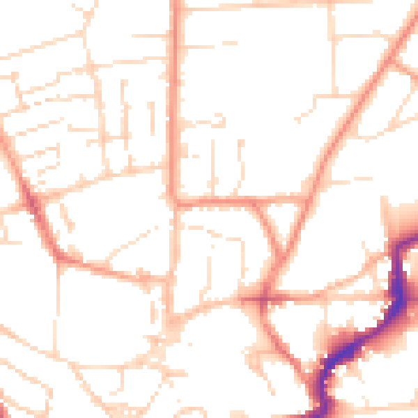
Daytime· 07:00 – 23:00
50.3dB

Night-time· 23:00 – 07:00
39.1dB