36 Manorgate Road, Kingston Upon Thames, KT2 7AL
About 36 Manorgate Road
36 Manorgate Road is a semi-detached house in Kingston Upon Thames (KT2 7AL). It has a recorded floor area of 41 m² (around 441 sq ft), construction records dating it to 2003-2006 and council tax band D. At 41 m² this is the 8th smallest of 26 units on EPC record in the building, where floor areas span 18–203 m². The building's EPC ratings span E to C, with this unit at the top. The latest certificate (September 2023) shows a C (score 75), near the top of the C band. The rating has held steady at C across 4 certificates since March 2011.
At 41 m² it sits well below the postcode median (66 m² across 25 EPCs), making it one of the more compact homes locally. 3 planning records sit against the property, 3 approved, 0 refused. Past consents include an extension, a conservatory and partial demolition, meaningful when judging how the property has evolved. Across 1995–2024, sale prices on this property compounded at 7% per year. On a £-per-square-foot basis, the last sale (£1,422/sq ft) was about 361.1% above the typical sold price in the postcode. Most recent transfer: August 2024 at £627,500.
Everything you need to know about 36 Manorgate Road
The true value, the hidden risks and the full sale history, in one report.
30-day money-back guarantee

The data behind every report


Energy performance
36 Manorgate Road's carbon output is low for the local stock.
EPC Rating
Property Improvements
Changes detected from historical EPC data
Floor insulation added or improved
More low energy lighting installed
Heating controls upgraded for better temperature management
Windows upgraded, improving insulation
Cavity wall insulation installed
Floor insulation added or improved
Planning history
Planning history includes recorded demolition works, indicating a major rebuild phase at this address.
- Mar 2022ConservatoryFullIn report
Extension: Side and rear of property
Demolition of existing rear conservatory and erection of single storey side and rear conservatory extension and internal alteration
ExtensionDemolition- Documents
- 16 docs on file
- Reference
- 22/00068/FUL
- Jun 2018ExtensionFullIn report
Extension: Single storey · Side and rear of property
Erection of a single storey side and rear extension
- Documents
- 18 docs on file
- Reference
- 18/12351/FUL
We flagged 2 things worth checking at 36 Manorgate Road
Independent checks surfaced things a buyer would want to understand before offering. The report explains each one in full, with the underlying data and what to ask.
- Signs of HMO activity in the area
- Larger development activity nearby
30-day money-back guarantee
Sales history & valuation
36 Manorgate Road has more than quadrupled in price since its earliest registered sale in 1995.
£629,000
Modelled from EPC, postcode comparables and a sale-price growth of 7.0% per year over 29 years.
£627,500
Growth on file: 7.0% per year over 29 years.
Sales timeline
29 August 2024Most recent
£627,500
+76.8%over 17 years20 August 2007
£355,000
+87.8%over 5 years30 November 2001
£189,000
+67.0%over 2 years23 January 1999
£113,150
+28.6%over 3 years25 June 1995
£88,000
Median price across the last 5 sales in KT2 7AL: £1,100,000 (2025–2022).
Nearby sales in KT2 7AL
Garden Flat, 8 Manorgate Road, Kingston Upon Thames, KT2 7AL
Sold Feb 2025
£270,0008 Manorgate Road, Kingston Upon Thames, KT2 7AL
Sold Feb 2025
£953,75016 Manorgate Road, Kingston Upon Thames, KT2 7AL
Sold Jun 2023
£1,470,00012 Manorgate Road, Kingston Upon Thames, KT2 7AL
Sold Dec 2022
£1,610,00018 Manorgate Road, Kingston Upon Thames, KT2 7AL
Sold Mar 2022
£1,505,000
Versus other Manorgate Road homes
36 Manorgate Road outperforms the street on price per m² by a wide margin.
Price per m²
£15,305
Street avg £4,593
Floor Area
41 m²
Street avg 49 m²
Habitable Rooms
2 rooms
Street avg 3 rooms
CO₂ Emissions
1.2 t/year
Street avg 2.4 t/year
Everything you need to know about 36 Manorgate Road
The true value, the hidden risks and the full sale history, in one report.
30-day money-back guarantee
The data behind every report
Similar properties nearby
The neighbourhood at a glance
Rail-style transport is unusually close for this postcode.
Crime
5/mo
Rising year-on-year across the wider district.
Nearest stop
0.1 km
Station Road (KT2) — bus stop.
Closest school
0.4 km
St Paul's CofE Primary School, Kingston Hill. 33 schools nearby.
Go deeper on the local area
The full report breaks down crime, transport links, schools and air quality in depth.
Road noise across the postcode
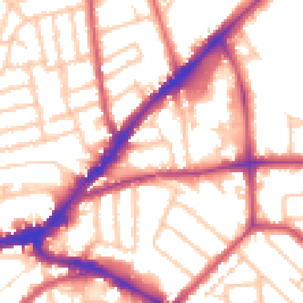
Daytime· 07:00 – 23:00
54.8dB

Night-time· 23:00 – 07:00
44.7dB