6 Burnham Road, Hughenden Valley, High Wycombe, HP14 4NY
About 6 Burnham Road
6 Burnham Road is a four-bedroom detached house in Hughenden Valley, High Wycombe, High Wycombe (HP14 4NY). It has a recorded floor area of 128 m² (around 1378 sq ft), construction records dating it to 1967-1975 and council tax band F. The latest certificate (July 2025) shows a D (score 63), on the cusp of jumping into the C band. The rating has held steady at D across 2 certificates since June 2012. The recommended improvements would push it to C (score 70). Other recorded features include notable views. Records show the property has been extended at some point in its history. The home occupies a cul-de-sac position.
Today's modelled estimate of £738,000 sits 57% above the 2012 sale of £470,000. Last sold in October 2012, so it's been off the market for around 14 years.
What this property has
Inside
- Bedrooms4
- Bathrooms2
- Dining roomYes
- Utility roomYes
- CloakroomYes
- StudyYes
- FireplaceYes
Outside
- Private gardenYes
- GarageSingle
- Summer houseYes
- Notable viewsYes
- Cul-de-sacYes
Building
- Previously extendedYes
- RefurbishedYes
Everything you need to know about 6 Burnham Road
The true value, the hidden risks and the full sale history, in one report.
Pick your report · from £14.99
One time fee only - money back guarantee

The data behind every report


Energy performance
EPC Rating
Certificate validity
Valid until 23 July 2035
Property Improvements
Changes detected from historical EPC data
More low energy lighting installed

Get a survey for this property
Level 3 Building Survey
Because the property has been extended more than once, we believe a Level 3 building survey should be considered.
From £1,220 · Includes VAT
Planning history
6 Burnham Road has no planning applications on record.
But the area is active
2 notable applications nearby — larger schemes and conversions that could reshape the street. The report maps them all.
Sales history & valuation
6 Burnham Road valuation sits well clear of the typical sold price in this postcode.
£738,000
Modelled from EPC, postcode comparables.
£470,000
Recorded with HM Land Registry.
Sales timeline
22 October 2012Most recent
£470,000
Median price across the last 5 sales in HP14 4NY: £590,000 (2025–2013).
Nearby sales in HP14 4NY
13 Burnham Road, Hughenden Valley, High Wycombe, HP14 4NY
Sold Mar 2025
£665,00014 Burnham Road, Hughenden Valley, High Wycombe, HP14 4NY
Sold Jun 2017
£670,0003 Burnham Road, Hughenden Valley, High Wycombe, HP14 4NY
Sold Oct 2013
£475,00020 Burnham Road, Hughenden Valley, High Wycombe, HP14 4NY
Sold Sept 2010
£467,0009 Burnham Road, Hughenden Valley, High Wycombe, HP14 4NY
Sold Jan 2010
£360,000
Versus other Burnham Road homes
6 Burnham Road outperforms the street on years held by a wide margin.
Price per m²
£3,672
Street avg £4,420
Floor Area
128 m²
Street avg 127 m²
Habitable Rooms
6 rooms
Street avg 6 rooms
CO₂ Emissions
4.5 t/year
Street avg 5.1 t/year
Everything you need to know about 6 Burnham Road
The true value, the hidden risks and the full sale history, in one report.
Pick your report · from £14.99
One time fee only - money back guarantee
The data behind every report
Similar properties nearby
1 Cherry Tree Close, Hughenden Valley
HP14 4LP
1 Cherrycroft Drive, Naphill
HP14 4QG
1 Burdett Drive, Walters Ash
HP14 4TL
1 Bramley End, Hughenden Valley
HP14 4NS
1 Brackenwood, Naphill
HP14 4TD
1 Chapel Cottages, Chapel Lane, Naphill
HP14 4RB
1 Deanfield Cottages, Speen Road, North Dean
HP14 4NG
1 Colliers Row, Church Lane, Bledlow Ridge
HP14 4BA
The neighbourhood at a glance
Daytime road noise here sits well below conversation level — a quiet pocket of the postcode.
Crime
51/mo
Falling year-on-year across the wider district.
Nearest stop
0.3 km
Coombe Lane — bus stop.
Closest school
0.7 km
Hughenden Primary School. 9 schools nearby.
Go deeper on the local area
A Local Area report breaks down crime, transport links, schools and air quality in depth.
Road noise across the postcode
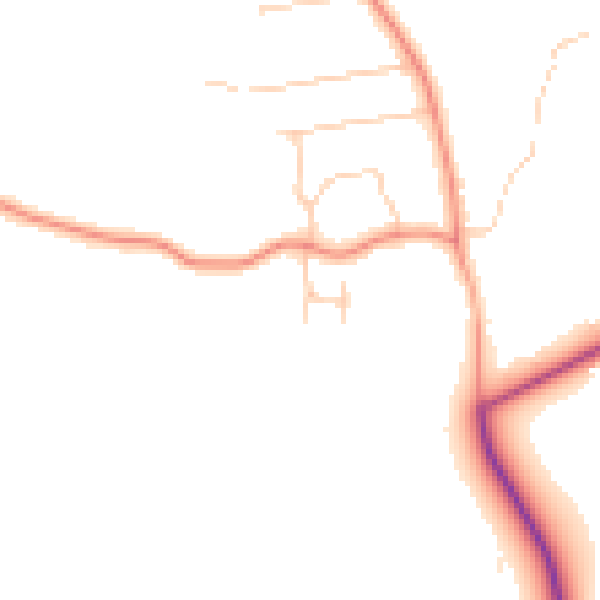
Daytime· 07:00 – 23:00
46.4dB

Night-time· 23:00 – 07:00
38.6dB