14 Burnham Road, Hughenden Valley, High Wycombe, HP14 4NY
About 14 Burnham Road
14 Burnham Road is a four-bedroom detached house in Hughenden Valley, High Wycombe, High Wycombe (HP14 4NY). It has a recorded floor area of 141 m² (around 1518 sq ft), construction records dating it to 1967-1975 and council tax band F. The latest certificate (November 2014) shows a D (score 64), on the cusp of jumping into the C band. The recommended improvements would push it to C (score 80). The latest certificate is from November 2014, so improvements made since then won't be reflected. Other recorded features include attached land beyond the plot.
One planning record on file: an extension approved in 2017. Past consents include an extension, meaningful when judging how the property has evolved. Across 2015–2017, sale prices on this property compounded at 6.4% per year. On a £-per-square-foot basis, the last sale (£441/sq ft) was about 42.2% above the typical sold price in the postcode. Last changed hands 9 years ago, in June 2017.
What this property has
Inside
- Bedrooms4
- Bathrooms1
- Dining roomYes
- EnsuiteYes
Outside
- GarageYes
- LandYes
Everything you need to know about 14 Burnham Road
The true value, the hidden risks and the full sale history, in one report.
Pick your report · every report is £14.99
One time fee only - money back guarantee

The data behind every report


Energy performance
14 Burnham Road's EPC is over a decade old — improvements since won't be reflected.
EPC Expired
This certificate is over 10 years old and is no longer valid.Expired 01 Nov 2024
EPC Rating
Get a survey for this property
Level 2 HomeBuyer Report
We've checked 10 risk factors against the available data for this property and believe a Level 2 HomeBuyer Report could be a suitable option for you.
From £895 · Includes VAT
Planning history
14 Burnham Road has an approved single-storey front extension on the planning record.
1 application on record at 14 Burnham Road, Hughenden Valley, High Wycombe, HP14 4NY
- Dec 2017ExtensionFullOutcome in report
Extension: Single storey · Front of property
Householder application for construction of single storey front extension
- Documents
- 5 docs on file
- Reference
- 17/08042/FUL
Unlock 14 Burnham Road, Hughenden Valley, High Wycombe, HP14 4NY's full planning history
You're seeing the shape of it. The report has the substance.
- Every decision — granted, refused or withdrawn (1 on record)
- All 1 application on this property in full, plus 2 notable nearby
- The 5 documents, officer reports & conditions
- What the pattern means for extending or converting here
One time fee only - money back guarantee
Sales history & valuation
Latest sale on 14 Burnham Road was the highest on Land Registry record across the postcode.
£699,000
Modelled from EPC, postcode comparables and a sale-price growth of 6.4% per year over 2 years.
£670,000
Growth on file: 6.4% per year over 2 years.
Sales timeline
28 June 2017Most recent
£670,000
+13.6%over 2 years15 June 2015
£590,000
Median price across the last 5 sales in HP14 4NY: £470,000 (2025–2010).
Nearby sales in HP14 4NY
13 Burnham Road, Hughenden Valley, High Wycombe, HP14 4NY
Sold Mar 2025
£665,0003 Burnham Road, Hughenden Valley, High Wycombe, HP14 4NY
Sold Oct 2013
£475,0006 Burnham Road, Hughenden Valley, High Wycombe, HP14 4NY
Sold Oct 2012
£470,00020 Burnham Road, Hughenden Valley, High Wycombe, HP14 4NY
Sold Sept 2010
£467,0009 Burnham Road, Hughenden Valley, High Wycombe, HP14 4NY
Sold Jan 2010
£360,000
Versus other Burnham Road homes
Floor Area for 14 Burnham Road runs comfortably ahead of the street norm.
Price per m²
£4,752
Street avg £4,150
Floor Area
141 m²
Street avg 125 m²
Habitable Rooms
7 rooms
Street avg 6 rooms
CO₂ Emissions
5.3 t/year
Street avg 4.9 t/year
Everything you need to know about 14 Burnham Road
The true value, the hidden risks and the full sale history, in one report.
Pick your report · every report is £14.99
One time fee only - money back guarantee
The data behind every report
Similar properties nearby
1 Cherry Tree Close, Hughenden Valley
HP14 4LP
1 Burdett Drive, Walters Ash
HP14 4TL
1 Brackenwood, Naphill
HP14 4TD
1 Cherrycroft Drive, Naphill
HP14 4QG
1 Bramley End, Hughenden Valley
HP14 4NS
1 Chapel Cottages, Chapel Lane, Naphill
HP14 4RB
1 Deanfield Cottages, Speen Road, North Dean
HP14 4NG
1 Chiltern View, Wycombe Road, Saunderton
HP14 4HX
The neighbourhood at a glance
Daytime road noise here sits well below conversation level — a quiet pocket of the postcode.
Crime
3/mo
Steady year-on-year across the wider district.
Nearest stop
0.3 km
Coombe Lane — bus stop.
Closest school
0.7 km
Hughenden Primary School. 9 schools nearby.
Go deeper on the local area
A Local Area report breaks down crime, transport links, schools and air quality in depth.
Road noise across the postcode
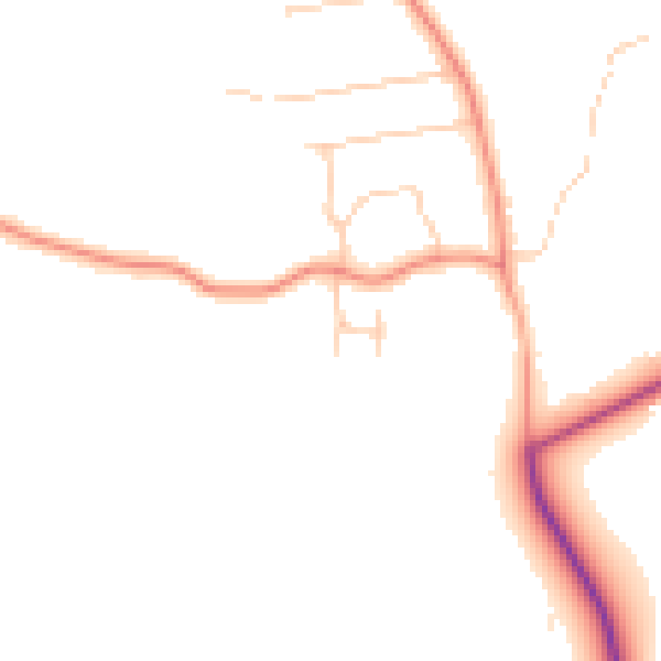
Daytime· 07:00 – 23:00
46.4dB

Night-time· 23:00 – 07:00
38.6dB