14 Warren Wood Drive, High Wycombe, HP11 1DZ
About 14 Warren Wood Drive
14 Warren Wood Drive is a five-bedroom detached house in High Wycombe (HP11 1DZ). It has a recorded floor area of 199 m² (around 2142 sq ft), construction records dating it to 1967-1975 and council tax band F. The latest certificate (May 2022) shows a D (score 57), a step below the typical UK home. The recommended improvements would push it to C (score 79).
At 199 m² the property is well over the postcode median (130 m² across 17 EPCs), placing it in the larger end of the local stock. 5 bedrooms is on the larger side for this postcode, where 3 is the typical count. 3 planning records sit against the property, 2 approved, 1 refused. Past consents include an extension and a conservatory, meaningful when judging how the property has evolved. Across 1997–2022, sale prices on this property compounded at 5.9% per year. On a £-per-square-foot basis, the last sale (£367/sq ft) was about 32.7% above the typical sold price in the postcode. Most recent transfer: December 2022 at £786,000. That sale was during the post-pandemic price surge, when transactions cleared materially above pre-2020 trend.
Know exactly what you're buying at 14 Warren Wood Drive
Before you offer, see what the listing won't tell you, the true value, the red flags and the full history.
Already flagged here
Valuation
against the asking price
Risks
planning & flood
Sold prices
similar homes nearby
Trends
the local market
What this property has
Inside
- Bedrooms5
- Bathrooms2
- Dining roomYes
- EnsuiteYes
Outside
- Private gardenRear
- GarageYes
Energy performance
14 Warren Wood Drive's carbon output runs well above what efficient homes in the postcode produce.
EPC Rating
Planning history
A a single-storey rear extension application was refused at 14 Warren Wood Drive in 2023.
- Apr 2024ExtensionFullIn report
Extension: Single storey · Rear of property
Householder application for construction of single storey rear extension
- Documents
- 9 docs on file
- Reference
- 24/05620/FUL
- Sept 2023ExtensionOutlineIn report
Extension: Single storey · Rear of property
Notification of proposed single storey rear extension; Depth extending from the original rear wall of 7.00 metres, a maximum height of 3.00 metres and an eaves height of 3.00 metres
- Documents
- 10 docs on file
- Reference
- 23/07021/HPDN
We flagged 2 things worth checking at 14 Warren Wood Drive
Independent checks surfaced things a buyer would want to understand before offering. The report explains each one in full, with the underlying data and what to ask.
- Signs of HMO activity in the area
- Larger development activity nearby
30-day money-back guarantee
Sales history & valuation
Latest sale on 14 Warren Wood Drive was the highest on Land Registry record across the postcode.
£805,000
Modelled from EPC, postcode comparables and a sale-price growth of 5.9% per year over 25 years.
£786,000
Growth on file: 5.9% per year over 25 years.
Sales timeline
16 December 2022Most recent
£786,000
+324.9%over 25 years11 September 1997
£185,000
Median price across the last 5 sales in HP11 1DZ: £620,000 (2025–2021).
Nearby sales in HP11 1DZ
26 Warren Wood Drive, High Wycombe, HP11 1DZ
Sold May 2025
£620,00012 Warren Wood Drive, High Wycombe, HP11 1DZ
Sold Apr 2024
£744,00018 Warren Wood Drive, High Wycombe, HP11 1DZ
Sold Feb 2023
£550,0008 Warren Wood Drive, High Wycombe, HP11 1DZ
Sold Feb 2022
£650,00022 Warren Wood Drive, High Wycombe, HP11 1DZ
Sold May 2021
£490,000
Everything we know about 14 Warren Wood Drive, in one report
What it's really worth, what could be wrong, and the planning, sales and area data in full.
What we flagged
- Signs of HMO activity in the area
- Larger development activity nearby

Versus other Warren Wood Drive homes
14 Warren Wood Drive is notably below the street on co₂ emissions.
Price per m²
£3,950
Street avg £3,955
Floor Area
199 m²
Street avg 133 m²
Habitable Rooms
9 rooms
Street avg 6 rooms
CO₂ Emissions
9.4 t/year
Street avg 5.7 t/year
Similar properties nearby
The neighbourhood at a glance
Rail-style transport is unusually close for this postcode.
Crime
7/mo
Steady year-on-year across the wider district.
Nearest stop
0.4 km
Cricket Ground — bus stop.
Closest school
0.8 km
Abbey View Primary Academy. 22 schools nearby.
Go deeper on the local area
The full report breaks down crime, transport links, schools and air quality in depth.
Road noise across the postcode
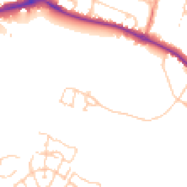
Daytime· 07:00 – 23:00
48.7dB

Night-time· 23:00 – 07:00
40.4dB