20 Ellis Farm Close, Woking, GU22 9QN
About 20 Ellis Farm Close
20 Ellis Farm Close is a four-bedroom detached house in Woking (GU22 9QN). It has a recorded floor area of 153 m² (around 1647 sq ft), construction records dating it to 1950-1966 and council tax band F. The latest certificate (September 2020) shows an E (score 54), well below the UK norm with real room to improve. The recommended improvements would lift it to C (score 71), a 2-band jump. Other recorded features include a conservatory. Records show the property has been extended at some point in its history.
One planning record on file: an extension approved in 2024. Past consents include an extension, meaningful when judging how the property has evolved. At 153 m² it's 18.6% larger than the typical home in the postcode (129 m² median across 19 EPCs). It lags the bulk of the postcode on energy efficiency (less efficient than 84% of similar EPCs). Across 2002–2021, sale prices on this property compounded at 4.6% per year. Today's modelled estimate of £928,000 is 17.5% above the 2021 sale price. On a £-per-square-foot basis, the last sale (£480/sq ft) was about 70.9% above the typical sold price in the postcode. Last sale on file: £790,000 in March 2021. That sale was during the post-pandemic price surge, when transactions cleared materially above pre-2020 trend.
What this property has
Inside
- Bedrooms4
- Bathrooms2
- Open-plan layoutYes
- Dining roomYes
- Utility roomYes
- CloakroomYes
- EnsuiteYes
- ConservatoryYes
Outside
- Private gardenRear
- GarageIntegral
Building
- Previously extendedYes
Everything you need to know about 20 Ellis Farm Close
The true value, the hidden risks and the full sale history, in one report.
Pick your report · every report is £14.99
One time fee only - money back guarantee

The data behind every report


Energy performance
20 Ellis Farm Close's carbon output runs well above what efficient homes in the postcode produce.
EPC Rating
Get a survey for this property
Level 3 Building Survey
Because the property has been extended more than once, we believe a Level 3 building survey should be considered.
From £1,495 · Includes VAT
Planning history
20 Ellis Farm Close has an approved single-storey front extension on the planning record.
1 application on record at 20 Ellis Farm Close, Woking, GU22 9QN
- Jun 2024ExtensionFullOutcome in report
Extension: Single storey · Front of property
Erection of a single storey front extension.
- Documents
- 8 docs on file
- Reference
- PLAN/2024/0318
Unlock 20 Ellis Farm Close, Woking, GU22 9QN's full planning history
You're seeing the shape of it. The report has the substance.
- Every decision — granted, refused or withdrawn (1 on record)
- All 1 application on this property in full, plus 1 notable nearby
- The 8 documents, officer reports & conditions
- What the pattern means for extending or converting here
One time fee only - money back guarantee
Sales history & valuation
20 Ellis Farm Close has more than doubled in price since the earliest registered sale in 2002.
£928,000
Modelled from EPC, postcode comparables and a sale-price growth of 4.6% per year over 19 years.
£790,000
Growth on file: 4.6% per year over 19 years.
Sales timeline
29 March 2021Most recent
£790,000
+113.5%over 15 years9 June 2005
£370,000
+9.5%over 2 years17 July 2002
£338,000
Median price across the last 5 sales in GU22 9QN: £650,000 (2025–2016).
Nearby sales in GU22 9QN
Versus other Ellis Farm Close homes
On price per m², 20 Ellis Farm Close stands well clear of the street.
Price per m²
£5,163
Street avg £3,851
Floor Area
153 m²
Street avg 138 m²
Habitable Rooms
5 rooms
Street avg 6 rooms
CO₂ Emissions
7.7 t/year
Street avg 5.8 t/year
Everything you need to know about 20 Ellis Farm Close
The true value, the hidden risks and the full sale history, in one report.
Pick your report · every report is £14.99
One time fee only - money back guarantee
The data behind every report
Similar properties nearby
1 Apers Avenue
GU22 9NB
1 Chestnut Grove
GU22 9PL
1 Acer Grove
GU22 9FN
1 Bullock Crescent
GU22 9FW
1 Church Cottages, Church Street, Old Woking
GU22 9JF
1 Beaconsfield Road
GU22 9ED
1 Bonsey Lane
GU22 9PT
1 Crowder Cottages, Kingfield Road
GU22 9EQ
The neighbourhood at a glance
Crime
8/mo
Steady year-on-year across the wider district.
Nearest stop
0.3 km
Cricket Pitch — bus stop.
Closest school
0.3 km
Westfield Primary School. 10 schools nearby.
Go deeper on the local area
A Local Area report breaks down crime, transport links, schools and air quality in depth.
Road noise across the postcode
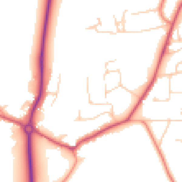
Daytime· 07:00 – 23:00
51.3dB

Night-time· 23:00 – 07:00
43.4dB