43a, High Street Wanstead, Redbridge, London, E11 2AA
About 43a
43a is a three-bedroom mid-terrace house in Redbridge, London, London (E11 2AA). It has a recorded floor area of 118 m² (around 1270 sq ft), construction records dating it to 1900-1929 and council tax band C. The latest certificate (April 2025) shows a D (score 61), on the cusp of jumping into the C band. When first surveyed in June 2013 the rating was E, the property has climbed 1 band since. Between certificates, lighting went from Poor to Very Good; while roof efficiency dropped from Average to Very Poor. The recommended improvements would push it to C (score 69). Other recorded features include a balcony.
At 118 m² the property is well over the postcode median (53 m² across 44 EPCs), placing it in the larger end of the local stock. Most recent transfer: March 2021 at £568,500. Across the public record there are 4 sales, relatively high churn for a single property. That sale was during the post-pandemic price surge, when transactions cleared materially above pre-2020 trend. Across 2002–2021, sale prices on this property compounded at 2.8% per year. Today's modelled estimate of £657,000 is 15.6% above the 2021 sale price. On a £-per-square-foot basis, the last sale (£448/sq ft) was about 244.7% above the typical sold price in the postcode.
Know exactly what you're buying at 43a
Before you offer, see what the listing won't tell you, the true value, the red flags and the full history.
Already flagged here
Valuation
against the asking price
Risks
planning & flood
Sold prices
similar homes nearby
Trends
the local market
What this property has
Inside
- Bedrooms3
- Bathrooms2
- CloakroomYes
Outside
- ParkingAllocated
- BalconyYes
Building
- Central heatingYes
- RefurbishedYes
Energy performance
EPC Rating
Property Improvements
Changes detected from historical EPC data
Heating controls upgraded for better temperature management
More low energy lighting installed
Planning history
43a has no planning applications on record.
Notable planning nearby
18applications of note in the surrounding area
We flagged 1 thing worth checking at 43a
Independent checks surfaced things a buyer would want to understand before offering. The report explains each one in full, with the underlying data and what to ask.
- Signs of HMO activity in the area
30-day money-back guarantee
Sales history & valuation
Latest sale on 43a was the highest on Land Registry record across the postcode.
£657,000
Modelled from EPC, postcode comparables and a sale-price growth of 2.8% per year over 19 years.
£568,500
Growth on file: 2.8% per year over 19 years.
Sales timeline
25 March 2021Most recent
£568,500
+43.2%over 6 years23 April 2014
£397,000
+76.4%over 11 years15 November 2002
£225,000
-33.8%25 July 2002
£340,000
Median price across the last 5 sales in E11 2AA: £160,000 (2024–2018).
Nearby sales in E11 2AA
29a, High Street Wanstead, Redbridge, London, E11 2AA
Sold Dec 2024
£5,000Rear Of 33, High Street Wanstead, Redbridge, London, E11 2AA
Sold Jun 2022
£440,000Rear Of 35, High Street Wanstead, Redbridge, London, E11 2AA
Sold Nov 2021
£160,00041a, High Street Wanstead, Redbridge, London, E11 2AA
Sold Mar 2021
£475,00017b, High Street Wanstead, Redbridge, London, E11 2AA
Sold Sept 2018
£40,000
Everything we know about 43a, in one report
What it's really worth, what could be wrong, and the planning, sales and area data in full.
What we flagged
- Signs of HMO activity in the area

Versus other High Street Wanstead homes
On price per m², 43a stands well clear of the street.
Price per m²
£4,818
Street avg £1,357
Floor Area
118 m²
Street avg 63 m²
Habitable Rooms
4 rooms
Street avg 3 rooms
CO₂ Emissions
4.9 t/year
Street avg 2.1 t/year
Similar properties nearby
1 Corbett Road, Redbridge
E11 2LD
1 Colvin Gardens, Redbridge
E11 2DD
1 Ansell House, Church Path, Redbridge
E11 2SS
1 Cowley Road, Redbridge
E11 2HA
1 Elm Hall Gardens, Redbridge
E11 2HX
1 Chaucer Road, Redbridge
E11 2RE
1 Elm Close, Redbridge
E11 2JE
1 East Way, Redbridge
E11 2DR
The neighbourhood at a glance
Rail-style transport is unusually close for this postcode.
Crime
5/mo
Rising year-on-year across the wider district.
Nearest stop
0.1 km
High Street / Hermon Hill — bus stop.
Closest school
0.1 km
Wanstead Church School. 45 schools nearby.
Go deeper on the local area
The full report breaks down crime, transport links, schools and air quality in depth.
Road noise across the postcode
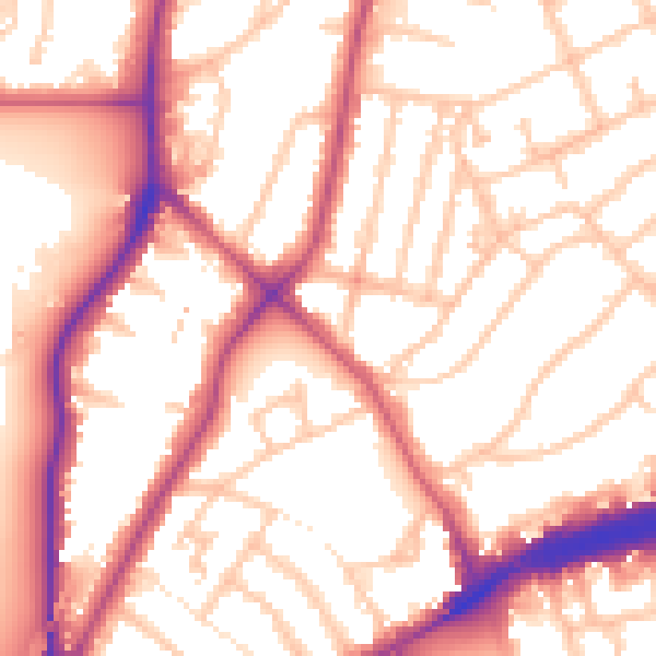
Daytime· 07:00 – 23:00
55.4dB

Night-time· 23:00 – 07:00
46.1dB