6 Alfred Road, Belvedere, DA17 5LL
About 6 Alfred Road
6 Alfred Road is a two-bedroom mid-terrace house in Belvedere (DA17 5LL). It has a recorded floor area of 66 m² (around 710 sq ft), construction records dating it to 1900-1929 and council tax band C. The latest certificate (May 2020) shows a D (score 61), on the cusp of jumping into the C band. The rating has held steady at D across 2 certificates since October 2009. Between certificates, wall efficiency went from Very Poor to Poor and lighting went from Very Poor to Very Good; while roof efficiency dropped from Average to Very Poor. The recommended improvements would push it to C (score 79). The home occupies a cul-de-sac position.
Last sale on file: £308,000 in February 2021. Across the public record there are 5 sales, relatively high churn for a single property. That sale was during the post-pandemic price surge, when transactions cleared materially above pre-2020 trend. Across 2002–2021, sale prices on this property compounded at 5% per year. Today's modelled estimate of £381,000 is 23.7% above the 2021 sale price. On a £-per-square-foot basis, the last sale (£434/sq ft) was about 84.6% above the typical sold price in the postcode. 3 planning records sit against the property, 3 approved, 0 refused. At 66 m² it's 17.5% smaller than the typical home in the postcode (80 m² median across 29 EPCs).
Know exactly what you're buying at 6 Alfred Road
Before you offer, see what the listing won't tell you, the true value, the red flags and the full history.
Already flagged here
Valuation
against the asking price
Risks
planning & flood
Sold prices
similar homes nearby
Trends
the local market
What this property has
Inside
- Bedrooms2
- Bathrooms1
- Dining roomYes
Outside
- Private gardenYes
- Cul-de-sacYes
Building
- RefurbishedYes
Energy performance
EPC Rating
Property Improvements
Changes detected from historical EPC data
Wall insulation improved
More low energy lighting installed
Planning history
- Apr 2019FullIn report
Application for a minor material amendment without provision of tree screening to parent permission 11/00497/FUL.The parent permission being for the re-development of site incorporating the erection of 6 dwellings comprising 1 x 2 bedroom house and 5 x 4 bedroom houses and associated parking.
- Documents
- 7 docs on file
- Reference
- 18/03055/FUL
- Oct 2013ConditionsIn report
Details to condition 7 (Land Assessment) and 15 (Demolition/construction methodology) pursuant to planning permission reference 11/00497/FUL relating to redevelopment of site incorporating the erection of 6 dwellings comprising of 1 x 2 bedroom houses and 5 x 4 bedroom houses and associated parking.
- Documents
- 5 docs on file
- Reference
- 11/00497/FUL01
We flagged 2 things worth checking at 6 Alfred Road
Independent checks surfaced things a buyer would want to understand before offering. The report explains each one in full, with the underlying data and what to ask.
- Signs of HMO activity in the area
- Larger development activity nearby
30-day money-back guarantee
Sales history & valuation
Sale price has at least doubled since 2002.
£381,000
Modelled from EPC, postcode comparables and a sale-price growth of 5.0% per year over 18 years.
£308,000
Growth on file: 5.0% per year over 18 years.
Sales timeline
5 February 2021Most recent
£308,000
+2.7%over 2 years3 May 2018
£300,000
+71.4%over 7 years21 January 2011
£175,000
+10.8%over 6 years16 August 2004
£157,995
+25.4%over 1 year1 September 2002
£126,000
Median price across the last 5 sales in DA17 5LL: £416,000 (2025–2021).
Nearby sales in DA17 5LL
Everything we know about 6 Alfred Road, in one report
What it's really worth, what could be wrong, and the planning, sales and area data in full.
What we flagged
- Signs of HMO activity in the area
- Larger development activity nearby

Versus other Alfred Road homes
6 Alfred Road outperforms the street on price per m² by a wide margin.
Price per m²
£4,667
Street avg £3,612
Floor Area
66 m²
Street avg 88 m²
Habitable Rooms
4 rooms
Street avg 4 rooms
CO₂ Emissions
3.4 t/year
Street avg 3.2 t/year
Similar properties nearby
The neighbourhood at a glance
Crime
4/mo
Steady year-on-year across the wider district.
Nearest stop
0.1 km
Albert Road / Nuxley Road — bus stop.
Closest school
0.4 km
Lessness Heath Primary School. 40 schools nearby.
Go deeper on the local area
The full report breaks down crime, transport links, schools and air quality in depth.
Road noise across the postcode
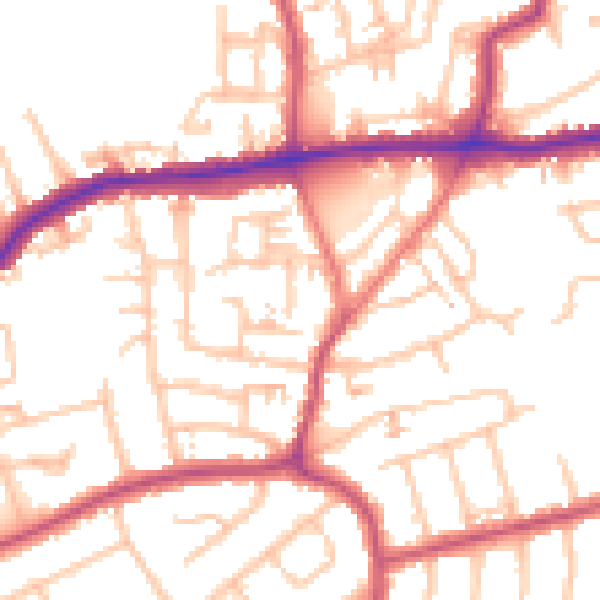
Daytime· 07:00 – 23:00
52.4dB

Night-time· 23:00 – 07:00
41.1dB