Church Farm, Thorpe Lane, Thorpe Audlin, Pontefract, WF8 3HE
About Church Farm
Church Farm is a detached house in Thorpe Audlin, Pontefract, Pontefract (WF8 3HE). It has a recorded floor area of 305 m² (around 3283 sq ft), construction records dating it to 2022 and council tax band D. The latest certificate (April 2022) returns a high B (score 87), putting the home a stone's throw from an A rating. When first surveyed in March 2019 the rating was E, the property has climbed 3 bands since. Between certificates, wall efficiency went from Very Poor to Very Good, roof efficiency went from Good to Very Good and window efficiency went from Average to Very Good.
At 305 m² the property is well over the postcode median (179 m² across 9 EPCs), placing it in the larger end of the local stock. Its energy rating outperforms most of the postcode (better than 78% of similar EPCs). Today's modelled estimate of £763,000 sits 348.8% above the 2019 sale of £170,000. On a £-per-square-foot basis, the last sale (£52/sq ft) was about 73.4% below the postcode norm. 3 planning records sit against the property, 1 approved, 1 refused. Most recent transfer: June 2019 at £170,000.
Everything you need to know about Church Farm
The true value, the hidden risks and the full sale history, in one report.
Pick your report · from £14.99
One time fee only - money back guarantee

The data behind every report







Energy performance
Achieving this rating across a home of this size is uncommon — larger homes typically score lower.
EPC Rating
Certificate validity
Valid until 10 April 2032
Property Improvements
Changes detected from historical EPC data
Heating controls upgraded for better temperature management
Hot water system upgraded
High performance glazing installed
Cavity wall insulation installed
Loft insulation upgraded to recommended levels
Floor insulation added or improved
More low energy lighting installed

Get a survey for this property
Level 3 Building Survey
Because the property is a large detached home over 300m², we believe a Level 3 building survey should be considered.
From £1,220 · Includes VAT
Planning history
Planning history includes recorded demolition works, indicating a major rebuild phase at this address.
3 applications on record at Church Farm, Thorpe Lane, Thorpe Audlin, Pontefract, WF8 3HE
- Aug 2020Demolition And RebuildFullOutcome in report
Construction of dwelling with attached garage following demolition of existing dwelling
- Documents
- 22 docs on file
- Reference
- 19/02570/FUL
- More recent applications — locked
- ConditionsJan 2021Decision
- DemolitionSept 2020Decision
Unlock Church Farm, Thorpe Lane, Thorpe Audlin, Pontefract, WF8 3HE's full planning history
You're seeing the shape of it. The report has the substance.
- Every decision — granted, refused or withdrawn (3 on record)
- All 3 applications on this property in full
- The 47 documents, officer reports & conditions
- What the pattern means for extending or converting here
One time fee only - money back guarantee
Sales history & valuation
Church Farm's modelled value sits at over four times its earliest registered sale price (2019).
£763,000
Modelled from EPC, postcode comparables.
£170,000
Recorded with HM Land Registry.
Sales timeline
27 June 2019Most recent
£170,000
Median price across the last 5 sales in WF8 3HE: £375,000 (2022–2019).
Nearby sales in WF8 3HE
1 Bridge Cottages, Thorpe Lane, Thorpe Audlin, Pontefract, WF8 3HE
Sold Dec 2022
£286,000Saxon, Thorpe Lane, Thorpe Audlin, Pontefract, WF8 3HE
Sold May 2022
£430,000Bridge House, Thorpe Lane, Thorpe Audlin, Pontefract, WF8 3HE
Sold Jan 2022
£875,000Wood View, Thorpe Lane, Thorpe Audlin, Pontefract, WF8 3HE
Sold Jun 2021
£218,000Wellesley, Thorpe Lane, Thorpe Audlin, Pontefract, WF8 3HE
Sold Dec 2019
£375,000
Versus other Thorpe Lane homes
Church Farm is notably below the street on price per m².
Price per m²
£557
Street avg £2,624
Floor Area
305 m²
Street avg 181 m²
CO₂ Emissions
3.7 t/year
Street avg 6.0 t/year
Years Held
7 years
Street avg 6 years
Everything you need to know about Church Farm
The true value, the hidden risks and the full sale history, in one report.
Pick your report · from £14.99
One time fee only - money back guarantee
The data behind every report
Similar properties nearby
1 Applewood Gardens, Darrington
WF8 3FG
1 Carleton Park Avenue
WF8 3RH
1 Ash Tree Fold, Darrington
WF8 3DN
1 Coopers Yard, Hundhill, East Hardwick
WF8 3DZ
1 Copper Beech Close
WF8 3NX
1 Ash Grove, Darrington
WF8 3AA
1 Ashbourne Drive
WF8 3QZ
1 Dale Court
WF8 3SF
The neighbourhood at a glance
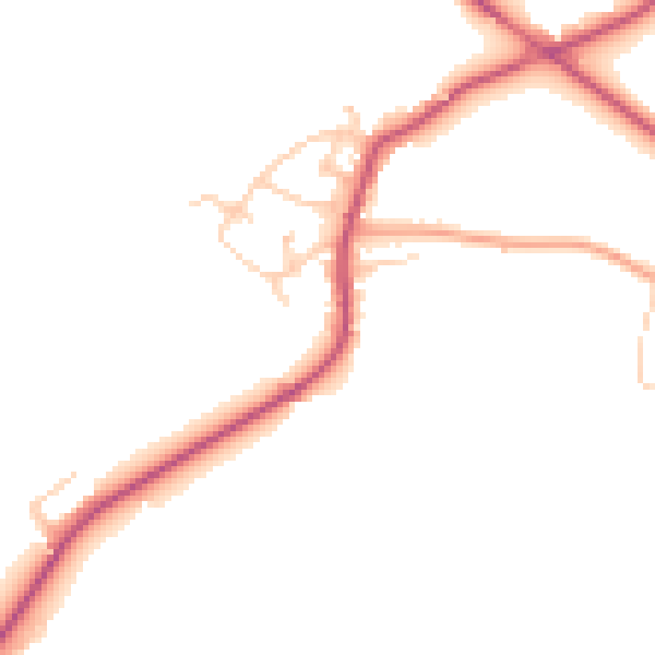
Daytime road noise here sits well below conversation level — a quiet pocket of the postcode.
Crime
322/mo
Falling year-on-year across the wider district.
Nearest stop
0.2 km
Thorpe Ln Hall Garth Road — bus stop.
Closest school
1.4 km
Badsworth Church of England Voluntary Controlled Junior and Infant School. 3 schools nearby.
Go deeper on the local area
A Local Area report breaks down crime, transport links, schools and air quality in depth.
Road noise across the postcode
Daytime· 07:00 – 23:00
46.4dB

Night-time· 23:00 – 07:00
39.4dB