55 Harris Road, Watford, WD25 0AZ
About 55 Harris Road
55 Harris Road is a three-bedroom semi-detached house in Watford (WD25 0AZ). It has a recorded floor area of 99 m² (around 1066 sq ft), construction records dating it to 1950-1966 and council tax band D. The latest certificate (March 2018) shows a D (score 64), on the cusp of jumping into the C band. Earlier certificates rated it C (June 2013); the latest reading is one band lower. Between certificates, window efficiency went from Poor to Average; while wall efficiency dropped from Good to Average and lighting dropped from Poor to Very Poor. The recommended improvements would lift it to B (score 84), a 2-band jump.
2 planning records sit against the property, 0 approved, 0 refused, 2 pending. An active application for an extension is awaiting a decision. At 99 m² it's 15.1% larger than the typical home in the postcode (86 m² median across 11 EPCs). Across 2001–2018, sale prices on this property compounded at 6.5% per year. Today's modelled estimate of £533,000 is 21.4% above the 2018 sale price. Last sale on file: £439,000 in September 2018.
What this property has
Inside
- Bedrooms3
- Dining roomYes
- Utility roomYes
- StudyYes
Outside
- Private gardenRear
- ParkingOff street
Everything you need to know about 55 Harris Road
The true value, the hidden risks and the full sale history, in one report.
30-day money-back guarantee

The data behind every report


Energy performance
Recommended upgrades on file would lift this property by multiple EPC bands.
EPC Rating
Property Improvements
Changes detected from historical EPC data
Windows upgraded, improving insulation
Planning history
55 Harris Road has 2 separate extension applications on the council record.
- Oct 2024ExtensionFullIn report
Extension: Single storey · Rear of property
Erection of a part single storey rear 5m extension to the existing property.
- Documents
- 7 docs on file
- Reference
- 24/00964/FULH
- Aug 2024ExtensionOutlineIn report
Extension: Single storey · Rear of property
The erection of a single storey rear extension which would extend beyond the rear wall of the original house by 5.00m for which the maximum height would be 4.00m and for which the height of the eaves would be 3.00m
- Documents
- 9 docs on file
- Reference
- 24/00786/HPD
What's in 55 Harris Road, Watford, WD25 0AZ's planning history?
Refusals, disputes and full decisions on this property and nearby, in the report.
Sales history & valuation
55 Harris Road has more than doubled in price since the earliest registered sale in 2001.
£533,000
Modelled from EPC, postcode comparables and a sale-price growth of 6.5% per year over 17 years.
£439,000
Growth on file: 6.5% per year over 17 years.
Sales timeline
25 September 2018Most recent
£439,000
+192.7%over 17 years20 September 2001
£150,000
Median price across the last 5 sales in WD25 0AZ: £468,000 (2023–2016).
Versus other Harris Road homes
EPC Rating for 55 Harris Road lags the street by a wide margin.
Price per m²
£4,434
Street avg £4,338
Floor Area
99 m²
Street avg 102 m²
Habitable Rooms
5 rooms
Street avg 5 rooms
CO₂ Emissions
4.2 t/year
Street avg 3.6 t/year
Everything you need to know about 55 Harris Road
The true value, the hidden risks and the full sale history, in one report.
30-day money-back guarantee
The data behind every report
Similar properties nearby
1 Bramble Close
WD25 0HF
1 Austin Villas, Woodside Road
WD25 0GD
1 Derwent Close
WD25 0NQ
1 All Saints Crescent
WD25 0LU
1 Coopers Mews
WD25 0JD
1 Avon Close
WD25 0DN
1 Aspen Park Drive
WD25 0RS
1 Cypress Walk
WD25 0RY
The neighbourhood at a glance
Crime
4/mo
Steady year-on-year across the wider district.
Nearest stop
0.1 km
Harris Road — bus stop.
Closest school
0.3 km
Kingsway Junior School. 28 schools nearby.
Go deeper on the local area
The full report breaks down crime, transport links, schools and air quality in depth.
Road noise across the postcode
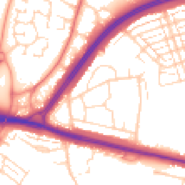
Daytime· 07:00 – 23:00
54.4dB

Night-time· 23:00 – 07:00
45.2dB