7 Harris Road, Watford, WD25 0AX
About 7 Harris Road
7 Harris Road is a three-bedroom semi-detached house in Watford (WD25 0AX). It has a recorded floor area of 89 m² (around 958 sq ft), construction records dating it to 1950-1966 and council tax band D. The property has solar panels and underfloor heating on record, all of which lower running costs and tend to lift resale appeal. Other recorded features include a loft. Records show the property has been extended at some point in its history. The latest certificate (November 2019) shows a C (score 71). The recommended improvements would push it to B (score 83).
At 89 m² the property is well over the postcode median (68 m² across 13 EPCs), placing it in the larger end of the local stock. Across 2006–2020, sale prices on this property compounded at 6.3% per year. Today's modelled estimate of £552,000 is 33% above the 2020 sale price. Most recent transfer: January 2020 at £415,000.
What this property has
Inside
- Bedrooms3
- Bathrooms2
- LoftYes
- FireplaceYes
Outside
- Private gardenYes
Building
- Underfloor heatingYes
- Solar panelsYes
- Previously extendedYes
- RefurbishedYes
Everything you need to know about 7 Harris Road
The true value, the hidden risks and the full sale history, in one report.
30-day money-back guarantee

The data behind every report


Energy performance
EPC Rating
Planning history
7 Harris Road has no planning applications on record.
Notable planning nearby
2applications of note in the surrounding area
Sales history & valuation
Sale price has at least doubled since 2006.
£552,000
Modelled from EPC, postcode comparables and a sale-price growth of 6.3% per year over 13 years.
£415,000
Growth on file: 6.3% per year over 13 years.
Sales timeline
31 January 2020Most recent
£415,000
+102.4%over 7 years19 March 2012
£205,000
+12.3%over 5 years20 August 2006
£182,500
Median price across the last 4 sales in WD25 0AX: £346,500 (2024–2017).
Versus other Harris Road homes
On floor area, 7 Harris Road stands well clear of the street.
Price per m²
£4,663
Street avg £4,875
Floor Area
89 m²
Street avg 71 m²
Habitable Rooms
4 rooms
Street avg 4 rooms
CO₂ Emissions
2.9 t/year
Street avg 2.8 t/year
Everything you need to know about 7 Harris Road
The true value, the hidden risks and the full sale history, in one report.
30-day money-back guarantee
The data behind every report
Similar properties nearby
1 Bramble Close
WD25 0HF
1 Austin Villas, Woodside Road
WD25 0GD
1 Derwent Close
WD25 0NQ
1 All Saints Crescent
WD25 0LU
1 Coopers Mews
WD25 0JD
1 Avon Close
WD25 0DN
1 Aspen Park Drive
WD25 0RS
1 Cypress Walk
WD25 0RY
The neighbourhood at a glance
Crime
4/mo
Steady year-on-year across the wider district.
Nearest stop
0.1 km
Rushton Avenue — bus stop.
Closest school
0.2 km
Kingsway Junior School. 28 schools nearby.
Go deeper on the local area
The full report breaks down crime, transport links, schools and air quality in depth.
Road noise across the postcode
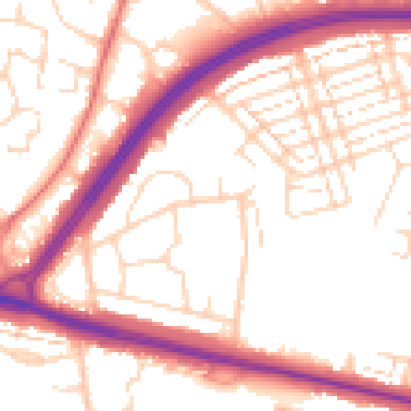
Daytime· 07:00 – 23:00
54.2dB

Night-time· 23:00 – 07:00
45.2dB