9 Purbrock Avenue, Watford, WD25 0AD
About 9 Purbrock Avenue
9 Purbrock Avenue is a three-bedroom semi-detached house in Watford (WD25 0AD). It has a recorded floor area of 95 m² (around 1023 sq ft), construction records dating it to 1930-1949 and council tax band E. The latest certificate (March 2023) shows a D (score 64), on the cusp of jumping into the C band. The recommended improvements would lift it to B (score 85), a 2-band jump.
It hasn't traded since December 1996, a hold of 29 years that's notably long for the area. Only one transfer is on record with HM Land Registry, suggesting it has stayed in the same hands for a long time. Today's modelled estimate of £551,000 sits 451% above the 1996 sale of £100,000. On a £-per-square-foot basis, the last sale (£98/sq ft) was about 62.9% below the postcode norm.
What this property has
Inside
- Bedrooms3
- Bathrooms1
- Open-plan layoutYes
- CloakroomYes
Outside
- Private gardenRear
- ParkingOff street
Building
- RefurbishedYes
Everything you need to know about 9 Purbrock Avenue
The true value, the hidden risks and the full sale history, in one report.
30-day money-back guarantee

The data behind every report


Energy performance
Recommended upgrades on file would lift this property by multiple EPC bands.
EPC Rating
Planning history
9 Purbrock Avenue has no planning applications on record.
Notable planning nearby
2applications of note in the surrounding area
Sales history & valuation
9 Purbrock Avenue's modelled value sits at over four times its earliest registered sale price (1996).
£551,000
Modelled from EPC, postcode comparables.
£100,000
Recorded with HM Land Registry.
Sales timeline
20 December 1996Most recent
£100,000
Median price across the last 5 sales in WD25 0AD: £530,000 (2025–2022).
Nearby sales in WD25 0AD
Versus other Purbrock Avenue homes
9 Purbrock Avenue is notably below the street on price per m².
Price per m²
£1,053
Street avg £4,045
Floor Area
95 m²
Street avg 114 m²
Habitable Rooms
4 rooms
Street avg 5 rooms
CO₂ Emissions
4.1 t/year
Street avg 5.7 t/year
Everything you need to know about 9 Purbrock Avenue
The true value, the hidden risks and the full sale history, in one report.
30-day money-back guarantee
The data behind every report
Similar properties nearby
1 Bramble Close
WD25 0HF
1 Austin Villas, Woodside Road
WD25 0GD
1 Derwent Close
WD25 0NQ
1 All Saints Crescent
WD25 0LU
1 Coopers Mews
WD25 0JD
1 Avon Close
WD25 0DN
1 Aspen Park Drive
WD25 0RS
1 Cypress Walk
WD25 0RY
The neighbourhood at a glance
Rail-style transport is unusually close for this postcode.
Crime
4/mo
Steady year-on-year across the wider district.
Nearest stop
0.2 km
Library — bus stop.
Closest school
0.5 km
Parkgate Infants' and Nursery School. 28 schools nearby.
Go deeper on the local area
The full report breaks down crime, transport links, schools and air quality in depth.
Road noise across the postcode
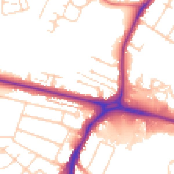
Daytime· 07:00 – 23:00
52.9dB

Night-time· 23:00 – 07:00
44.2dB