121b, St Albans Road, Watford, WD17 1RD
About 121b
121b is a mid-terrace house in Watford (WD17 1RD). It has a recorded floor area of 52 m² (around 560 sq ft) and construction records dating it to 1900-1929. The latest certificate (May 2019) shows a C (score 72). The rating has held steady at C across 2 certificates since April 2019.
4 planning records sit against the property, 0 approved, 1 refused.
Everything you need to know about 121b
The true value, the hidden risks and the full sale history, in one report.
30-day money-back guarantee

The data behind every report


Energy performance
EPC Rating
Planning history
- Feb 2020RenovationFullIn report
Shopfront alteration to provide separate access to shop and flat
- Documents
- 4 docs on file
- Reference
- 19/01449/FUL
- Jan 2017ConditionsIn report
Details submitted for Condition 3 (Materials) Condition 4 (Construction Environmental Management Plan), Condition 5 (Bin and Cycle Storage), Condition 7 (Enclosure Details pursuant to planning permission 13/01013/FUL.
- Documents
- 8 docs on file
- Reference
- 16/00857/DISCON
We flagged 2 things worth checking at 121b
Independent checks surfaced things a buyer would want to understand before offering. The report explains each one in full, with the underlying data and what to ask.
- Signs of HMO activity in the area
- Larger development activity nearby
30-day money-back guarantee
Sales history & valuation
121b has no Land Registry sales on file, suggesting it has stayed in the same hands since registration began.
£288,000
Modelled from EPC, postcode comparables.
No sales recorded with HM Land Registry
That can mean the property has never traded since the registry began publishing in 1995, was a new build that hasn't been registered yet, or is held in the same hands long-term.
Median price across the last 5 sales in WD17 1RD: £350,000 (2024–2022).
Nearby sales in WD17 1RD
Versus other St Albans Road homes
121b outperforms the street on epc rating by a wide margin.
EPC Rating
72 (C)
Street avg 64 (D)
Floor Area
52 m²
Street avg 61 m²
CO₂ Emissions
1.9 t/year
Street avg 2.9 t/year
Habitable Rooms
3 rooms
Street avg 3 rooms
Everything you need to know about 121b
The true value, the hidden risks and the full sale history, in one report.
30-day money-back guarantee
The data behind every report
Similar properties nearby
109c, St Albans Road
WD17 1RD
10 Wellington Road
WD17 1QU
103 105, Flat 1, St Albans Road
WD17 1RD
10 Elm Court, Albert Road South
WD17 1QQ
103 105, Flat 2, St Albans Road
WD17 1RD
109a, St Albans Road
WD17 1RD
1 Terrace Gardens
WD17 1RB
10 St Johns Road
WD17 1PT
The neighbourhood at a glance
Rail-style transport is unusually close for this postcode.
Crime
10/mo
Steady year-on-year across the wider district.
Nearest stop
0.2 km
West Street — bus stop.
Closest school
0.7 km
Lanchester Primary School. 36 schools nearby.
Go deeper on the local area
The full report breaks down crime, transport links, schools and air quality in depth.
Road noise across the postcode
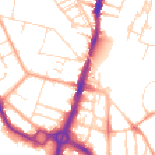
Daytime· 07:00 – 23:00
52.5dB

Night-time· 23:00 – 07:00
42.6dB