109a, St Albans Road, Watford, WD17 1RD
About 109a
109a is a mid-terrace house in Watford (WD17 1RD). It has a recorded floor area of 54 m² (around 581 sq ft), construction records dating it to 1958 and council tax band C. The latest certificate (March 2023) shows an E (score 53), well below the UK norm with real room to improve. When first surveyed in January 2013 the rating was G, the property has climbed 2 bands since. Between certificates, wall efficiency went from Very Poor to Good, roof efficiency went from Very Poor to Very Good and window efficiency went from Poor to Good. Main heating runs on electricity: electricity, unspecified tariff. At 54 m² this is the 21st smallest of 42 units on EPC record in the building, where floor areas span 36–122 m². The building's EPC ratings span E to B, with this unit at the bottom.
Across 2022–2023, sale prices on this property compounded at -47.9% per year. Today's modelled estimate of £272,000 is 15% below the 2023 sale of £320,000, below the original sale price, which typically signals condition or completion-status changes worth verifying. On a £-per-square-foot basis, the last sale (£551/sq ft) was about 55.8% above the typical sold price in the postcode. 10 planning records sit against the property, 4 approved, 0 refused. Past consents include HMO conversion, change of use to residential and subdivision, meaningful when judging how the property has evolved. It lags the bulk of the postcode on energy efficiency (less efficient than 83% of similar EPCs). Most recent transfer: November 2023 at £320,000.
Everything you need to know about 109a
The true value, the hidden risks and the full sale history, in one report.
30-day money-back guarantee

The data behind every report


Energy performance
109a's carbon output is low for the local stock.
EPC Rating
Property Improvements
Changes detected from historical EPC data
Windows upgraded, improving insulation
Loft insulation installed or upgraded to 250mm+
More low energy lighting installed
Hot water system upgraded
High performance glazing installed
Cavity wall insulation installed
Planning history
Council records show a subdivision application — the property's legal arrangement has been altered.
- Mar 2024HMOAmendmentIn report
Lawful Development Certificate for change of use of the property from a 3 bed flat under use class C3 to a small House in Multiple Occupation (HMO) comprising 4no. bedrooms / 4no. occupants under use class C4.
- Documents
- 15 docs on file
- Reference
- 24/00103/LDC
- Sept 2023ConditionsIn report
Details submitted for Condition 3 (ventilation system and soundproofing) and Condition 4 (refuse and recycling storage) pursuant to planning permission 23/00315/CTR
- Documents
- 6 docs on file
- Reference
- 23/00704/DISCON
We flagged 2 things worth checking at 109a
Independent checks surfaced things a buyer would want to understand before offering. The report explains each one in full, with the underlying data and what to ask.
- Signs of HMO activity in the area
- Larger development activity nearby
30-day money-back guarantee
Sales history & valuation
109a changed hands twice within eighteen months — unusual for the area.
£272,000
Modelled from EPC, postcode comparables and a sale-price growth of -47.9% per year over 1 year.
£320,000
Growth on file: -47.9% per year over 1 year.
Sales timeline
7 November 2023Most recent
£320,000
-54.9%over 1 year18 August 2022
£710,000
Median price across the last 5 sales in WD17 1RD: £350,000 (2024–2016).
Nearby sales in WD17 1RD
121a, St Albans Road, Watford, WD17 1RD
Sold Mar 2024
£350,000109c, St Albans Road, Watford, WD17 1RD
Sold Nov 2023
£290,000113a, St Albans Road, Watford, WD17 1RD
Sold May 2023
£700,000101 St Albans Road, Watford, WD17 1RD
Sold Feb 2020
£365,000Flat, 107 St Albans Road, Watford, WD17 1RD
Sold Dec 2016
£330,000
Versus other St Albans Road homes
On co₂ emissions, 109a stands well clear of the street.
Price per m²
£5,926
Street avg £6,231
Floor Area
54 m²
Street avg 61 m²
CO₂ Emissions
0.7 t/year
Street avg 2.9 t/year
Years Held
3 years
Street avg 8 years
Everything you need to know about 109a
The true value, the hidden risks and the full sale history, in one report.
30-day money-back guarantee
The data behind every report
Similar properties nearby
1 Terrace Gardens
WD17 1RB
10 St Johns Road
WD17 1PT
103 105, Flat 2, St Albans Road
WD17 1RD
103 105, Flat 4, St Albans Road
WD17 1RD
103 105, Flat 1, St Albans Road
WD17 1RD
10 Wellington Road
WD17 1QU
1 Elm Court, Albert Road South
WD17 1QQ
109c, St Albans Road
WD17 1RD
The neighbourhood at a glance
Rail-style transport is unusually close for this postcode.
Crime
10/mo
Steady year-on-year across the wider district.
Nearest stop
0.2 km
West Street — bus stop.
Closest school
0.7 km
Lanchester Primary School. 36 schools nearby.
Go deeper on the local area
The full report breaks down crime, transport links, schools and air quality in depth.
Road noise across the postcode
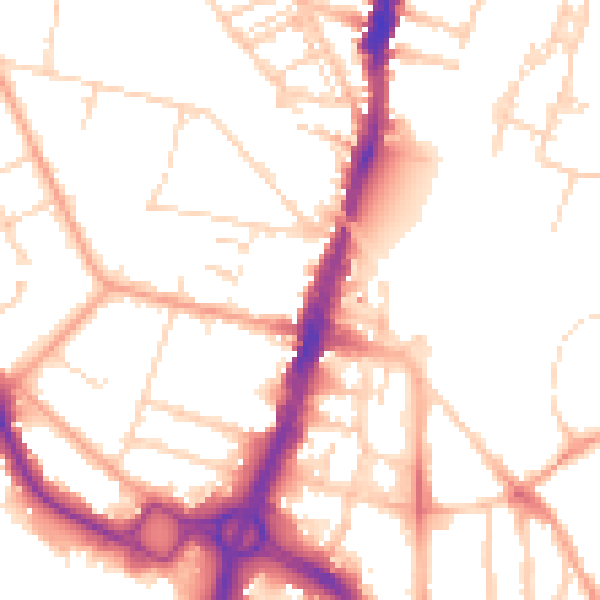
Daytime· 07:00 – 23:00
52.5dB

Night-time· 23:00 – 07:00
42.6dB