44 Petersfield Road, Staines Upon Thames, TW18 1DL
About 44 Petersfield Road
44 Petersfield Road is a four-bedroom semi-detached house in Staines Upon Thames (TW18 1DL). It has a recorded floor area of 149 m² (around 1604 sq ft), construction records dating it to 1930-1949 and council tax band E. The latest certificate (January 2022) shows a C (score 70). When first surveyed in December 2008 the rating was E, the property has climbed 2 bands since. Between certificates, roof efficiency went from Very Poor to Average, hot-water efficiency went from Poor to Good and lighting went from Very Poor to Very Good; while wall efficiency dropped from Average to Very Poor. The recommended improvements would push it to B (score 84).
At 149 m² the property is well over the postcode median (72 m² across 21 EPCs), placing it in the larger end of the local stock. Across 1998–2015, sale prices on this property compounded at 6.9% per year. Today's modelled estimate of £686,000 sits 51.4% above the 2015 sale of £453,000. On a £-per-square-foot basis, the last sale (£282/sq ft) was about 15.3% below the postcode norm. One planning record on file: an extension approved in 2001. Past consents include an extension, meaningful when judging how the property has evolved. Last sold in June 2015, so it's been off the market for around 11 years.
Know exactly what you're buying at 44 Petersfield Road
Before you offer, see what the listing won't tell you, the true value, the red flags and the full history.
Already flagged here
Valuation
against the asking price
Risks
planning & flood
Sold prices
similar homes nearby
Trends
the local market
What this property has
Inside
- Bedrooms4
- Bathrooms2
- EnsuiteYes
Outside
- ParkingYes
Energy performance
EPC Rating
Property Improvements
Changes detected from historical EPC data
Heating controls upgraded for better temperature management
Windows upgraded, improving insulation
Roof insulation improved
Hot water system upgraded
Roof insulation improved
More low energy lighting installed
Planning history
Council records include a two-storey rear extension at 44 Petersfield Road.
- Jul 2001ExtensionFullIn report
Extension: Two storey · Rear of property
Erection of a two storey rear extension
- Documents
- 7 docs on file
- Reference
- 01/00343/FUL
We flagged 1 thing worth checking at 44 Petersfield Road
Independent checks surfaced things a buyer would want to understand before offering. The report explains each one in full, with the underlying data and what to ask.
- Signs of HMO activity in the area
30-day money-back guarantee
Sales history & valuation
44 Petersfield Road has more than tripled in price since its earliest registered sale in 1998.
£686,000
Modelled from EPC, postcode comparables and a sale-price growth of 6.9% per year over 17 years.
£453,000
Growth on file: 6.9% per year over 17 years.
Sales timeline
8 June 2015Most recent
£453,000
+46.1%over 3 years30 January 2012
£310,000
+110.9%over 13 years18 June 1998
£147,000
Median price across the last 5 sales in TW18 1DL: £415,000 (2024–2021).
Nearby sales in TW18 1DL
48 Petersfield Road, Staines Upon Thames, TW18 1DL
Sold Nov 2024
£435,000102 Petersfield Road, Staines Upon Thames, TW18 1DL
Sold Nov 2023
£336,00056 Petersfield Road, Staines Upon Thames, TW18 1DL
Sold Apr 2022
£415,00078 Petersfield Road, Staines Upon Thames, TW18 1DL
Sold Oct 2021
£425,00070 Petersfield Road, Staines Upon Thames, TW18 1DL
Sold Mar 2021
£467,500
Everything we know about 44 Petersfield Road, in one report
What it's really worth, what could be wrong, and the planning, sales and area data in full.
What we flagged
- Signs of HMO activity in the area

Versus other Petersfield Road homes
44 Petersfield Road outperforms the street on floor area by a wide margin.
Price per m²
£3,040
Street avg £4,799
Floor Area
149 m²
Street avg 73 m²
Habitable Rooms
8 rooms
Street avg 4 rooms
CO₂ Emissions
4.6 t/year
Street avg 2.9 t/year
Similar properties nearby
1 Chestnut Manor Close
TW18 1AG
1 Abbot Close
TW18 1QY
1 Berryscroft Road
TW18 1ND
1 Church Villas, The Broadway, Laleham
TW18 1SB
1 Cherry Tree Avenue
TW18 1JB
1 Chestnut Grove
TW18 1DB
1 Fenton Avenue
TW18 1DD
1 Edinburgh Drive
TW18 1PX
The neighbourhood at a glance
Crime
8/mo
Steady year-on-year across the wider district.
Nearest stop
0.2 km
Boundary Road End — bus stop.
Closest school
0.3 km
The Matthew Arnold School. 15 schools nearby.
Go deeper on the local area
The full report breaks down crime, transport links, schools and air quality in depth.
Road noise across the postcode
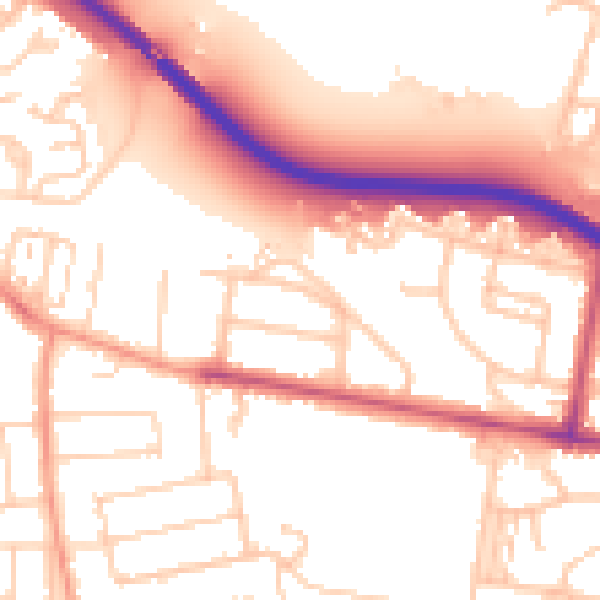
Daytime· 07:00 – 23:00
54.3dB

Night-time· 23:00 – 07:00
45.5dB