2a, Avon Road, Lewisham, London, SE4 1QQ
About 2a
2a is a semi-detached house in Lewisham, London, London (SE4 1QQ). It has a recorded floor area of 66 m² (around 710 sq ft), construction records dating it to before 1900 and council tax band C. At 66 m² this is the 13th smallest of 27 units on EPC record in the building, where floor areas span 29–213 m². The building's EPC ratings span F to C across 27 units on file. The latest certificate (April 2025) shows a D (score 68), on the cusp of jumping into the C band. The rating has held steady at D across 2 certificates since October 2019. The recommended improvements would push it to C (score 75).
One historical planning record sits against the property in 2022.
Everything you need to know about 2a
The true value, the hidden risks and the full sale history, in one report.
Pick your report · every report is £14.99
One time fee only - money back guarantee

The data behind every report


Energy performance
EPC Rating
Get a survey for this property
Level 3 Building Survey
Because the property was built before 1919 and has solid (non-cavity) walls, we believe a Level 3 building survey should be considered.
From £1,020 · Includes VAT
Planning history
1 application on record at 2a, Avon Road, Lewisham, London, SE4 1QQ
- Oct 2022Tree WorksTreesOutcome in report
FRONT: ONE Bay Tree (T1)(ht.6m) HEIGHT REDUCE by 2m to ht.4m FRONT: ONE Elderberry (T2) LATERAL REDUCE for 2m clearance from the building, on SW compass points. REAR: ONE Bay Tree (T3)(ht.6m) HEIGHT REDUCE by 2m to ht.4m
- Documents
- 3 docs on file
- Reference
- DC/22/128255
Unlock 2a, Avon Road, Lewisham, London, SE4 1QQ's full planning history
You're seeing the shape of it. The report has the substance.
- Every decision — granted, refused or withdrawn (1 on record)
- All 1 application on this property in full, plus 19 notable nearby
- The 3 documents, officer reports & conditions
- What the pattern means for extending or converting here
One time fee only - money back guarantee
Sales history & valuation
2a has no Land Registry sales on file, suggesting it has stayed in the same hands since registration began.
£489,000
Modelled from EPC, postcode comparables.
No sales recorded with HM Land Registry
That can mean the property has never traded since the registry began publishing in 1995, was a new build that hasn't been registered yet, or is held in the same hands long-term.
Median price across the last 5 sales in SE4 1QQ: £1,075,000 (2021–2015).
Nearby sales in SE4 1QQ
6 Avon Road, Lewisham, London, SE4 1QQ
Sold Dec 2021
£115,00017 Avon Road, Lewisham, London, SE4 1QQ
Sold Apr 2021
£400,00010 Avon Road, Lewisham, London, SE4 1QQ
Sold Mar 2018
£1,860,00012 Avon Road, Lewisham, London, SE4 1QQ
Sold Jul 2016
£1,325,0001 Avon Road, Lewisham, London, SE4 1QQ
Sold Oct 2015
£1,075,000
Versus other Avon Road homes
EPC Rating
68 (D)
Street avg 65 (D)
Floor Area
66 m²
Street avg 67 m²
CO₂ Emissions
2.5 t/year
Street avg 2.8 t/year
Habitable Rooms
3 rooms
Street avg 3 rooms
Everything you need to know about 2a
The true value, the hidden risks and the full sale history, in one report.
Pick your report · every report is £14.99
One time fee only - money back guarantee
The data behind every report
Similar properties nearby
1 3, Flat 2, Ashby Road, Lewisham
SE4 1PR
1 2, Flat 4, Vulcan Terrace, Lewisham
SE4 1DA
1 2, Flat 6, Vulcan Terrace, Lewisham
SE4 1DA
1 2, Flat 5, Vulcan Terrace, Lewisham
SE4 1DA
1 2, Flat 11, Vulcan Terrace, Lewisham
SE4 1DA
1 3, Flat 4, Ashby Road, Lewisham
SE4 1PR
1 3, Flat 5, Ashby Road, Lewisham
SE4 1PR
1 2, Flat 7, Vulcan Terrace, Lewisham
SE4 1DA
The neighbourhood at a glance
Rail-style transport is unusually close for this postcode.
Crime
7/mo
Rising year-on-year across the wider district.
Nearest stop
0.3 km
Tyrwhitt Road — bus stop.
Closest school
0.5 km
Ashmead Primary School. 69 schools nearby.
Go deeper on the local area
A Local Area report breaks down crime, transport links, schools and air quality in depth.
Road noise across the postcode
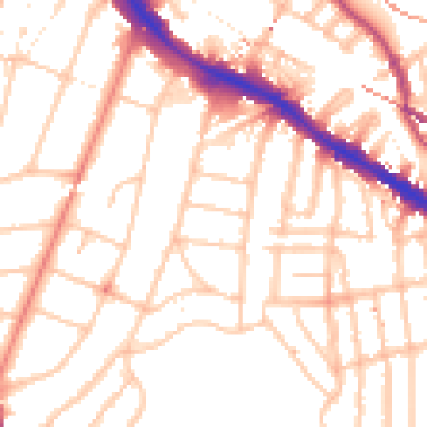
Daytime· 07:00 – 23:00
52.3dB

Night-time· 23:00 – 07:00
42.5dB