1 Billingshurst Road, Broadbridge Heath, Horsham, RH12 3LB
About 1 Billingshurst Road
1 Billingshurst Road is a property in Broadbridge Heath, Horsham, Horsham (RH12 3LB). It has council tax band D.
Sold October 2019 for £381,500.
Everything you need to know about 1 Billingshurst Road
The true value, the hidden risks and the full sale history, in one report.
Pick your report · every report is £14.99
One time fee only - money back guarantee

The data behind every report


Energy performance
No EPC on record
This property doesn't have an Energy Performance Certificate yet. An EPC is required to sell or let — and unlocks our automated valuation.
Get a survey for this property
Level 2 HomeBuyer Report
We've checked 10 risk factors against the available data for this property and believe a Level 2 HomeBuyer Report could be a suitable option for you.
Planning history
1 Billingshurst Road has no planning applications on record.
But the area is active
10 notable applications nearby — larger schemes and conversions that could reshape the street. The report maps them all.
Sales history & valuation
£381,500
Recorded with HM Land Registry.
Sales timeline
23 October 2019Most recent
£381,500
Median price across the last 5 sales in RH12 3LB: £357,500 (2024–2010).
Nearby sales in RH12 3LB
19 Billingshurst Road, Broadbridge Heath, Horsham, RH12 3LB
Sold Jan 2024
£357,50011 Billingshurst Road, Broadbridge Heath, Horsham, RH12 3LB
Sold Jan 2020
£435,0009 Billingshurst Road, Broadbridge Heath, Horsham, RH12 3LB
Sold Aug 2017
£385,0007 Billingshurst Road, Broadbridge Heath, Horsham, RH12 3LB
Sold Feb 2012
£210,0005b, Billingshurst Road, Broadbridge Heath, Horsham, RH12 3LB
Sold May 2009
£250,000
Everything you need to know about 1 Billingshurst Road
The true value, the hidden risks and the full sale history, in one report.
Pick your report · every report is £14.99
One time fee only - money back guarantee
The data behind every report
Similar properties nearby
1 Carter Drive, Broadbridge Heath
RH12 3GZ
1 Brown Close, Broadbridge Heath
RH12 3UR
1 Adams Close, Broadbridge Heath
RH12 3UT
1 Barnsfold Cottages, Barnsfold Lane, Rudgwick
RH12 3BN
1 Arundene Cottage, Loxwood Road, Rudgwick
RH12 3BT
1 Caffyn Place, Broadbridge Heath
RH12 3XH
1 Brook Cottages, Loxwood Road, Rudgwick
RH12 3BP
1 Buck Way, Broadbridge Heath
RH12 3UH
The neighbourhood at a glance
Crime
2/mo
Steady year-on-year across the wider district.
Nearest stop
0.0 km
Church Road — bus stop.
Closest school
0.2 km
Shelley Primary School. 10 schools nearby.
Go deeper on the local area
A Local Area report breaks down crime, transport links, schools and air quality in depth.
Road noise across the postcode
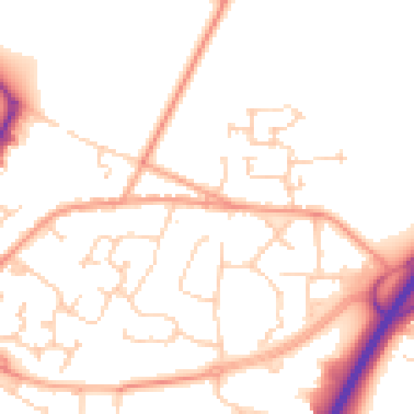
Daytime· 07:00 – 23:00
50.9dB

Night-time· 23:00 – 07:00
41.0dB