Skip to content

2 St Edmunds Lane, Burnham Market, King's Lynn, PE31 8LE

1 planning record
Bedrooms
3
Bathrooms
3
Floor area
155 m²
1668 sq ft
Energy rating
C
Score 76
Overview

About 2 St Edmunds Lane

A plain-English summary derived from public records, EPC certificates, sold prices and local data.

2 St Edmunds Lane is a three-bedroom property in King's Lynn (PE31 8LE). It has a recorded floor area of 155 m² (around 1668 sq ft). The latest certificate (December 2015) shows a C (score 76), near the top of the C band. The recommended improvements would lift it to A (score 98), a 2-band jump. Main heating runs on electricity: electricity, unspecified tariff. The latest certificate is from December 2015, so improvements made since then won't be reflected.

One historical planning record sits against the property in 2022. The record references conservation-area consent, which constrain future alterations. At 155 m² it's 28.6% smaller than the typical home in the postcode (217 m² median across 12 EPCs). Across 2016–2021, sale prices on this property compounded at 2.2% per year. Today's modelled estimate of £1,164,000 is 30.1% above the 2021 sale price. Last sale on file: £895,000 in March 2021. That sale was during the post-pandemic price surge, when transactions cleared materially above pre-2020 trend.

Specifications

What this property has

Pulled from EPC certificates, claim submissions and our property model. Empty categories are hidden — we only show what's known.

Inside

  • Bedrooms3
  • Bathrooms3
  • Open-plan layoutYes
  • Dining roomYes
  • EnsuiteYes
  • FireplaceYes

Outside

  • Private gardenSouth-facing
  • GarageYes

Building

  • RefurbishedYes
Before you decide

Everything you need to know about 2 St Edmunds Lane

The true value, the hidden risks and the full sale history, in one report.

Larger development activity nearby

Pick your report · every report is £14.99

One time fee only - money back guarantee

Preview of the full property report

The data behind every report

  • HM Land Registry, source of sold price history
  • Department for Education, source of schools data
  • Police.uk, source of crime statistics
  • Department for Transport, source of stations and transport links
  • Environment Agency, source of flood risk data
  • Department for Environment, Food & Rural Affairs, source of road noise data
  • PlanIt, source of planning application records
Energy

Energy performance

Every EPC certificate filed against this property — current rating, recorded improvements, and where there's headroom to reach a higher band.

Recommended upgrades on file would lift this property by multiple EPC bands.

EPC Expired

This certificate is over 10 years old and is no longer valid.Expired 15 Dec 2025

EPC Rating

A
B
C
C76
D
E
F
G
Main Heating
Heat Pump
Main Fuel
Electric
Hot Water
Poor
Windows
Very Good
CO2 Emissions
3.2 t/year
Occupancy
SDL Surveying

Get a survey for this property

Level 2 HomeBuyer Report

HouseEPC C

We've checked 10 risk factors against the available data for this property and believe a Level 2 HomeBuyer Report could be a suitable option for you.

From £1,245 · Includes VAT

Planning

Planning history

Applications and permits filed against 2 St Edmunds Lane, Burnham Market, King's Lynn, PE31 8LE, sourced from the PlanIt planning register.

2 St Edmunds Lane sits within a conservation area — exterior works face additional planning controls.

1 application on record at 2 St Edmunds Lane, Burnham Market, King's Lynn, PE31 8LE

1decisions5documents15nearby
Flagged:Conservation area
  1. Jul 2022
    Tree WorksTrees
    Outcome in report

    Four trees to be cut back to match height of the remainder of the hedge, within a Conservation Area

    Conservation Area
    Documents
    5 docs on file
    Reference
    22/00103/TREECA
    Full record in report

Unlock 2 St Edmunds Lane, Burnham Market, King's Lynn, PE31 8LE's full planning history

You're seeing the shape of it. The report has the substance.

  • Every decision — granted, refused or withdrawn (1 on record)
  • All 1 application on this property in full, plus 15 notable nearby
  • The 5 documents, officer reports & conditions
  • What the pattern means for extending or converting here
£14.99one-off · instant

One time fee only - money back guarantee

Price

Sales history & valuation

Recorded transactions, our model's current estimate, and a quick read on what neighbouring properties have sold for.

The latest sale landed in the post-pandemic price surge — useful context when reading the figure.

Current estimate

£1,164,000

Modelled from EPC, postcode comparables and a sale-price growth of 2.2% per year over 5 years.

See how we calculated this
Last sold (2021)

£895,000

Growth on file: 2.2% per year over 5 years.

Sales timeline

  1. 1 March 2021Most recent

    £895,000

    +12.0%over 5 years
  2. 15 January 2016

    £799,000

Median price across the last 5 sales in PE31 8LE: £1,150,000 (2024–2018).

On the street

Versus other St Edmunds Lane homes

Four headline reads against 12 similar houses on this street, drawn from the latest EPC and Land Registry data.

EPC Rating for 2 St Edmunds Lane lags the street by a wide margin.

Price per m²

£5,774

Street avg £5,126

Above

Floor Area

155 m²

Street avg 199 m²

Strongly below

CO₂ Emissions

3.2 t/year

Street avg 3.4 t/year

Above

Years Held

5 years

Street avg 8 years

Strongly below
Before you decide

Everything you need to know about 2 St Edmunds Lane

The true value, the hidden risks and the full sale history, in one report.

Larger development activity nearby

Pick your report · every report is £14.99

One time fee only - money back guarantee

Preview of the full property report

The data behind every report

  • HM Land Registry, source of sold price history
  • Department for Education, source of schools data
  • Police.uk, source of crime statistics
  • Department for Transport, source of stations and transport links
  • Environment Agency, source of flood risk data
  • Department for Environment, Food & Rural Affairs, source of road noise data
  • PlanIt, source of planning application records
Area

The neighbourhood at a glance

A condensed read of the local area. Each tile links through to the full breakdown on the King's Lynn district page.

Daytime road noise here sits well below conversation level — a quiet pocket of the postcode.

Crime

3/mo

Steady year-on-year across the wider district.

Closest school

0.5 km

Burnham Market Primary School. 1 school nearby.

Go deeper on the local area

A Local Area report breaks down crime, transport links, schools and air quality in depth.
Noise

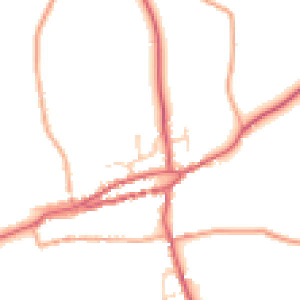
Road noise across the postcode

Modelled day and night-time noise levels around PE31 8LE from Defra's strategic mapping. The pin marks this postcode's centroid.
Daytime road noise heatmap for PE31 8LE

Daytime· 07:00 – 23:00

47.2dB

Low
Night-time road noise heatmap for PE31 8LE

Night-time· 23:00 – 07:00

39.1dB

Low
55 dB
60 dB
65 dB
70 dB
75 dB
80 dB
Defra Road Noise Strategic Mapping, Round 4
FAQ

Common questions

The questions buyers, sellers and homeowners most often ask about 2 St Edmunds Lane, Burnham Market, King's Lynn, PE31 8LE. Each answer is also embedded as structured data for search engines.