39 Brook Street, Nottingham, NG1 1EA
About 39 Brook Street
39 Brook Street is a three-bedroom mid-terrace house in Nottingham (NG1 1EA). It has a recorded floor area of 64 m² (around 689 sq ft), construction records dating it to 1950-1966 and council tax band A. The latest certificate (July 2019) shows a C (score 71). When first surveyed in April 2018 the rating was E, the property has climbed 2 bands since. Between certificates, window efficiency went from Very Poor to Average, hot-water efficiency went from Poor to Good and lighting went from Average to Good; while wall efficiency dropped from Average to Poor and roof efficiency dropped from Good to Average. The recommended improvements would push it to B (score 89).
Today's modelled estimate of £171,000 sits 54.1% above the 2018 sale of £111,000. On a £-per-square-foot basis, the last sale (£161/sq ft) was about 32% above the typical sold price in the postcode. One planning record on file: partial demolition approved in 2006. Past consents include partial demolition, meaningful when judging how the property has evolved. Last changed hands 8 years ago, in May 2018. At 64 m² it's 19% smaller than the typical home in the postcode (79 m² median across 13 EPCs).
What this property has
Inside
- Bedrooms3
- Bathrooms1
- Dining roomYes
- EnsuiteYes
- FireplaceYes
Outside
- Private gardenRear
- ParkingAllocated
Building
- RefurbishedYes
Everything you need to know about 39 Brook Street
The true value, the hidden risks and the full sale history, in one report.
Pick your report · every report is £14.99
One time fee only - money back guarantee

The data behind every report


Energy performance
EPC Rating
Property Improvements
Changes detected from historical EPC data
Heating controls upgraded for better temperature management
Hot water system upgraded
Single glazing replaced with double or better glazing
Get a survey for this property
Level 2 HomeBuyer Report
We've checked 10 risk factors against the available data for this property and believe a Level 2 HomeBuyer Report could be a suitable option for you.
From £495 · Includes VAT
Planning history
Planning history includes recorded demolition works, indicating a major rebuild phase at this address.
1 application on record at 39 Brook Street, Nottingham, NG1 1EA
- Jul 2006DemolitionOtherOutcome in report
Demolition of residential properties, including details of the method of proposed demolition and any proposed restoration of the site.
- Documents
- 1 doc on file
- Reference
- 06/01024/PADS4
Unlock 39 Brook Street, Nottingham, NG1 1EA's full planning history
You're seeing the shape of it. The report has the substance.
- Every decision — granted, refused or withdrawn (1 on record)
- All 1 application on this property in full, plus 14 notable nearby
- The 1 documents, officer reports & conditions
- What the pattern means for extending or converting here
One time fee only - money back guarantee
Sales history & valuation
39 Brook Street valuation sits well clear of the typical sold price in this postcode.
£171,000
Modelled from EPC, postcode comparables.
£111,000
Recorded with HM Land Registry.
Sales timeline
14 May 2018Most recent
£111,000
Median price across the last 5 sales in NG1 1EA: £230,000 (2024–2022).
Nearby sales in NG1 1EA
Versus other Brook Street homes
Floor Area for 39 Brook Street lags the street by a wide margin.
Price per m²
£1,734
Street avg £2,012
Floor Area
64 m²
Street avg 89 m²
Habitable Rooms
4 rooms
Street avg 4 rooms
CO₂ Emissions
2.2 t/year
Street avg 2.5 t/year
Everything you need to know about 39 Brook Street
The true value, the hidden risks and the full sale history, in one report.
Pick your report · every report is £14.99
One time fee only - money back guarantee
The data behind every report
Similar properties nearby
10 Brightmoor Street
NG1 1FD
105 Cliff Road
NG1 1GT
1 The Ice House, Belward Street
NG1 1JW
103 Cliff Road
NG1 1GT
1 Belward Street
NG1 1JZ
1 Park View Court, Bath Street
NG1 1DD
1 Halifax Place
NG1 1QN
107 Cliff Road
NG1 1GT
The neighbourhood at a glance
Rail-style transport is unusually close for this postcode.
Crime
39/mo
Rising year-on-year across the wider district.
Nearest stop
0.1 km
Bath Street HR — bus stop.
Closest school
0.4 km
Nottingham College. 41 schools nearby.
Go deeper on the local area
A Local Area report breaks down crime, transport links, schools and air quality in depth.
Road noise across the postcode
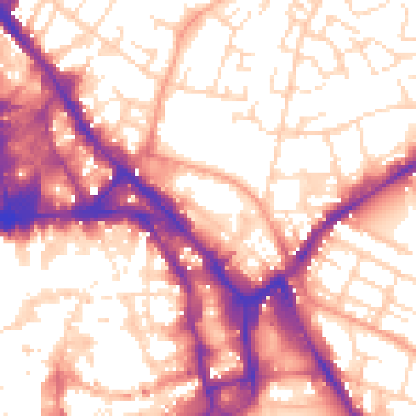
Daytime· 07:00 – 23:00
57.4dB

Night-time· 23:00 – 07:00
47.3dB