35 Blackleach Drive, Worsley, Manchester, M28 3GP
About 35 Blackleach Drive
35 Blackleach Drive is a property in Worsley, Manchester, Manchester (M28 3GP). It has council tax band B.
One historical planning record sits against the property in 2006.
Energy performance
No EPC on record
This property doesn't have an Energy Performance Certificate yet. An EPC is required to sell or let — and unlocks our automated valuation.
Get a survey for this property
Level 2 HomeBuyer Report
We've checked 10 risk factors against the available data for this property and believe a Level 2 HomeBuyer Report could be a suitable option for you.
Planning history
- Sept 2006Demolition And RebuildOutlineOutcome in report
Prior Notification for the demolition of two storey flats
- Documents
- 6 docs on file
- Reference
- 06/53212/DEMCON
Sales history & valuation
No sales recorded with HM Land Registry
That can mean the property has never traded since the registry began publishing in 1995, was a new build that hasn't been registered yet, or is held in the same hands long-term.
Median price across the last 5 sales in M28 3GP: £143,000 (2021–2011).
Similar properties nearby
1 Abbeydale Gardens, Worsley
M28 3PY
1 Ainsworth Court, Stanley Road, Worsley
M28 3EQ
1 Albert Avenue, Worsley
M28 3GE
1 Alexandra Road, Worsley
M28 3RJ
1 Algernon Road, Worsley
M28 3RD
1 Argyle Avenue, Worsley
M28 3GD
1 Arthur Avenue, Worsley
M28 3QF
1 Ashwood Avenue, Worsley
M28 3GQ
The neighbourhood at a glance
Nearest stop
0.2 km
Grosvenor Road — bus stop.
Closest school
0.3 km
North Walkden Primary School. 38 schools nearby.
Road noise across the postcode
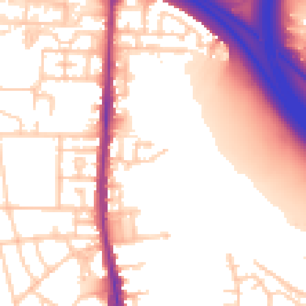
Daytime· 07:00 – 23:00
56.4dB

Night-time· 23:00 – 07:00
48.8dB