1 Brookfield Drive, Worsley, Manchester, M28 1JY
About 1 Brookfield Drive
1 Brookfield Drive is a detached house in Worsley, Manchester, Manchester (M28 1JY). It has a recorded floor area of 94 m² (around 1012 sq ft), construction records dating it to 1967-1975 and council tax band D. The latest certificate (November 2020) shows a D (score 59), a step below the typical UK home. The recommended improvements would lift it to B (score 83), a 2-band jump.
2 planning records sit against the property, 1 approved, 0 refused.
Everything you need to know about 1 Brookfield Drive
The true value, the hidden risks and the full sale history, in one report.
Pick your report · every report is £14.99
One time fee only - money back guarantee

The data behind every report


Energy performance
Recommended upgrades on file would lift this property by multiple EPC bands.
EPC Rating
Get a survey for this property
Level 2 HomeBuyer Report
We've checked 10 risk factors against the available data for this property and believe a Level 2 HomeBuyer Report could be a suitable option for you.
From £595 · Includes VAT
Planning history
2 applications on record at 1 Brookfield Drive, Worsley, Manchester, M28 1JY
- Nov 2021RenovationFullOutcome in report
Removal of boundary fence and erection of a boundary brick wall/pillars including timber fence panels
- Documents
- 5 docs on file
- Reference
- 21/78563/HH
- More recent applications — locked
- ExtensionSept 2023Decision
Unlock 1 Brookfield Drive, Worsley, Manchester, M28 1JY's full planning history
You're seeing the shape of it. The report has the substance.
- Every decision — granted, refused or withdrawn (1 on record)
- All 2 applications on this property in full
- The 12 documents, officer reports & conditions
- What the pattern means for extending or converting here
One time fee only - money back guarantee
Sales history & valuation
1 Brookfield Drive has no Land Registry sales on file, suggesting it has stayed in the same hands since registration began.
£343,000
Modelled from EPC, postcode comparables.
No sales recorded with HM Land Registry
That can mean the property has never traded since the registry began publishing in 1995, was a new build that hasn't been registered yet, or is held in the same hands long-term.
Median price across the last 5 sales in M28 1JY: £335,000 (2024–2017).
Nearby sales in M28 1JY
14 Brookfield Drive, Worsley, Manchester, M28 1JY
Sold Dec 2024
£335,00022 Brookfield Drive, Worsley, Manchester, M28 1JY
Sold Feb 2023
£440,0007 Brookfield Drive, Worsley, Manchester, M28 1JY
Sold Sept 2022
£441,00012 Brookfield Drive, Worsley, Manchester, M28 1JY
Sold Mar 2021
£330,00035 Brookfield Drive, Worsley, Manchester, M28 1JY
Sold Dec 2016
£252,000
Versus other Brookfield Drive homes
On habitable rooms, 1 Brookfield Drive runs well behind the street norm.
EPC Rating
59 (D)
Street avg 65 (D)
Floor Area
94 m²
Street avg 112 m²
CO₂ Emissions
5.0 t/year
Street avg 4.6 t/year
Habitable Rooms
4 rooms
Street avg 6 rooms
Everything you need to know about 1 Brookfield Drive
The true value, the hidden risks and the full sale history, in one report.
Pick your report · every report is £14.99
One time fee only - money back guarantee
The data behind every report
Similar properties nearby
1 Bankfield Drive, Worsley
M28 1GA
1 Bridge Mill Place, Worsley
M28 1PD
1 Bleasefell Chase, Worsley
M28 1UZ
1 Border Brook Lane, Worsley
M28 1XJ
1 Booths Hall Grove, Worsley
M28 1LQ
1 Ashford Avenue, Worsley
M28 1JJ
1 Barnfield Drive, Worsley
M28 1NF
1 Amberhill Way, Worsley
M28 1UP
The neighbourhood at a glance
Nearest stop
0.3 km
Highclove Lane — bus stop.
Closest school
0.3 km
St Andrew's CofE Primary School. 20 schools nearby.
Go deeper on the local area
A Local Area report breaks down crime, transport links, schools and air quality in depth.
Road noise across the postcode
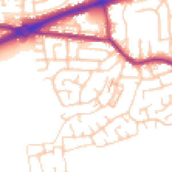
Daytime· 07:00 – 23:00
52.0dB

Night-time· 23:00 – 07:00
42.6dB