14 Brookfield Drive, Worsley, Manchester, M28 1JY
About 14 Brookfield Drive
14 Brookfield Drive is a detached house in Worsley, Manchester, Manchester (M28 1JY). It has a recorded floor area of 95 m² (around 1023 sq ft), construction records dating it to 1950-1966 and council tax band D. The latest certificate (August 2024) shows a C (score 69), just inside the C band. The recommended improvements would push it to B (score 84).
It changed hands recently, sold December 2024 for £335,000. Today's modelled estimate of £381,000 is 13.7% above the 2024 sale price. On a £-per-square-foot basis, the last sale (£328/sq ft) was about 83.8% above the typical sold price in the postcode.
Everything you need to know about 14 Brookfield Drive
The true value, the hidden risks and the full sale history, in one report.
Pick your report · every report is £14.99
One time fee only - money back guarantee

The data behind every report


Energy performance
EPC Rating
Get a survey for this property
Level 2 HomeBuyer Report
We've checked 10 risk factors against the available data for this property and believe a Level 2 HomeBuyer Report could be a suitable option for you.
From £595 · Includes VAT
Planning history
14 Brookfield Drive has no planning applications on record.
A planning report still maps activity across the surrounding area and reads this property's extension & conversion potential.
Sales history & valuation
14 Brookfield Drive valuation sits well clear of the typical sold price in this postcode.
£381,000
Modelled from EPC, postcode comparables.
£335,000
Recorded with HM Land Registry.
Sales timeline
12 December 2024Most recent
£335,000
Median price across the last 5 sales in M28 1JY: £330,000 (2023–2016).
Nearby sales in M28 1JY
22 Brookfield Drive, Worsley, Manchester, M28 1JY
Sold Feb 2023
£440,0007 Brookfield Drive, Worsley, Manchester, M28 1JY
Sold Sept 2022
£441,00012 Brookfield Drive, Worsley, Manchester, M28 1JY
Sold Mar 2021
£330,00035 Brookfield Drive, Worsley, Manchester, M28 1JY
Sold Dec 2016
£252,00021 Brookfield Drive, Worsley, Manchester, M28 1JY
Sold Sept 2016
£290,000
Versus other Brookfield Drive homes
14 Brookfield Drive is notably below the street on years held.
Price per m²
£3,526
Street avg £2,576
Floor Area
95 m²
Street avg 112 m²
Habitable Rooms
5 rooms
Street avg 5 rooms
CO₂ Emissions
3.6 t/year
Street avg 4.7 t/year
Everything you need to know about 14 Brookfield Drive
The true value, the hidden risks and the full sale history, in one report.
Pick your report · every report is £14.99
One time fee only - money back guarantee
The data behind every report
Similar properties nearby
1 Bleasefell Chase, Worsley
M28 1UZ
1 Booths Hall Grove, Worsley
M28 1LQ
1 Brookfield Drive, Worsley
M28 1JY
1 Bankfield Drive, Worsley
M28 1GA
1 Amberhill Way, Worsley
M28 1UP
1 Boothstown Drive, Worsley
M28 1UF
1 Arkholme, Worsley
M28 1ZJ
1 Bridge Mill Place, Worsley
M28 1PD
The neighbourhood at a glance
Nearest stop
0.3 km
Highclove Lane — bus stop.
Closest school
0.3 km
St Andrew's CofE Primary School. 20 schools nearby.
Go deeper on the local area
A Local Area report breaks down crime, transport links, schools and air quality in depth.
Road noise across the postcode
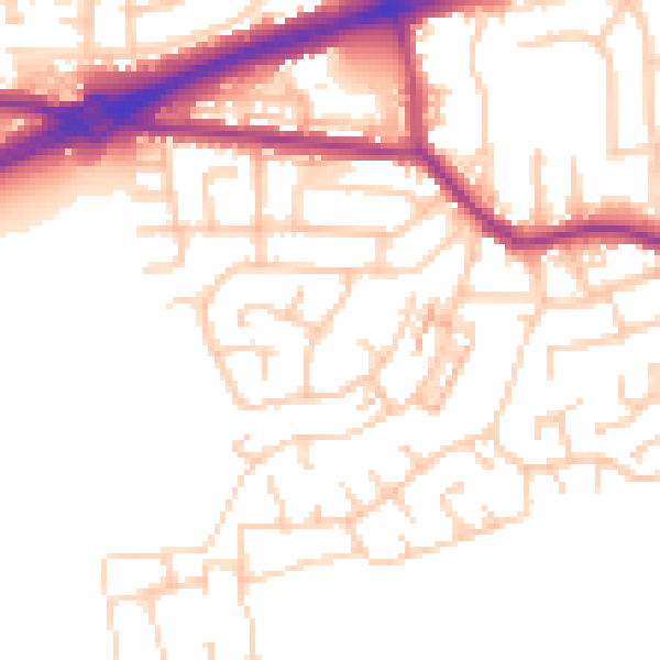
Daytime· 07:00 – 23:00
52.0dB

Night-time· 23:00 – 07:00
42.6dB