12 West Side, High Road, Turnford, Broxbourne, EN10 6DF
About 12 West Side
12 West Side is a five-bedroom semi-detached house in Turnford, Broxbourne, Broxbourne (EN10 6DF). It has a recorded floor area of 158 m² (around 1701 sq ft), construction records dating it to 1930-1949 and council tax band E. The latest certificate (May 2023) shows a C (score 69), just inside the C band. The recommended improvements would push it to B (score 81).
It hasn't traded since November 1999, a hold of 27 years that's notably long for the area. Only one transfer is on record with HM Land Registry, suggesting it has stayed in the same hands for a long time. At 158 m² the property is well over the postcode median (115 m² across 12 EPCs), placing it in the larger end of the local stock. On energy efficiency it sits in the top 10% of properties in this postcode. 5 bedrooms is on the larger side for this postcode, where 3 is the typical count. Today's modelled estimate of £628,000 sits 300% above the 1999 sale of £157,000. On a £-per-square-foot basis, the last sale (£92/sq ft) was about 67.6% below the postcode norm. 6 planning records sit against the property, 3 approved, 0 refused. Past consents include subdivision, an extension and a loft conversion, meaningful when judging how the property has evolved.
What this property has
Inside
- Bedrooms5
- Bathrooms4
- Dining roomYes
- EnsuiteYes
Outside
- ParkingOff street
Everything you need to know about 12 West Side
The true value, the hidden risks and the full sale history, in one report.
30-day money-back guarantee

The data behind every report


Energy performance
12 West Side ranks among the most efficient homes in the postcode for energy use.
EPC Rating
Planning history
Council records show a subdivision application — the property's legal arrangement has been altered.
- Aug 2018SubdivisionFullIn report
Conversion of dwelling to accommodate No.2 Flats
- Documents
- 11 docs on file
- Reference
- 07/18/0585/F
- Apr 2018SubdivisionFullIn report
Internal and external alterations to create 3 no. flats (Re-submission 07/17/0558/F)
- Documents
- 7 docs on file
- Reference
- 07/18/0222/F
We flagged 1 thing worth checking at 12 West Side
Independent checks surfaced things a buyer would want to understand before offering. The report explains each one in full, with the underlying data and what to ask.
- Larger development activity nearby
30-day money-back guarantee
Sales history & valuation
12 West Side's modelled value sits at over four times its earliest registered sale price (1999).
£628,000
Modelled from EPC, postcode comparables.
£157,000
Recorded with HM Land Registry.
Sales timeline
5 November 1999Most recent
£157,000
Median price across the last 5 sales in EN10 6DF: £480,000 (2022–2016).
Nearby sales in EN10 6DF
24 West Side, High Road, Turnford, Broxbourne, EN10 6DF
Sold Aug 2022
£530,00013 West Side, High Road, Turnford, Broxbourne, EN10 6DF
Sold Dec 2019
£480,00015 West Side, High Road, Turnford, Broxbourne, EN10 6DF
Sold Jan 2019
£490,00020 West Side, High Road, Turnford, Broxbourne, EN10 6DF
Sold Jun 2018
£400,00021 West Side, High Road, Turnford, Broxbourne, EN10 6DF
Sold Nov 2016
£400,000
Versus other West Side homes
Years Held for 12 West Side runs comfortably ahead of the street norm.
Price per m²
£994
Street avg £3,551
Floor Area
158 m²
Street avg 164 m²
Habitable Rooms
8 rooms
Street avg 6 rooms
CO₂ Emissions
5.2 t/year
Street avg 7.5 t/year
Everything you need to know about 12 West Side
The true value, the hidden risks and the full sale history, in one report.
30-day money-back guarantee
The data behind every report
Similar properties nearby
1 Arrow Yard, Old Nazeing Road
EN10 6RX
1 De Burgh Close
EN10 6GL
1 Elgin Road
EN10 6JQ
1 Academia Avenue
EN10 6FW
1 Farriers End
EN10 6BS
1 Cedrus Close
EN10 6GA
1 Broomfield Avenue
EN10 6AX
1 Eaton Gardens
EN10 6SA
The neighbourhood at a glance
Crime
3/mo
Steady year-on-year across the wider district.
Nearest stop
0.2 km
Hertford Regional College — bus stop.
Closest school
0.3 km
Longlands Primary School and Nursery. 16 schools nearby.
Go deeper on the local area
The full report breaks down crime, transport links, schools and air quality in depth.
Road noise across the postcode
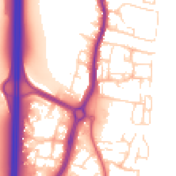
Daytime· 07:00 – 23:00
56.2dB

Night-time· 23:00 – 07:00
47.5dB