1 Greenbank Road, Greenbank, Bristol, BS5 6EZ
About 1 Greenbank Road
1 Greenbank Road is a semi-detached house in Greenbank, Bristol, Bristol (BS5 6EZ). It has a recorded floor area of 146 m² (around 1572 sq ft), construction records dating it to 1900-1929 and council tax band B. At 146 m² this is the largest unit on EPC record across the building (15–146 m²). The building's EPC ratings span E to C, with this unit at the top. The latest certificate (April 2013) shows a C (score 69), just inside the C band. The latest certificate is from April 2013, so improvements made since then won't be reflected.
It hasn't traded since September 2007, a hold of 19 years that's notably long for the area. That sale landed at the peak of the pre-credit-crunch market, which is a useful reference point when interpreting the price. At 146 m² the property is well over the postcode median (91 m² across 27 EPCs), placing it in the larger end of the local stock. Across 2000–2007, sale prices on this property compounded at 22.6% per year. Today's modelled estimate of £381,000 sits 58.7% above the 2007 sale of £240,000. 2 planning records sit against the property, 1 approved, 1 refused. Past consents include new windows and change of use to residential, meaningful when judging how the property has evolved.
Everything you need to know about 1 Greenbank Road
The true value, the hidden risks and the full sale history, in one report.
Pick your report · from £14.99
One time fee only - money back guarantee

The data behind every report





Energy performance
1 Greenbank Road's EPC is over a decade old — improvements since won't be reflected.
EPC Expired
This certificate is over 10 years old and is no longer valid.Expired 12 Apr 2023
EPC Rating
Certificate validity
Expired on 12 April 2023

Get a survey for this property
Level 3 Building Survey
Because the property was built before 1919, has been extended more than once, and has solid (non-cavity) walls, we believe a Level 3 building survey should be considered.
From £955 · Includes VAT
Planning history
2 applications on record at 1 Greenbank Road, Greenbank, Bristol, BS5 6EZ
- Oct 2001Change of UseFullOutcome in report
Change of use of first floor from office use (Use Class B1) to 2 no. self contained flats (Use Class C3) and external alterations to include new shopfront window and entrance door to front elevation and 3 no. windows to side elevation.
New Windows- Reference
- 01/02839/F
- More recent applications — locked
- Change Of UseMay 2008Decision
Unlock 1 Greenbank Road, Greenbank, Bristol, BS5 6EZ's full planning history
You're seeing the shape of it. The report has the substance.
- Every decision — granted, refused or withdrawn (2 on record)
- All 2 applications on this property in full, plus 30 notable nearby
- The 8 documents, officer reports & conditions
- What the pattern means for extending or converting here
One time fee only - money back guarantee
Sales history & valuation
Price for 1 Greenbank Road has grown more than fourfold since the 2000 starting point.
£381,000
Modelled from EPC, postcode comparables and a sale-price growth of 22.6% per year over 7 years.
£240,000
Growth on file: 22.6% per year over 7 years.
Sales timeline
20 September 2007Most recent
£240,000
+300.0%over 6 years30 November 2000
£60,000
Median price across the last 5 sales in BS5 6EZ: £400,000 (2026–2022).
Nearby sales in BS5 6EZ
5 Greenbank Road, Greenbank, Bristol, BS5 6EZ
Sold Jan 2026
£361,37539 Greenbank Road, Greenbank, Bristol, BS5 6EZ
Sold Jul 2025
£319,00013 Greenbank Road, Greenbank, Bristol, BS5 6EZ
Sold Feb 2024
£500,00023 Greenbank Road, Greenbank, Bristol, BS5 6EZ
Sold Aug 2022
£420,00035 Greenbank Road, Greenbank, Bristol, BS5 6EZ
Sold Jun 2021
£360,000
Versus other Greenbank Road homes
Floor Area for 1 Greenbank Road runs comfortably ahead of the street norm.
Price per m²
£1,644
Street avg £2,801
Floor Area
146 m²
Street avg 51 m²
Habitable Rooms
6 rooms
Street avg 3 rooms
CO₂ Emissions
5.0 t/year
Street avg 2.5 t/year
Everything you need to know about 1 Greenbank Road
The true value, the hidden risks and the full sale history, in one report.
Pick your report · from £14.99
One time fee only - money back guarantee
The data behind every report
Similar properties nearby
1 Bruce Road
BS5 6EE
1 Chapel Road, Easton
BS5 6DX
1 Boswell Street
BS5 6SG
1 Camelford Road
BS5 6HW
1 Battersea Road
BS5 6AJ
1 Belle Vue Road, Easton
BS5 6DR
1 Ashdene Avenue
BS5 6QH
1 Bridge Road, Eastville
BS5 6XG
The neighbourhood at a glance
Rail-style transport is unusually close for this postcode.
Crime
627/mo
Steady year-on-year across the wider district.
Nearest stop
0.1 km
Belle Vue Road — bus stop.
Closest school
0.4 km
May Park Primary School. 45 schools nearby.
Go deeper on the local area
A Local Area report breaks down crime, transport links, schools and air quality in depth.
Road noise across the postcode
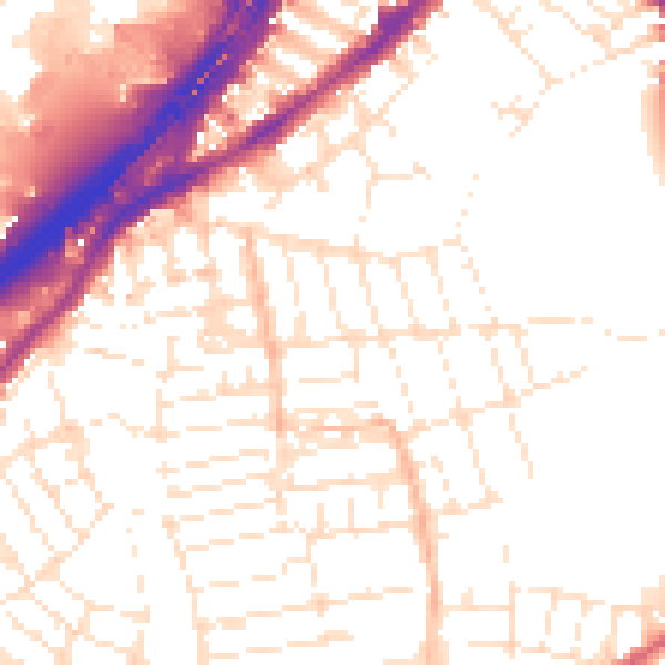
Daytime· 07:00 – 23:00
53.5dB

Night-time· 23:00 – 07:00
43.8dB