7 Rossall Avenue, Little Stoke, Bristol, BS34 6JT
About 7 Rossall Avenue
7 Rossall Avenue is a semi-detached house in Little Stoke, Bristol, Bristol (BS34 6JT). It has a recorded floor area of 80 m² (around 861 sq ft), construction records dating it to 1930-1949 and council tax band C. The latest certificate (November 2021) shows an F (score 33), near the bottom of the EPC scale. The rating has held steady at F across 2 certificates since November 2021. Between certificates, roof efficiency went from Very Poor to Good; while hot-water efficiency dropped from Average to Poor and main heating dropped from Average to Very Poor. The recommended improvements would lift it to B (score 83), a 4-band jump. Main heating runs on electricity.
On energy efficiency it sits in the bottom 10% of properties in this postcode — significant headroom for improvement.
Everything you need to know about 7 Rossall Avenue
The true value, the hidden risks and the full sale history, in one report.
Pick your report · every report is £14.99
One time fee only - money back guarantee

The data behind every report


Energy performance
7 Rossall Avenue sits at the bottom of the postcode for energy efficiency — meaningful headroom to improve.
EPC Rating
Property Improvements
Changes detected from historical EPC data
Heating system changed
Heating controls upgraded for better temperature management
Hot water efficiency decreased
Roof insulation improved
Get a survey for this property
Level 3 Building Survey
Because the property has solid (non-cavity) walls, we believe a Level 3 building survey should be considered.
From £955 · Includes VAT
Planning history
7 Rossall Avenue has no planning applications on record.
But the area is active
5 notable applications nearby — larger schemes and conversions that could reshape the street. The report maps them all.
Sales history & valuation
7 Rossall Avenue has no Land Registry sales on file, suggesting it has stayed in the same hands since registration began.
£341,000
Modelled from EPC, postcode comparables.
No sales recorded with HM Land Registry
That can mean the property has never traded since the registry began publishing in 1995, was a new build that hasn't been registered yet, or is held in the same hands long-term.
Median price across the last 5 sales in BS34 6JT: £320,000 (2023–2019).
Nearby sales in BS34 6JT
3 Rossall Avenue, Little Stoke, Bristol, BS34 6JT
Sold Aug 2023
£320,0009 Rossall Avenue, Little Stoke, Bristol, BS34 6JT
Sold Jul 2023
£401,2505 Rossall Avenue, Little Stoke, Bristol, BS34 6JT
Sold Feb 2023
£335,00019 Rossall Avenue, Little Stoke, Bristol, BS34 6JT
Sold Jan 2020
£245,000Helendean, Rossall Avenue, Little Stoke, Bristol, BS34 6JT
Sold Oct 2019
£232,500
Versus other Rossall Avenue homes
7 Rossall Avenue is notably below the street on epc rating.
EPC Rating
33 (F)
Street avg 65 (D)
Floor Area
80 m²
Street avg 91 m²
CO₂ Emissions
6.4 t/year
Street avg 3.5 t/year
Habitable Rooms
5 rooms
Street avg 5 rooms
Everything you need to know about 7 Rossall Avenue
The true value, the hidden risks and the full sale history, in one report.
Pick your report · every report is £14.99
One time fee only - money back guarantee
The data behind every report
Similar properties nearby
1 Collins Avenue, Little Stoke
BS34 6JZ
1 Brockley Close, Little Stoke
BS34 6EZ
1 Filby Drive, Little Stoke
BS34 6EL
1 Farley Close, Little Stoke
BS34 6HB
1 Bourton Avenue, Patchway
BS34 6EB
1 Highnam Close, Patchway
BS34 6AB
1 Brookcote Drive, Little Stoke
BS34 6LG
1 Ash Close, Little Stoke
BS34 6RE
The neighbourhood at a glance
Rail-style transport is unusually close for this postcode.
Crime
6/mo
Steady year-on-year across the wider district.
Nearest stop
0.1 km
Patchway Rail Station — railway station.
Closest school
0.5 km
Little Stoke Primary School. 21 schools nearby.
Go deeper on the local area
A Local Area report breaks down crime, transport links, schools and air quality in depth.
Road noise across the postcode
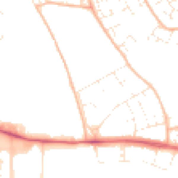
Daytime· 07:00 – 23:00
48.7dB

Night-time· 23:00 – 07:00
39.1dB