11 St Leonards Road, Bournemouth, BH8 8QH
About 11 St Leonards Road
11 St Leonards Road is a one-bedroom semi-detached house in Bournemouth (BH8 8QH). It has a recorded floor area of 49 m² (around 527 sq ft), construction records dating it to 1930-1949 and council tax band A. The latest certificate (April 2023) shows a D (score 59), a step below the typical UK home. Earlier certificates rated it C (January 2010); the latest reading is one band lower. Between certificates, lighting went from Good to Very Good; while roof efficiency dropped from Average to Very Poor and window efficiency dropped from Good to Average. At 49 m² this is the 6th smallest of 13 units on EPC record in the building, where floor areas span 43–99 m². The building's EPC ratings span E to C across 13 units on file.
Most recent transfer: November 2018 at £155,000. Across the public record there are 8 sales, relatively high churn for a single property. Across 1997–2018, sale prices on this property compounded at 7.9% per year. On a £-per-square-foot basis, the last sale (£294/sq ft) was about 38.9% above the typical sold price in the postcode.
What this property has
Inside
- Bedrooms1
- Bathrooms1
Everything you need to know about 11 St Leonards Road
The true value, the hidden risks and the full sale history, in one report.
Pick your report · every report is £14.99
One time fee only - money back guarantee

The data behind every report


Energy performance
EPC Rating
Property Improvements
Changes detected from historical EPC data
Hot water efficiency decreased
Heating controls upgraded for better temperature management
More low energy lighting installed
Get a survey for this property
Level 2 HomeBuyer Report
We've checked 10 risk factors against the available data for this property and believe a Level 2 HomeBuyer Report could be a suitable option for you.
From £495 · Includes VAT
Planning history
11 St Leonards Road has no planning applications on record.
But the area is active
34 notable applications nearby — larger schemes and conversions that could reshape the street. The report maps them all.
Sales history & valuation
11 St Leonards Road has more than quadrupled in price since its earliest registered sale in 1997.
£167,000
Modelled from EPC, postcode comparables and a sale-price growth of 7.9% per year over 21 years.
£155,000
Growth on file: 7.9% per year over 21 years.
Sales timeline
12 November 2018Most recent
£155,000
+31.4%over 3 years28 April 2015
£118,000
+5.4%over 9 years10 February 2006
£112,000
+52.5%over 3 years5 September 2002
£73,450
+22.5%over 2 years22 June 2000
£59,950
+44.5%18 April 2000
£41,500
-1.2%over 2 years2 October 1997
£42,000
+37.7%16 June 1997
£30,500
Median price across the last 5 sales in BH8 8QH: £175,000 (2024–2018).
Nearby sales in BH8 8QH
9a, St Leonards Road, Bournemouth, BH8 8QH
Sold Aug 2024
£175,00013 St Leonards Road, Bournemouth, BH8 8QH
Sold Mar 2020
£225,5003 St Leonards Road, Bournemouth, BH8 8QH
Sold Sept 2018
£165,00011a, St Leonards Road, Bournemouth, BH8 8QH
Sold Mar 2016
£146,0005 St Leonards Road, Bournemouth, BH8 8QH
Sold Jul 2009
£187,500
Versus other St Leonards Road homes
11 St Leonards Road is notably below the street on epc rating.
Price per m²
£3,163
Street avg £3,146
Floor Area
49 m²
Street avg 52 m²
Habitable Rooms
2 rooms
Street avg 3 rooms
CO₂ Emissions
2.9 t/year
Street avg 2.3 t/year
Everything you need to know about 11 St Leonards Road
The true value, the hidden risks and the full sale history, in one report.
Pick your report · every report is £14.99
One time fee only - money back guarantee
The data behind every report
Similar properties nearby
1 Wessex Gate, Malmesbury Park Road
BH8 8PD
1 Chelsea Gardens
BH8 8EL
1 Orcheston Road
BH8 8SP
1 Portchester Road
BH8 8JT
1 Capstone Gardens
BH8 8RU
1 Bennett Road
BH8 8QF
1 Methuen Close
BH8 8NA
1 Wellington Road
BH8 8JQ
The neighbourhood at a glance
Rail-style transport is unusually close for this postcode.
Crime
14/mo
Steady year-on-year across the wider district.
Nearest stop
0.2 km
Methuen Road — bus stop.
Closest school
0.2 km
Malmesbury Park Primary School. 26 schools nearby.
Go deeper on the local area
A Local Area report breaks down crime, transport links, schools and air quality in depth.
Road noise across the postcode
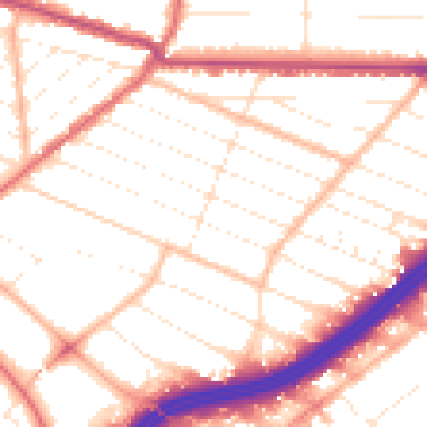
Daytime· 07:00 – 23:00
52.7dB
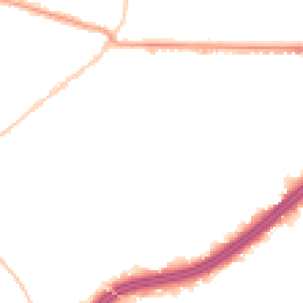
Night-time· 23:00 – 07:00
42.9dB