6 Ferris Avenue, Bournemouth, BH8 0AP
About 6 Ferris Avenue
6 Ferris Avenue is a two-bedroom detached house in Bournemouth (BH8 0AP). It has a recorded floor area of 74 m² (around 797 sq ft), construction records dating it to 1950-1966 and council tax band D. The latest certificate (May 2019) shows a D (score 64), on the cusp of jumping into the C band. The recommended improvements would lift it to B (score 82), a 2-band jump. Our model identifies extension potential, subject to local planning policy.
2 planning records sit against the property, 2 approved, 0 refused. Past consents include an extension and a loft conversion, meaningful when judging how the property has evolved. On a £-per-square-foot basis, the last sale (£565/sq ft) was about 101.5% above the typical sold price in the postcode. At 74 m² it's 22.1% smaller than the typical home in the postcode (95 m² median across 5 EPCs). Last sale on file: £450,000 in October 2022. That sale was during the post-pandemic price surge, when transactions cleared materially above pre-2020 trend.
What this property has
Inside
- Bedrooms2
- Bathrooms1
- EnsuiteYes
Outside
- Private gardenYes
- GarageYes
Building
- Extension potentialPossible
Everything you need to know about 6 Ferris Avenue
The true value, the hidden risks and the full sale history, in one report.
Pick your report · every report is £14.99
One time fee only - money back guarantee

The data behind every report


Energy performance
Recommended upgrades on file would lift this property by multiple EPC bands.
EPC Rating
Get a survey for this property
Level 2 HomeBuyer Report
We've checked 10 risk factors against the available data for this property and believe a Level 2 HomeBuyer Report could be a suitable option for you.
From £695 · Includes VAT
Planning history
2 applications on record at 6 Ferris Avenue, Bournemouth, BH8 0AP
- May 2023ExtensionFullOutcome in report
Alterations and extensions to bungalow to include formation of new 1st floor level and installation of roof lights
- Documents
- 13 docs on file
- Reference
- 7-2023-14399-A
- More recent applications — locked
- Loft ConversionJan 2024Decision
Unlock 6 Ferris Avenue, Bournemouth, BH8 0AP's full planning history
You're seeing the shape of it. The report has the substance.
- Every decision — granted, refused or withdrawn (2 on record)
- All 2 applications on this property in full
- The 23 documents, officer reports & conditions
- What the pattern means for extending or converting here
One time fee only - money back guarantee
Sales history & valuation
Latest sale on 6 Ferris Avenue was the highest on Land Registry record across the postcode.
£439,000
Modelled from EPC, postcode comparables.
£450,000
Recorded with HM Land Registry.
Sales timeline
27 October 2022Most recent
£450,000
Median price across the last 5 sales in BH8 0AP: £327,500 (2024–2012).
Nearby sales in BH8 0AP
Versus other Ferris Avenue homes
Price per m² for 6 Ferris Avenue runs comfortably ahead of the street norm.
Price per m²
£6,081
Street avg £3,405
Floor Area
74 m²
Street avg 86 m²
Habitable Rooms
4 rooms
Street avg 4 rooms
CO₂ Emissions
3.2 t/year
Street avg 3.6 t/year
Everything you need to know about 6 Ferris Avenue
The true value, the hidden risks and the full sale history, in one report.
Pick your report · every report is £14.99
One time fee only - money back guarantee
The data behind every report
Similar properties nearby
1 Downton Close
BH8 0EP
1 Bucklers Way
BH8 0EW
1 Ashurst Road
BH8 0NW
1 Culford Close
BH8 0HX
1 Chesilbourne Grove
BH8 0BA
1 Barrowgate Way
BH8 0HD
1 Braishfield Gardens
BH8 0QA
1 Calmore Close
BH8 0NN
The neighbourhood at a glance
Crime
14/mo
Steady year-on-year across the wider district.
Nearest stop
0.1 km
Mill Road — bus stop.
Closest school
0.3 km
Bournemouth School for Girls. 22 schools nearby.
Go deeper on the local area
A Local Area report breaks down crime, transport links, schools and air quality in depth.
Road noise across the postcode
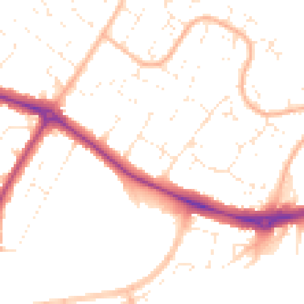
Daytime· 07:00 – 23:00
50.2dB

Night-time· 23:00 – 07:00
40.1dB