2 Ferris Avenue, Bournemouth, BH8 0AP
About 2 Ferris Avenue
2 Ferris Avenue is a two-bedroom property in Bournemouth (BH8 0AP). It has council tax band D. The home occupies a corner plot.
Untraded for 17 years, with the last transfer in December 2009. That sale fell during the post-crash dip, which often skews comparisons against later neighbouring sales. Across 1999–2009, sale prices on this property compounded at 6.8% per year.
What this property has
Inside
- Bedrooms2
- StudyYes
Outside
- ParkingOff street
- Corner plotYes
Building
- RefurbishedYes
Everything you need to know about 2 Ferris Avenue
The true value, the hidden risks and the full sale history, in one report.
Pick your report · every report is £14.99
One time fee only - money back guarantee

The data behind every report


Energy performance
No EPC on record
This property doesn't have an Energy Performance Certificate yet. An EPC is required to sell or let — and unlocks our automated valuation.
Get a survey for this property
Level 2 HomeBuyer Report
We've checked 10 risk factors against the available data for this property and believe a Level 2 HomeBuyer Report could be a suitable option for you.
Planning history
2 Ferris Avenue has no planning applications on record.
A planning report still maps activity across the surrounding area and reads this property's extension & conversion potential.
Sales history & valuation
Sale price has at least doubled since 1999.
£266,000
Growth on file: 6.8% per year over 11 years.
Sales timeline
4 December 2009Most recent
£266,000
+6.4%over 1 year17 March 2008
£250,000
+92.3%over 9 years15 January 1999
£130,000
Median price across the last 5 sales in BH8 0AP: £345,000 (2024–2014).
Nearby sales in BH8 0AP
Everything you need to know about 2 Ferris Avenue
The true value, the hidden risks and the full sale history, in one report.
Pick your report · every report is £14.99
One time fee only - money back guarantee
The data behind every report
Similar properties nearby
1 Downton Close
BH8 0EP
1 Bucklers Way
BH8 0EW
1 Ashurst Road
BH8 0NW
1 Culford Close
BH8 0HX
1 Chesilbourne Grove
BH8 0BA
1 Barrowgate Way
BH8 0HD
1 Braishfield Gardens
BH8 0QA
1 Calmore Close
BH8 0NN
The neighbourhood at a glance
Crime
14/mo
Steady year-on-year across the wider district.
Nearest stop
0.1 km
Mill Road — bus stop.
Closest school
0.3 km
Bournemouth School for Girls. 22 schools nearby.
Go deeper on the local area
A Local Area report breaks down crime, transport links, schools and air quality in depth.
Road noise across the postcode
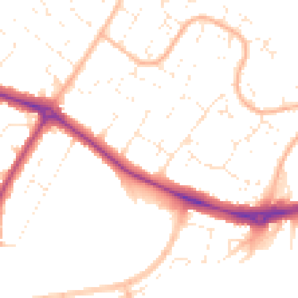
Daytime· 07:00 – 23:00
50.2dB

Night-time· 23:00 – 07:00
40.1dB