19 De Redvers Road, Poole, BH14 8TS
About 19 De Redvers Road
19 De Redvers Road is a four-bedroom detached house in Poole (BH14 8TS). It has a recorded floor area of 194 m² (around 2090 sq ft), construction records dating it to 1983-1990 and council tax band E. The latest certificate (February 2009) shows a D (score 58), a step below the typical UK home. The latest certificate is from February 2009, so improvements made since then won't be reflected. Period features are noted in the property record.
It hasn't traded since December 1999, a hold of 27 years that's notably long for the area. Across 1997–1999, sale prices on this property compounded at 22.3% per year. Today's modelled estimate of £730,000 sits 216% above the 1999 sale of £231,000. On a £-per-square-foot basis, the last sale (£111/sq ft) was about 58.6% below the postcode norm. 13 planning records sit against the property, 10 approved, 2 refused. Past consents include tree works, an extension and a loft conversion, meaningful when judging how the property has evolved.
What this property has
Inside
- Bedrooms4
- Dining roomYes
- EnsuiteYes
Outside
- Private gardenWrap around
- GarageIntegral
Building
- Period featuresYes
Everything you need to know about 19 De Redvers Road
The true value, the hidden risks and the full sale history, in one report.
Pick your report · from £14.99
One time fee only - money back guarantee

The data behind every report







Energy performance
19 De Redvers Road's carbon output runs well above what efficient homes in the postcode produce.
EPC Expired
This certificate is over 10 years old and is no longer valid.Expired 05 Feb 2019
EPC Rating
Certificate validity
Expired on 5 February 2019

Get a survey for this property
Level 2 HomeBuyer Report
We've checked 10 risk factors against the available data for this property and believe a Level 2 HomeBuyer Report could be a suitable option for you.
From £995 · Includes VAT
Planning history
19 De Redvers Road has 2 separate extension applications on the council record.
13 applications on record at 19 De Redvers Road, Poole, BH14 8TS
- Mar 2001Loft ConversionFullOutcome in report
Convert existing garage into a bedroom and erect a new attached garage. Erect a dormer window at front and convert roofspace into a bedroom with en-suite shower room
Extension- Documents
- 2 docs on file
- Reference
- 01/09028/007/F
- More recent applications — locked
- Tree WorksFeb 2026Decision
- Tree WorksJan 2025Decision
+ 10 more applications in the report
Unlock 19 De Redvers Road, Poole, BH14 8TS's full planning history
You're seeing the shape of it. The report has the substance.
- Every decision — granted, refused or withdrawn (13 on record)
- All 13 applications on this property in full, plus 14 notable nearby
- The 70 documents, officer reports & conditions
- What the pattern means for extending or converting here
One time fee only - money back guarantee
Sales history & valuation
19 De Redvers Road's modelled value sits at over four times its earliest registered sale price (1997).
£730,000
Modelled from EPC, postcode comparables and a sale-price growth of 22.3% per year over 3 years.
£231,000
Growth on file: 22.3% per year over 3 years.
Sales timeline
10 December 1999Most recent
£231,000
+71.1%over 2 years10 April 1997
£135,000
Median price across the last 5 sales in BH14 8TS: £755,000 (2025–2018).
Nearby sales in BH14 8TS
Versus other De Redvers Road homes
19 De Redvers Road is notably below the street on co₂ emissions.
Price per m²
£1,190
Street avg £3,408
Floor Area
194 m²
Street avg 182 m²
Habitable Rooms
7 rooms
Street avg 7 rooms
CO₂ Emissions
11.0 t/year
Street avg 5.1 t/year
Everything you need to know about 19 De Redvers Road
The true value, the hidden risks and the full sale history, in one report.
Pick your report · from £14.99
One time fee only - money back guarantee
The data behind every report
Similar properties nearby
1 Avalon
BH14 8HT
1 Buckler Heights
BH14 8TA
1 Daylesford Close
BH14 8DY
1 Elms Close
BH14 8EP
1 Broadwater Avenue
BH14 8QY
1 Blake Hill Crescent
BH14 8QN
1 Dorset Lake Avenue
BH14 8JD
1 Castledene Crescent
BH14 8DP
The neighbourhood at a glance
Rail-style transport is unusually close for this postcode.
Crime
105/mo
Falling year-on-year across the wider district.
Nearest stop
0.1 km
Durlston Road — bus stop.
Closest school
0.7 km
Baden-Powell and St Peter's Church of England Junior School. 15 schools nearby.
Go deeper on the local area
A Local Area report breaks down crime, transport links, schools and air quality in depth.
Road noise across the postcode
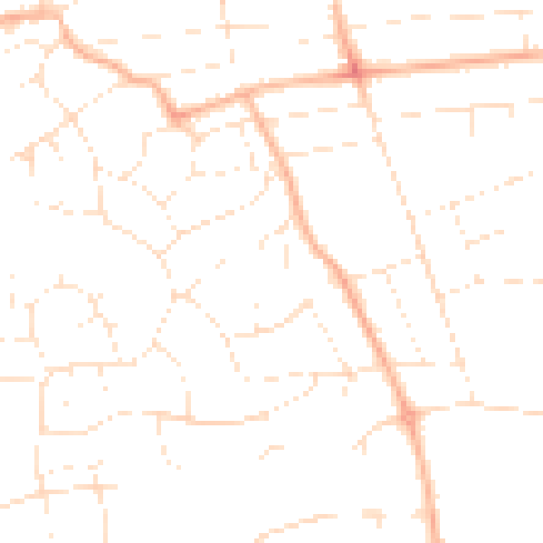
Daytime· 07:00 – 23:00
48.0dB

Night-time· 23:00 – 07:00
36.8dB