Melbury, Flat 7, 14 Lindsay Road, Poole, BH13 6AT
About Melbury
Melbury is a three-bedroom semi-detached house in Poole (BH13 6AT). It has a recorded floor area of 70 m² (around 753 sq ft), construction records dating it to 1967-1975 and council tax band C. The latest certificate (July 2021) shows an E (score 44), well below the UK norm with real room to improve. Earlier certificates rated it D (August 2011); the latest reading is one band lower. Between certificates, lighting went from Very Poor to Very Good; while window efficiency dropped from Good to Average and main heating dropped from Average to Very Poor. The recommended improvements would lift it to C (score 77), a 2-band jump. Main heating runs on electricity. At 70 m² this is the 4th smallest of 15 units on EPC record in Melbury, where floor areas span 66–99 m². The building's EPC ratings span F to C across 15 units on file.
On energy efficiency it sits in the bottom 10% of properties in this postcode — significant headroom for improvement. Across 1996–2022, sale prices on this property compounded at 7% per year. On a £-per-square-foot basis, the last sale (£319/sq ft) was about 43% above the typical sold price in the postcode. Last sale on file: £240,000 in March 2022. That sale was during the post-pandemic price surge, when transactions cleared materially above pre-2020 trend.
What this property has
Inside
- Bedrooms3
- Bathrooms1
Outside
- GarageYes
Everything you need to know about Melbury
The true value, the hidden risks and the full sale history, in one report.
Pick your report · from £14.99
One time fee only - money back guarantee

The data behind every report


Energy performance
Melbury sits at the bottom of the postcode for energy efficiency — meaningful headroom to improve.
EPC Rating
Certificate validity
Valid until 19 July 2031
Property Improvements
Changes detected from historical EPC data
Heating system changed
Hot water system changed
More low energy lighting installed

Get a survey for this property
Level 3 Building Survey
Because the property has no mains gas supply, we believe a Level 3 building survey should be considered.
From £885 · Includes VAT
Planning history
Melbury has no planning applications on record.
But the area is active
5 notable applications nearby — larger schemes and conversions that could reshape the street. The report maps them all.
Sales history & valuation
Price for Melbury has grown more than fourfold since the 1996 starting point.
£259,000
Modelled from EPC, postcode comparables and a sale-price growth of 7.0% per year over 26 years.
£240,000
Growth on file: 7.0% per year over 26 years.
Sales timeline
25 March 2022Most recent
£240,000
+471.4%over 25 years16 July 1996
£42,000
Median price across the last 5 sales in BH13 6AT: £230,000 (2025–2018).
Nearby sales in BH13 6AT
Melbury, Flat 4, 14 Lindsay Road, Poole, BH13 6AT
Sold Jul 2025
£230,000Melbury, Flat 5, 14 Lindsay Road, Poole, BH13 6AT
Sold Mar 2025
£240,000Melbury, Flat 6, 14 Lindsay Road, Poole, BH13 6AT
Sold Feb 2022
£209,000Melbury, Flat 10, 14 Lindsay Road, Poole, BH13 6AT
Sold May 2021
£217,000Melbury, Flat 3, 14 Lindsay Road, Poole, BH13 6AT
Sold Feb 2018
£230,000
Versus other Lindsay Road homes
Price per m² for Melbury runs comfortably ahead of the street norm.
Price per m²
£3,429
Street avg £2,714
Floor Area
70 m²
Street avg 74 m²
Habitable Rooms
4 rooms
Street avg 3 rooms
CO₂ Emissions
3.8 t/year
Street avg 2.8 t/year
Everything you need to know about Melbury
The true value, the hidden risks and the full sale history, in one report.
Pick your report · from £14.99
One time fee only - money back guarantee
The data behind every report
Similar properties nearby
Airthrey Court, Flat 6, 5 Wilderton Road
BH13 6EB
Airthrey Court, Flat 2, 5 Wilderton Road
BH13 6EB
Airthrey Court, Flat 3, 5 Wilderton Road
BH13 6EB
Airthrey Court, Flat 4, 5 Wilderton Road
BH13 6EB
Albany House, Flat 8, 3 Balcombe Road
BH13 6DX
Airthrey Court, Flat 1, 5 Wilderton Road
BH13 6EB
Airthrey Court, Flat 8, 5 Wilderton Road
BH13 6EB
Airthrey Court, Flat 5, 5 Wilderton Road
BH13 6EB
The neighbourhood at a glance
Rail-style transport is unusually close for this postcode.
Crime
54/mo
Falling year-on-year across the wider district.
Nearest stop
0.2 km
The Victoria School — bus stop.
Closest school
1.0 km
Heatherlands Primary School. 13 schools nearby.
Go deeper on the local area
A Local Area report breaks down crime, transport links, schools and air quality in depth.
Road noise across the postcode
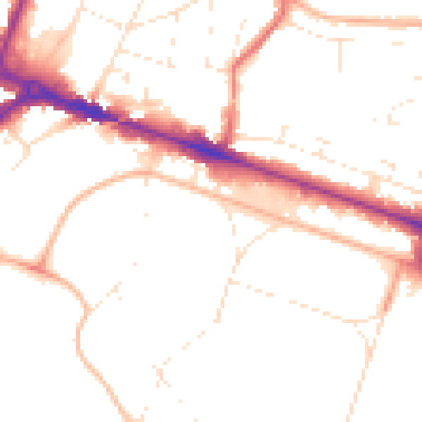
Daytime· 07:00 – 23:00
49.6dB

Night-time· 23:00 – 07:00
40.3dB