Model valuation£417,0008 Busby Close
Local market context
Estimated value
£429,000
Newest record on this page: February 2025. Land Registry and EPC registers update monthly, so this page can trail them by 2–3 months.
Our estimate
£429,000
Your note and figure are shown publicly on this page.
The estimate for 59 Wellfield Road is modelled from its 59 m² EPC floor area, its 2 recorded sales and recent sales of comparable homes in AL10 0BY. It is an automated estimate, not a survey or mortgage valuation: condition, layout and improvements that aren't on record can move the real figure either way.
Floor area
59 m² from the EPC lodged in August 2019
Sales of this home
2 sales recorded, the latest in 2021
Recent sales in AL10 0BY
5 sales, median £450,000 (2025–2021)
| Data | This page | Full report |
|---|---|---|
| Sales | Latest sale shown: February 2025 | Latest available records, read when you order |
| Valuation | Estimate from the last refresh | Analysed against comparable sales |
| Planning | 1 application | Full history, plus nearby schemes |
| Flood risk | Not shown | Included |
Price for 59 Wellfield Road has grown more than fourfold since the 1999 starting point.
25 November 2021Most recent
£380,000
+336.8%over 22 years8 July 1999
£87,000
Median price across the last 5 sales in AL10 0BY: £450,000 (2025–2021).
75 Wellfield Road, Hatfield, AL10 0BY
Sold Feb 2025
101 Wellfield Road, Hatfield, AL10 0BY
Sold Sept 2024
99 Wellfield Road, Hatfield, AL10 0BY
Sold Apr 2024
Oakwell 39a, Wellfield Road, Hatfield, AL10 0BY
Sold Aug 2022
87 Wellfield Road, Hatfield, AL10 0BY
Sold Feb 2021
One time fee only - money back guarantee
59 Wellfield Road is a three-bedroom semi-detached house in Hatfield (AL10 0BY). It has a recorded floor area of 59 m² (around 635 sq ft), construction records dating it to 1950-1966 and council tax band D. The latest certificate (August 2019) shows a D (score 67), on the cusp of jumping into the C band. The rating has held steady at D across 2 certificates since August 2009. Between certificates, wall efficiency went from Poor to Average, roof efficiency went from Good to Very Good and window efficiency went from Average to Good. The recommended improvements would lift it to B (score 87), a 2-band jump. Our model identifies extension potential, subject to local planning policy.
At 59 m² it sits well below the postcode median (95 m² across 16 EPCs), making it one of the more compact homes locally. One planning record on file: an extension approved in 2022. Past consents include an extension, meaningful when judging how the property has evolved. Across 1999–2021, sale prices on this property compounded at 6.8% per year. Today's modelled estimate of £429,000 is 12.9% above the 2021 sale price. On a £-per-square-foot basis, the last sale (£598/sq ft) was about 124.8% above the typical sold price in the postcode. Most recent transfer: November 2021 at £380,000. That sale was during the post-pandemic price surge, when transactions cleared materially above pre-2020 trend.
The true value, the hidden risks and the full sale history, in one report.
Pick your report · from £14.99
One time fee only - money back guarantee
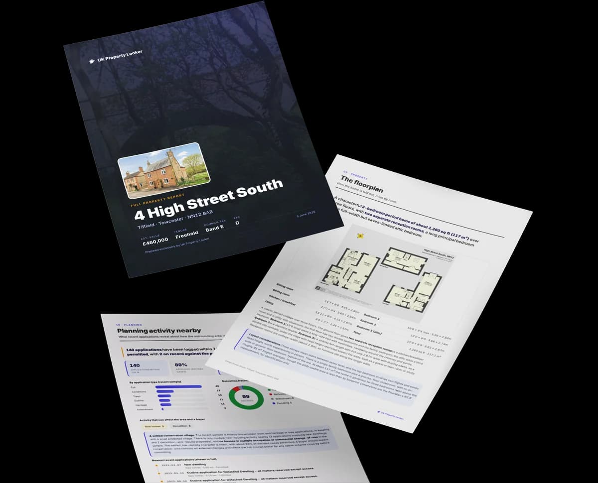
The data behind every report


Recommended upgrades on file would lift this property by multiple EPC bands.
Certificate validity
Valid until 28 August 2029
Changes detected from historical EPC data
Window efficiency improved
Cavity wall insulation installed
Loft insulation upgraded to recommended levels
More low energy lighting installed
Council records include a part-single-part-two-storey extension at 59 Wellfield Road.
1 application on record at 59 Wellfield Road, Hatfield, AL10 0BY
Extension: Part single, part two storey
Erection of a two storey front extension, and single storey, part two storey rear extension
You're seeing the shape of it. The report has the substance.
One time fee only - money back guarantee
59 Wellfield Road outperforms the street on price per m² by a wide margin.
Price per m²
£6,441
Street avg £3,572
Floor Area
59 m²
Street avg 96 m²
Habitable Rooms
4 rooms
Street avg 5 rooms
CO₂ Emissions
2.6 t/year
Street avg 4.6 t/year
Crime
359/mo
Falling year-on-year across the wider district.
Nearest stop
0.2 km
Jasmine Gardens — bus stop.
Closest school
0.4 km
Birchwood Avenue Primary School. 13 schools nearby.
Go deeper on the local area
A Local Area report breaks down crime, transport links, schools and air quality in depth.

Get a survey for this property
We've checked 10 risk factors against the available data for this property and believe a Level 2 HomeBuyer Report could be a suitable option for you.
From £695 · Includes VAT
AL10 0UG
AL10 0RD
AL10 0UA
AL10 0FH
AL10 0JE
AL10 0UT
AL10 0PY
AL10 0HF
Property research, connected
Explore sale histories, valuations, energy ratings and local areas. Ask the assistant to connect the details and take your research further.
Start your researchLeave a note for other visitors about work done or anything the records miss, and say what you think it's worth. It takes about two minutes.