315 Warrington Road, Abram, Wigan, WN2 5RJ
About 315 Warrington Road
315 Warrington Road is an end-of-terrace house in Abram, Wigan, Wigan (WN2 5RJ). It has a recorded floor area of 81 m² (around 872 sq ft), construction records dating it to before 1900 and council tax band A. At 81 m² this is the 18th smallest of 36 units on EPC record in the building, where floor areas span 41–246 m². The building's EPC ratings span F to C across 36 units on file. The latest certificate (April 2019) shows a D (score 60), on the cusp of jumping into the C band. The recommended improvements would push it to C (score 75).
Across 2020–2020, sale prices on this property compounded at -24.7% per year. Today's modelled estimate of £129,000 is 63.1% below the 2020 sale of £350,000, an unusual pattern given regional price growth and worth checking against the EPC condition. On a £-per-square-foot basis, the last sale (£401/sq ft) was about 447.3% above the typical sold price in the postcode. 2 planning records sit against the property, 2 approved, 0 refused. Past consents include new windows, subdivision and change of use to residential, meaningful when judging how the property has evolved. Most recent transfer: December 2020 at £350,000.
Everything you need to know about 315 Warrington Road
The true value, the hidden risks and the full sale history, in one report.
Pick your report · from £14.99
One time fee only - money back guarantee

The data behind every report


Energy performance
EPC Rating
Certificate validity
Valid until 9 April 2029

Get a survey for this property
Level 3 Building Survey
Because the property was built before 1919 and has solid (non-cavity) walls, we believe a Level 3 building survey should be considered.
From £820 · Includes VAT
Planning history
Council records show a subdivision application — the property's legal arrangement has been altered.
2 applications on record at 315 Warrington Road, Abram, Wigan, WN2 5RJ
- Mar 2010SubdivisionFullOutcome in report
To convert former offices into 6no. apartments with installation of rooflights to front and rear, dormer to rear and second floor window to front, together with conversion of disused workshop into 3no. dwellinghouses with balconies at first floor level.
Change of Use- Documents
- 16 docs on file
- Reference
- A/09/73695
- More recent applications — locked
- FullJul 2011Decision
Unlock 315 Warrington Road, Abram, Wigan, WN2 5RJ's full planning history
You're seeing the shape of it. The report has the substance.
- Every decision — granted, refused or withdrawn (2 on record)
- All 2 applications on this property in full, plus 8 notable nearby
- The 22 documents, officer reports & conditions
- What the pattern means for extending or converting here
One time fee only - money back guarantee
Sales history & valuation
Latest sale on 315 Warrington Road was the highest on Land Registry record across the postcode.
£129,000
Modelled from EPC, postcode comparables and a sale-price growth of -24.7% per year over 1 year.
£350,000
Growth on file: -24.7% per year over 1 year.
Sales timeline
4 December 2020Most recent
£350,000
-24.7%over 9 months20 February 2020
£465,000
13 February 2020
£465,000
Median price across the last 5 sales in WN2 5RJ: £92,500 (2026–2018).
Nearby sales in WN2 5RJ
339 Warrington Road, Abram, Wigan, WN2 5RJ
Sold Feb 2026
£130,000309 Warrington Road, Abram, Wigan, WN2 5RJ
Sold Jan 2023
£168,000351 Warrington Road, Abram, Wigan, WN2 5RJ
Sold Apr 2022
£82,000355 Warrington Road, Abram, Wigan, WN2 5RJ
Sold Dec 2018
£82,000341 Warrington Road, Abram, Wigan, WN2 5RJ
Sold Oct 2018
£85,000
Versus other Warrington Road homes
315 Warrington Road is notably below the street on epc rating.
EPC Rating
60 (D)
Street avg 64 (D)
Floor Area
81 m²
Street avg 77 m²
CO₂ Emissions
4.3 t/year
Street avg 3.7 t/year
Habitable Rooms
3 rooms
Street avg 3 rooms
Everything you need to know about 315 Warrington Road
The true value, the hidden risks and the full sale history, in one report.
Pick your report · from £14.99
One time fee only - money back guarantee
The data behind every report
Similar properties nearby
1 Aspinall Street, Platt Bridge
WN2 5NR
1 Bank Street, Platt Bridge
WN2 5BW
1 Bickershaw Lane, Abram
WN2 5PL
1 Beech Tree Houses, Bamfurlong
WN2 5LB
1 Croal Avenue, Platt Bridge
WN2 5EY
1 Crown Wood Court, Bamfurlong
WN2 5LY
1 Brecon Close, Platt Bridge
WN2 5NA
1 Ashwood Avenue, Abram
WN2 5YE
The neighbourhood at a glance
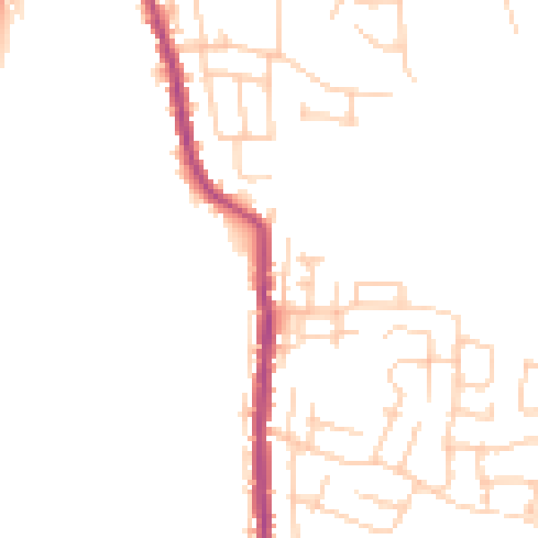
Daytime road noise here sits well below conversation level — a quiet pocket of the postcode.
Crime
2/mo
Steady year-on-year across the wider district.
Nearest stop
0.1 km
Abram Council Offices — bus stop.
Closest school
0.7 km
St John's Church of England Primary School, Abram. 8 schools nearby.
Go deeper on the local area
A Local Area report breaks down crime, transport links, schools and air quality in depth.
Road noise across the postcode
Daytime· 07:00 – 23:00
46.4dB

Night-time· 23:00 – 07:00
38.3dB