750a, St Albans Road, Watford, WD25 9FH
About 750a
750a is a two-bedroom detached house in Watford (WD25 9FH). It has a recorded floor area of 86 m² (around 926 sq ft), construction records dating it to 1930-1949 and council tax band D. The latest certificate (October 2017) returns a B (score 84), comfortably above the UK average. When first surveyed in April 2014 the rating was D, the property has climbed 2 bands since. Between certificates, wall efficiency went from Very Poor to Very Good, window efficiency went from Average to Very Good and lighting went from Good to Very Good; while hot-water efficiency dropped from Very Good to Good. The recommended improvements would push it to A (score 95).
At 86 m² the property is well over the postcode median (63 m² across 34 EPCs), placing it in the larger end of the local stock. Last changed hands 12 years ago, in August 2014. Across the public record there are 5 sales, relatively high churn for a single property. Across 1996–2014, sale prices on this property compounded at 12.8% per year. Today's modelled estimate of £551,000 is 21.1% above the 2014 sale price. On a £-per-square-foot basis, the last sale (£492/sq ft) was about 91.6% above the typical sold price in the postcode. 2 planning records sit against the property, 0 approved, 0 refused.
What this property has
Inside
- Bedrooms2
- Bathrooms1
Everything you need to know about 750a
The true value, the hidden risks and the full sale history, in one report.
30-day money-back guarantee

The data behind every report


Energy performance
750a's carbon output is low for the local stock.
EPC Rating
Property Improvements
Changes detected from historical EPC data
Heating controls upgraded for better temperature management
Hot water efficiency decreased
High performance glazing installed
Cavity wall insulation installed
Loft insulation upgraded to recommended levels
More low energy lighting installed
Planning history
- Jan 2018ConditionsIn report
Variation of condition 2 of planning permission 16/01078/FUL to enable a fence to be erected to enclose the garden of the house in the position of a wall.
- Documents
- 4 docs on file
- Reference
- 17/01670/VAR
- May 2017ConditionsIn report
Variation of condition 4 of planning permission 16/01078/FUL - change to previously approved roof tiles.Condition Number(s): 4Conditions(s) Removal:The tiles described in the condition are not availableChange roof tiles to Marley Modern Old English Dark Red
- Documents
- 8 docs on file
- Reference
- 17/00315/VAR
What's in 750a, St Albans Road, Watford, WD25 9FH's planning history?
Refusals, disputes and full decisions on this property and nearby, in the report.
Sales history & valuation
Price for 750a has grown more than fourfold since the 1996 starting point.
£551,000
Modelled from EPC, postcode comparables and a sale-price growth of 12.8% per year over 18 years.
£455,000
Growth on file: 12.8% per year over 18 years.
Sales timeline
17 August 2014Most recent
£455,000
+255.5%over 7 years31 October 2006
£128,000
+8.5%over 4 years18 July 2002
£118,000
+81.5%over 3 years26 April 1999
£65,000
+30.0%over 3 years11 April 1996
£50,000
Median price across the last 5 sales in WD25 9FH: £350,000 (2025–2018).
Nearby sales in WD25 9FH
770a, St Albans Road, Watford, WD25 9FH
Sold Mar 2025
£398,000796 St Albans Road, Watford, WD25 9FH
Sold Apr 2022
£575,000Flat 3, 760 St Albans Road, Watford, WD25 9FH
Sold Oct 2021
£280,000Flat 4, 760 St Albans Road, Watford, WD25 9FH
Sold Jul 2018
£277,000Summer Vale Court, Flat 1, 750 St Albans Road, Watford, WD25 9FH
Sold Nov 2017
£250,000
Versus other St Albans Road homes
750a outperforms the street on price per m² by a wide margin.
Price per m²
£5,291
Street avg £3,202
Floor Area
86 m²
Street avg 112 m²
CO₂ Emissions
1.3 t/year
Street avg 5.2 t/year
Years Held
12 years
Street avg 16 years
Everything you need to know about 750a
The true value, the hidden risks and the full sale history, in one report.
30-day money-back guarantee
The data behind every report
Similar properties nearby
1 Biddenham Court, First Avenue
WD25 9PT
1 Cuffley Avenue
WD25 9RB
1 Falcon Way
WD25 9AA
1 Da Vinci Court, Cezanne Road
WD25 9BF
1 Felden Close
WD25 9QW
1 Bovingdon Crescent
WD25 9RA
1 Beken Court, First Avenue
WD25 9PG
1 Coates Way
WD25 9NR
The neighbourhood at a glance
Rail-style transport is unusually close for this postcode.
Crime
4/mo
Steady year-on-year across the wider district.
Nearest stop
0.1 km
Rochester Drive — bus stop.
Closest school
0.5 km
The Grove Academy. 22 schools nearby.
Go deeper on the local area
The full report breaks down crime, transport links, schools and air quality in depth.
Road noise across the postcode
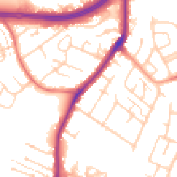
Daytime· 07:00 – 23:00
53.3dB

Night-time· 23:00 – 07:00
45.2dB