1 Alderdale Drive, High Lane, Stockport, SK6 8BX
About 1 Alderdale Drive
1 Alderdale Drive is a five-bedroom detached house in High Lane, Stockport, Stockport (SK6 8BX). It has a recorded floor area of 226 m² (around 2433 sq ft), construction records dating it to 1983-1990 and council tax band G. The latest certificate (January 2023) shows a C (score 73). The home occupies a cul-de-sac position.
At 226 m² the property is well over the postcode median (116 m² across 16 EPCs), placing it in the larger end of the local stock. Its energy rating outperforms most of the postcode (better than 75% of similar EPCs). One planning record on file: tree works approved in 2020. Past consents include tree works, meaningful when judging how the property has evolved. Across 1996–2024, sale prices on this property compounded at 5.1% per year. Today's modelled estimate of £771,000 is 12.6% above the 2024 sale price. On a £-per-square-foot basis, the last sale (£282/sq ft) was about 45.5% above the typical sold price in the postcode. Last sale on file: £685,000 in October 2024.
What this property has
Inside
- Bedrooms5
- Bathrooms2
- Dining roomYes
- Utility roomYes
- CloakroomYes
- EnsuiteYes
Outside
- Private gardenYes
- GarageYes
- Cul-de-sacYes
Everything you need to know about 1 Alderdale Drive
The true value, the hidden risks and the full sale history, in one report.
Pick your report · from £14.99
One time fee only - money back guarantee

The data behind every report


Energy performance
1 Alderdale Drive's carbon output runs well above what efficient homes in the postcode produce.
EPC Rating
Certificate validity
Valid until 4 January 2033

Get a survey for this property
Level 2 HomeBuyer Report
We've checked 10 risk factors against the available data for this property and believe a Level 2 HomeBuyer Report could be a suitable option for you.
From £995 · Includes VAT
Planning history
1 application on record at 1 Alderdale Drive, High Lane, Stockport, SK6 8BX
- Sept 2020Tree WorksTreesOutcome in report
T1. Alder. Front left hand side. Woodland tree. Reduce the lowest 5 branches by up to 2m T2. Horse chestnut. Left hand side. boundary. Woodland tree. Pollard the tree to the first union at approx 5m A3. 35m. Mix. Left hand side boundary. Woodland trees. Remove saplings under 75mm diameter. A 4m band of growth adjacent to the fence line Arisings to be removed from site. The client has consulted with the land owner (SMBC), the above works were proposed. The work is to keep the woodland back from the garden it is encroaching upon. TPO#: 10E - W10, TPO#: 128E - W2, TPO#: 13E - W5
- Documents
- 2 docs on file
- Reference
- DC/077601
Unlock 1 Alderdale Drive, High Lane, Stockport, SK6 8BX's full planning history
You're seeing the shape of it. The report has the substance.
- Every decision — granted, refused or withdrawn (1 on record)
- All 1 application on this property in full
- The 2 documents, officer reports & conditions
- What the pattern means for extending or converting here
One time fee only - money back guarantee
Sales history & valuation
Latest sale on 1 Alderdale Drive was the highest on Land Registry record across the postcode.
£771,000
Modelled from EPC, postcode comparables and a sale-price growth of 5.1% per year over 28 years.
£685,000
Growth on file: 5.1% per year over 28 years.
Sales timeline
17 October 2024Most recent
£685,000
+309.0%over 28 years2 May 1996
£167,500
Median price across the last 5 sales in SK6 8BX: £340,000 (2022–2020).
Nearby sales in SK6 8BX
10 Alderdale Drive, High Lane, Stockport, SK6 8BX
Sold Jan 2022
£1,6154 Alderdale Drive, High Lane, Stockport, SK6 8BX
Sold Nov 2021
£556,00012 Alderdale Drive, High Lane, Stockport, SK6 8BX
Sold Jun 2021
£400,00017 Alderdale Drive, High Lane, Stockport, SK6 8BX
Sold Mar 2021
£1,2255 Alderdale Drive, High Lane, Stockport, SK6 8BX
Sold Sept 2019
£455,000
Versus other Alderdale Drive homes
On years held, 1 Alderdale Drive runs well behind the street norm.
Price per m²
£3,031
Street avg £2,495
Floor Area
226 m²
Street avg 124 m²
Habitable Rooms
8 rooms
Street avg 6 rooms
CO₂ Emissions
6.4 t/year
Street avg 5.1 t/year
Everything you need to know about 1 Alderdale Drive
The true value, the hidden risks and the full sale history, in one report.
Pick your report · from £14.99
One time fee only - money back guarantee
The data behind every report
Similar properties nearby
1 Carr Brow, High Lane
SK6 8EX
1 Coniston Road, High Lane
SK6 8AW
1 Dovedale Close, High Lane
SK6 8DU
1 Charnwood, High Lane
SK6 8DZ
1 Ashley Gardens, Windlehurst Road, High Lane
SK6 8AB
1 Brookside Lane, High Lane
SK6 8HL
1 Dene Way, High Lane
SK6 8EQ
1 Bowfell Drive, High Lane
SK6 8HZ
The neighbourhood at a glance
Rail-style transport is unusually close for this postcode.
Crime
2/mo
Steady year-on-year across the wider district.
Nearest stop
0.1 km
Buxton Road — bus stop.
Closest school
0.3 km
Brookside Primary School. 5 schools nearby.
Go deeper on the local area
A Local Area report breaks down crime, transport links, schools and air quality in depth.
Road noise across the postcode
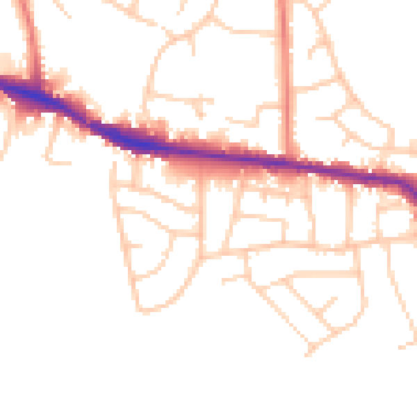
Daytime· 07:00 – 23:00
48.4dB

Night-time· 23:00 – 07:00
40.7dB