73a, Rokeby Road, London, SE4 1DF
About 73a
73a is a two-bedroom semi-detached house in London (SE4 1DF). It has a recorded floor area of 51 m² (around 549 sq ft), construction records dating it to before 1900 and council tax band C. The latest certificate (March 2023) shows a D (score 66), on the cusp of jumping into the C band. The recommended improvements would push it to C (score 75).
2 planning records sit against the property, 2 approved, 0 refused. Past consents include new windows, meaningful when judging how the property has evolved. At 51 m² it's 20.3% smaller than the typical home in the postcode (64 m² median across 13 EPCs). Today's modelled estimate of £410,000 is 23.3% above the 2023 sale price. Most recent transfer: August 2023 at £332,500.
What this property has
Inside
- Bedrooms2
- Bathrooms1
- Dining roomYes
Outside
- Private gardenYes
Building
- RefurbishedYes
Everything you need to know about 73a
The true value, the hidden risks and the full sale history, in one report.
Pick your report · every report is £14.99
One time fee only - money back guarantee

The data behind every report


Energy performance
EPC Rating
Get a survey for this property
Level 3 Building Survey
Because the property was built before 1919 and has solid (non-cavity) walls, we believe a Level 3 building survey should be considered.
From £1,020 · Includes VAT
Planning history
2 applications on record at 73a, Rokeby Road, London, SE4 1DF
- May 2015RenovationFullOutcome in report
The replacement of single glazed timber windows with double glazed timber windows to the front and side elevations together with the replacement of single glazed timber windows with uPVC double glazed windows and door to the rear elevation at Flats A and B, 73 Rokeby Road SE4.
New Windows- Documents
- 7 docs on file
- Reference
- DC/15/090922
- More recent applications — locked
- RenovationMay 2015Decision
Unlock 73a, Rokeby Road, London, SE4 1DF's full planning history
You're seeing the shape of it. The report has the substance.
- Every decision — granted, refused or withdrawn (2 on record)
- All 2 applications on this property in full, plus 19 notable nearby
- The 14 documents, officer reports & conditions
- What the pattern means for extending or converting here
One time fee only - money back guarantee
Sales history & valuation
£410,000
Modelled from EPC, postcode comparables.
£332,500
Recorded with HM Land Registry.
Sales timeline
24 August 2023Most recent
£332,500
Median price across the last 5 sales in SE4 1DF: £465,000 (2025–2023).
Nearby sales in SE4 1DF
70 Rokeby Road, Lewisham, London, SE4 1DF
Sold Jun 2025
£1,450,00073 Rokeby Road, Lewisham, London, SE4 1DF
Sold Feb 2025
£320,05076 Rokeby Road, Lewisham, London, SE4 1DF
Sold Jul 2024
£465,00074 Rokeby Road, Lewisham, London, SE4 1DF
Sold Jul 2024
£610,00075 Rokeby Road, Lewisham, London, SE4 1DF
Sold Aug 2023
£446,000
Versus other Rokeby Road homes
On epc rating, 73a runs well behind the street norm.
Price per m²
£6,520
Street avg £7,339
Floor Area
51 m²
Street avg 63 m²
Habitable Rooms
3 rooms
Street avg 3 rooms
CO₂ Emissions
2.2 t/year
Street avg 2.2 t/year
Everything you need to know about 73a
The true value, the hidden risks and the full sale history, in one report.
Pick your report · every report is £14.99
One time fee only - money back guarantee
The data behind every report
Similar properties nearby
1 Adelaide Avenue, Lewisham
SE4 1YT
1 Beverley Court, Breakspears Road, Lewisham
SE4 1UN
1 Bearstead Rise, Lewisham
SE4 1RQ
1 Breakspears Mews, Lewisham
SE4 1PY
1 3, Flat 6, Ashby Road, Lewisham
SE4 1PR
1 3, Flat 4, Ashby Road, Lewisham
SE4 1PR
1 3, Flat 5, Ashby Road, Lewisham
SE4 1PR
1 2, Flat 12, Vulcan Terrace, Lewisham
SE4 1DA
The neighbourhood at a glance
Rail-style transport is unusually close for this postcode.
Crime
7/mo
Rising year-on-year across the wider district.
Nearest stop
0.1 km
Malpas Road — bus stop.
Closest school
0.1 km
Myatt Garden Primary School. 71 schools nearby.
Go deeper on the local area
A Local Area report breaks down crime, transport links, schools and air quality in depth.
Road noise across the postcode
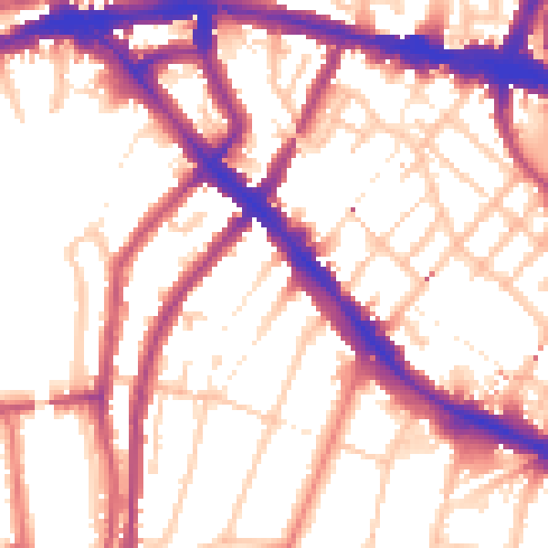
Daytime· 07:00 – 23:00
55.8dB

Night-time· 23:00 – 07:00
46.4dB