36 Eckington Road, Coal Aston, Dronfield, S18 3AT
About 36 Eckington Road
36 Eckington Road is a detached house in Coal Aston, Dronfield, Dronfield (S18 3AT). It has a recorded floor area of 255 m² (around 2745 sq ft), construction records dating it to 1900-1929 and council tax band G. The latest certificate (September 2019) shows an E (score 44), well below the UK norm with real room to improve. The recommended improvements would lift it to C (score 71), a 2-band jump.
At 255 m² the property is well over the postcode median (68 m² across 10 EPCs), placing it in the larger end of the local stock. One planning record on file: an extension approved in 2021. Past consents include an extension, a porch, a conservatory and new windows, meaningful when judging how the property has evolved. The record references listed-building consent and conservation-area consent, which constrain future alterations. Today's modelled estimate of £818,000 is 48.7% above the 2020 sale price. On a £-per-square-foot basis, the last sale (£200/sq ft) was about 32% above the typical sold price in the postcode. Most recent transfer: September 2020 at £550,000.
Know exactly what you're buying at 36 Eckington Road
Before you offer, see what the listing won't tell you, the true value, the red flags and the full history.
Valuation
against the asking price
Risks
planning & flood
Sold prices
similar homes nearby
Trends
the local market
Energy performance
36 Eckington Road's carbon output runs well above what efficient homes in the postcode produce.
EPC Rating
Planning history
36 Eckington Road has a listed-building consent on record — alterations to a listed property are tightly controlled.
- Mar 2021PorchFullIn report
Extension: Single storey
Replacement of existing windows with new UPVC sliding sash, new entrance door and glazing to enclose the existing open porch, installation of additional rooflight and replacement of existing timber conservatory with a contemporary stone and render single storey extension (Amended Title) (Affecting Setting of a Listed Building/Conservation Area)
ListedConservation AreaExtensionConservatoryNew Windows- Documents
- 12 docs on file
- Reference
- 21/00071/FLH
What's in 36 Eckington Road, Coal Aston, Dronfield, S18 3AT's planning history?
Refusals, disputes and full decisions on this property and nearby, in the report.
Sales history & valuation
The latest sale landed in the post-pandemic price surge — useful context when reading the figure.
£818,000
Modelled from EPC, postcode comparables.
£550,000
Recorded with HM Land Registry.
Sales timeline
23 September 2020Most recent
£550,000
Median price across the last 5 sales in S18 3AT: £152,500 (2024–2017).
Nearby sales in S18 3AT
26 Eckington Road, Coal Aston, Dronfield, S18 3AT
Sold Mar 2024
£127,20016 Eckington Road, Coal Aston, Dronfield, S18 3AT
Sold Jun 2022
£615,0008 Eckington Road, Coal Aston, Dronfield, S18 3AT
Sold May 2018
£130,00028 Eckington Road, Coal Aston, Dronfield, S18 3AT
Sold Mar 2018
£152,50034a, Eckington Road, Coal Aston, Dronfield, S18 3AT
Sold Mar 2017
£415,000
Everything we know about 36 Eckington Road, in one report
What it's really worth, what could be wrong, and the planning, sales and area data in full.
- Am I paying too much?
- Is something wrong with it?
- Is the agent's story true?
- Will it hold its value?

Versus other Eckington Road homes
36 Eckington Road is notably below the street on epc rating.
Price per m²
£2,157
Street avg £2,165
Floor Area
255 m²
Street avg 114 m²
Habitable Rooms
9 rooms
Street avg 5 rooms
CO₂ Emissions
17.0 t/year
Street avg 6.5 t/year
Similar properties nearby
1 Valentines Court, Coal Aston
S18 3DH
1 Firthwood Road, Coal Aston
S18 3BW
1 Forresters Lane, Coal Aston
S18 3AN
1 Deakon Drive, Coal Aston
S18 3DJ
1 Stone Close, Coal Aston
S18 3AS
1 Ferndale Rise, Coal Aston
S18 3BS
1 Eckington Road, Coal Aston
S18 3AT
1 Ferndale Road, Coal Aston
S18 3BT
The neighbourhood at a glance
Daytime road noise here sits well below conversation level — a quiet pocket of the postcode.
Crime
5/mo
Steady year-on-year across the wider district.
Nearest stop
0.2 km
Wilson Road — bus stop.
Closest school
0.5 km
Northfield Junior School. 18 schools nearby.
Go deeper on the local area
The full report breaks down crime, transport links, schools and air quality in depth.
Road noise across the postcode
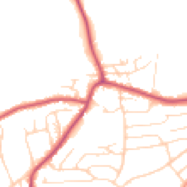
Daytime· 07:00 – 23:00
48.9dB

Night-time· 23:00 – 07:00
40.2dB