11 East Anglian Way, Gorleston, Great Yarmouth, NR31 6TY
About 11 East Anglian Way
11 East Anglian Way is a four-bedroom detached house in Gorleston, Great Yarmouth, Great Yarmouth (NR31 6TY). It has a recorded floor area of 123 m² (around 1329 sq ft), construction records dating it to 1996-2002 and council tax band E. The latest certificate (November 2010) shows a D (score 66), on the cusp of jumping into the C band. The recommended improvements would push it to C (score 72). The latest certificate is from November 2010, so improvements made since then won't be reflected.
Untraded for 16 years, with the last transfer in January 2011. Across 2000–2011, sale prices on this property compounded at 4.8% per year. Today's modelled estimate of £295,000 is 47.5% above the 2011 sale price. One historical planning record sits against the property in 2026.
What this property has
Inside
- Bedrooms4
- Dining roomYes
- EnsuiteYes
Outside
- Private gardenRear
- GarageYes
Building
- Heating systemGas
Everything you need to know about 11 East Anglian Way
The true value, the hidden risks and the full sale history, in one report.
Pick your report · from £14.99
One time fee only - money back guarantee

The data behind every report


Energy performance
11 East Anglian Way's EPC is over a decade old — improvements since won't be reflected.
EPC Expired
This certificate is over 10 years old and is no longer valid.Expired 17 Nov 2020
EPC Rating
Certificate validity
Expired on 17 November 2020

Get a survey for this property
Level 2 HomeBuyer Report
We've checked 10 risk factors against the available data for this property and believe a Level 2 HomeBuyer Report could be a suitable option for you.
From £545 · Includes VAT
Planning history
1 application on record at 11 East Anglian Way, Gorleston, Great Yarmouth, NR31 6TY
1 live now- Jan 2026Tree WorksTreesOutcome in report
Works to trees protected by Tree Preservation Order (ref: TPO No.2 2022) - T1 (Sycamore) - Reduce limb growing NE by 4.5m into the upright union; reduce the garden side by 2m, reducing the crown spread from 8m to 6m; crown raise the canopy to 3m from ground level; T2 (Sycamore) - Reduce garden side of the tree by 2m, reducing the crown spread from 8m to 6m; crown raise the canopy to 3m from ground level; T3 (Sycamore) - Reduce overall crown (excluding height) by 2m and 2.5m over the neighbouring garden, reducing crown spread from 9.5m to 7m; crown raise the canopy to 3m from ground level.
- Documents
- 9 docs on file
- Reference
- 06/25/0977/TRE
Unlock 11 East Anglian Way, Gorleston, Great Yarmouth, NR31 6TY's full planning history
You're seeing the shape of it. The report has the substance.
- Every decision — granted, refused or withdrawn
- All 1 application on this property in full, plus 2 notable nearby
- The 9 documents, officer reports & conditions
- What the pattern means for extending or converting here
One time fee only - money back guarantee
Sales history & valuation
11 East Anglian Way changed hands twice within eighteen months — unusual for the area.
£295,000
Modelled from EPC, postcode comparables and a sale-price growth of 4.8% per year over 11 years.
£200,000
Growth on file: 4.8% per year over 11 years.
Sales timeline
24 January 2011Most recent
£200,000
21 January 2011
£200,000
+66.7%over 10 years30 March 2000
£119,950
Median price across the last 5 sales in NR31 6TY: £280,000 (2026–2021).
Nearby sales in NR31 6TY
25 East Anglian Way, Gorleston, Great Yarmouth, NR31 6TY
Sold Mar 2026
£310,0003b, East Anglian Way, Gorleston, Great Yarmouth, NR31 6TY
Sold Dec 2021
£225,00023 East Anglian Way, Gorleston, Great Yarmouth, NR31 6TY
Sold Aug 2021
£280,00027 East Anglian Way, Gorleston, Great Yarmouth, NR31 6TY
Sold Apr 2021
£390,00045 East Anglian Way, Gorleston, Great Yarmouth, NR31 6TY
Sold Apr 2021
£260,000
Versus other East Anglian Way homes
11 East Anglian Way outperforms the street on floor area by a wide margin.
Price per m²
£1,620
Street avg £2,143
Floor Area
123 m²
Street avg 106 m²
Habitable Rooms
5 rooms
Street avg 6 rooms
CO₂ Emissions
4.8 t/year
Street avg 3.9 t/year
Everything you need to know about 11 East Anglian Way
The true value, the hidden risks and the full sale history, in one report.
Pick your report · from £14.99
One time fee only - money back guarantee
The data behind every report
Similar properties nearby
1 Cliff Park Cottages, Lowestoft Road, Gorleston
NR31 6JL
1 Garnham Road, Gorleston
NR31 6PB
1 Bridge Road, Gorleston
NR31 6HQ
1 Elmhurst Close, Gorleston
NR31 6ST
1 Baker Street, Gorleston
NR31 6QT
1 Drudge Road, Gorleston
NR31 6BD
1 Brett Avenue, Gorleston
NR31 6HE
1 Arnott Avenue, Gorleston
NR31 6HS
The neighbourhood at a glance
Crime
363/mo
Steady year-on-year across the wider district.
Closest school
0.1 km
St Mary and St Peter Catholic Primary School. 19 schools nearby.
Go deeper on the local area
A Local Area report breaks down crime, transport links, schools and air quality in depth.
Road noise across the postcode
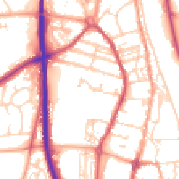
Daytime· 07:00 – 23:00
54.9dB

Night-time· 23:00 – 07:00
45.1dB