19 Lyndhurst Avenue, Denton, Manchester, M34 2BF
About 19 Lyndhurst Avenue
19 Lyndhurst Avenue is a two-bedroom mid-terrace house in Denton, Manchester, Manchester (M34 2BF). It has a recorded floor area of 77 m² (around 829 sq ft), construction records dating it to 1900-1929 and council tax band A. The latest certificate (July 2025) shows a C (score 71). When first surveyed in September 2010 the rating was E, the property has climbed 2 bands since. Between certificates, wall efficiency went from Poor to Good, roof efficiency went from Very Poor to Good and lighting went from Very Poor to Very Good; while window efficiency dropped from Average to Poor. The recommended improvements would push it to B (score 81).
Across 1997–2019, sale prices on this property compounded at 3.9% per year. Today's modelled estimate of £197,000 sits 162.7% above the 2019 sale of £75,000. Most recent transfer: January 2019 at £75,000. Across the public record there are 5 sales, relatively high churn for a single property. Its energy rating outperforms most of the postcode (better than 82% of similar EPCs).
What this property has
Inside
- Bedrooms2
- Bathrooms1
Outside
- Private gardenYes
Everything you need to know about 19 Lyndhurst Avenue
The true value, the hidden risks and the full sale history, in one report.
Pick your report · every report is £14.99
One time fee only - money back guarantee

The data behind every report


Energy performance
EPC Rating
Property Improvements
Changes detected from historical EPC data
Heating controls upgraded for better temperature management
Cavity wall insulation installed
Roof insulation improved
More low energy lighting installed
Get a survey for this property
Level 3 Building Survey
Because the property was built before 1919, we believe a Level 3 building survey should be considered.
From £820 · Includes VAT
Planning history
19 Lyndhurst Avenue has no planning applications on record.
But the area is active
3 notable applications nearby — larger schemes and conversions that could reshape the street. The report maps them all.
Sales history & valuation
Sale price has at least doubled since 1997.
£197,000
Modelled from EPC, postcode comparables and a sale-price growth of 3.9% per year over 22 years.
£75,000
Growth on file: 3.9% per year over 22 years.
Sales timeline
25 January 2019Most recent
£75,000
-26.8%over 1 year18 May 2017
£102,500
+10.2%over 6 years23 November 2010
£93,000
+89.8%over 8 years1 August 2002
£49,000
+50.8%over 5 years24 April 1997
£32,500
Median price across the last 5 sales in M34 2BF: £120,000 (2024–2020).
Nearby sales in M34 2BF
25 Lyndhurst Avenue, Denton, Manchester, M34 2BF
Sold Dec 2024
£205,00017 Lyndhurst Avenue, Denton, Manchester, M34 2BF
Sold Apr 2022
£163,0007 Lyndhurst Avenue, Denton, Manchester, M34 2BF
Sold Jan 2022
£120,00011 Lyndhurst Avenue, Denton, Manchester, M34 2BF
Sold Jun 2021
£112,0001 Lyndhurst Avenue, Denton, Manchester, M34 2BF
Sold Jun 2014
£87,000
Versus other Lyndhurst Avenue homes
On co₂ emissions, 19 Lyndhurst Avenue stands well clear of the street.
Price per m²
£974
Street avg £1,398
Floor Area
77 m²
Street avg 76 m²
Habitable Rooms
4 rooms
Street avg 4 rooms
CO₂ Emissions
2.6 t/year
Street avg 3.8 t/year
Everything you need to know about 19 Lyndhurst Avenue
The true value, the hidden risks and the full sale history, in one report.
Pick your report · every report is £14.99
One time fee only - money back guarantee
The data behind every report
Similar properties nearby
1 Acre Street, Denton
M34 2AE
1 Ainsworth Close, Denton
M34 2PZ
1 Danebank Mews, Denton
M34 2JN
1 Ash Road, Denton
M34 2WE
1 Cedar Grove, Denton
M34 2BD
1 Cooke Street, Denton
M34 2AG
1 Clarkson Close, Denton
M34 2DS
1 Balmoral Drive, Denton
M34 2JT
The neighbourhood at a glance
Crime
1/mo
Steady year-on-year across the wider district.
Nearest stop
0.1 km
Victoria Street — bus stop.
Closest school
0.4 km
St Mary's RC Primary School. 27 schools nearby.
Go deeper on the local area
A Local Area report breaks down crime, transport links, schools and air quality in depth.
Road noise across the postcode
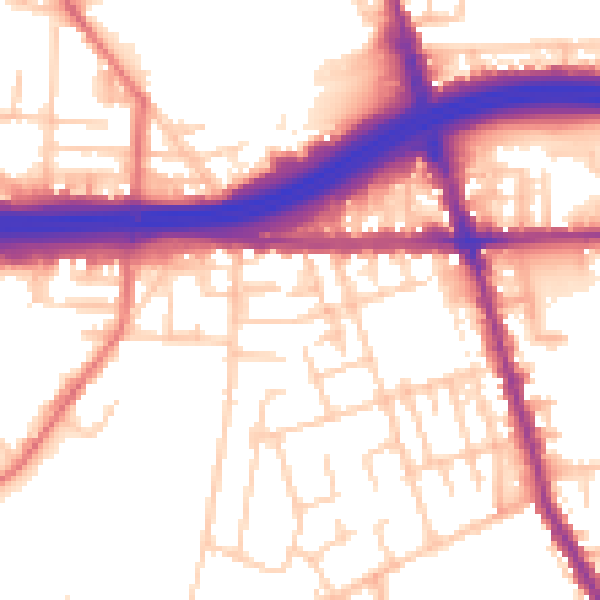
Daytime· 07:00 – 23:00
55.6dB

Night-time· 23:00 – 07:00
46.2dB